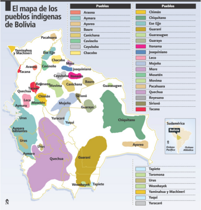
Dispossesions in the Americas

Dispossesions in the Americas

  • Home
  • Explore
  • About
  • Authors
  • Art
  • Bodies
  • Curricula
  • Cultural Heritage
  • Maps
  • Territories
Back to Explore
Map 1872 - 1876

CASIQUIARE;RIO ATABAPO;ET COURS INFERIEUR DE I’YNIRIDA

  • MONTOLIEU;FREDERIC

Published: 1880

  • Download Image

Peoples

  • JAVARANAS
  • CURACHICANAS
  • PIAROA
  • JIVI
  • MACOS
  • MUCUCHIES
  • ABERIANA
  • YEKUANA
  • BANIVA
  • AZANENI
  • PUINAVE
  • CARUSANAS
  • YAVARANA
  • YAVITERO
  • QUEREQUENAS
  • CUNIPASANAS
  • PACIMONARIS
  • MANDAWAKA
  • BARIA

Citation

Montolieu;Frédéric. Casiquiare;rio Atabapo et cours inférieur de l'Ynirida. Map. Paris: Bulletin de La Société de Géographie;1880. Accessed February 11;2023. https://gallica.bnf.fr/ark:/12148/btv1b84389363/f1.item.zoom#.

  • Download Image

Reading in Spanish

Map 1872 - 1876

CASIQUIARE;RIO ATABAPO;ET COURS INFERIEUR DE I’YNIRIDA

  • MONTOLIEU;FREDERIC

Published: 1880

  • Download Image
  • Download Image

Reading in Portuguese

Map 1872 - 1876

CASIQUIARE;RIO ATABAPO;ET COURS INFERIEUR DE I’YNIRIDA

  • MONTOLIEU;FREDERIC

Published: 1880

  • Download Image

Peoples

  • JAVARANAS
  • CURACHICANAS
  • PIAROA
  • JIVI
  • MACOS
  • MUCUCHIES
  • ABERIANA
  • YEKUANA
  • BANIVA
  • AZANENI
  • PUINAVE
  • CARUSANAS
  • YAVARANA
  • YAVITERO
  • QUEREQUENAS
  • CUNIPASANAS
  • PACIMONARIS
  • MANDAWAKA
  • BARIA

Citation

Montolieu;Frédéric. Casiquiare;rio Atabapo et cours inférieur de l'Ynirida. Map. Paris: Bulletin de La Société de Géographie;1880. Accessed February 11;2023. https://gallica.bnf.fr/ark:/12148/btv1b84389363/f1.item.zoom#.

  • Download Image

Related Content

Mapa de la América Central comprendida entre el Golfo Dulce y Cartagena de Indias;por el Norte y entre la Bahía de Fonseca de Panamá por el Sur.

Mapa de la América Central comprendida entre el Golfo Dulce y Cartagena de Indias;por el Norte y entre la Bahía de Fonseca de Panamá por el Sur.

Map 1777
Caracoles zapatistas

Caracoles zapatistas

Map 2016
El mapa de los pueblos indígenas de Bolivia

El mapa de los pueblos indígenas de Bolivia

Map 2007
PAI TAVYTERÃ

PAI TAVYTERÃ

Map 2015
South America corrected from the observation communicated to the
     Royal Society"s of London & Paris by John Senex, at the Globe against St.
     Dunstans Church Fleetstreet.

South America corrected from the observation communicated to the Royal Society"s of London & Paris by John Senex, at the Globe against St. Dunstans Church Fleetstreet.

Map 1755
Movilizaciones indígenas, mapas e historias por la propiedad de la tierra en el chaco argentino. La lucha de las familias tobas por poxoŷaxaic alhua.

Movilizaciones indígenas, mapas e historias por la propiedad de la tierra en el chaco argentino. La lucha de las familias tobas por poxoŷaxaic alhua.

Map 2004
of Amerindians

of Amerindians

Map
Presencia indígena en Argentina

Presencia indígena en Argentina

Map 2015

Dispossessions in the Americas

A project by

University of Pennsylvania

Copyright 2024

With support from

Mellon Foundation

Site design & development

Element 84

Art Credits

Montolieu;Frédéric. Casiquiare;rio Atabapo et cours inférieur de l’Ynirida. Map. Paris: Bulletin de La Société de Géographie;1880. Accessed February 11;2023. https://gallica.bnf.fr/ark:/12148/btv1b84389363/f1.item.zoom#.

Site Pages

  • Home
  • Explore
  • About
  • Authors
  • Art
  • Bodies
  • Curricula
  • Cultural Heritage
  • Maps
  • Territories