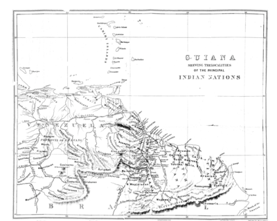
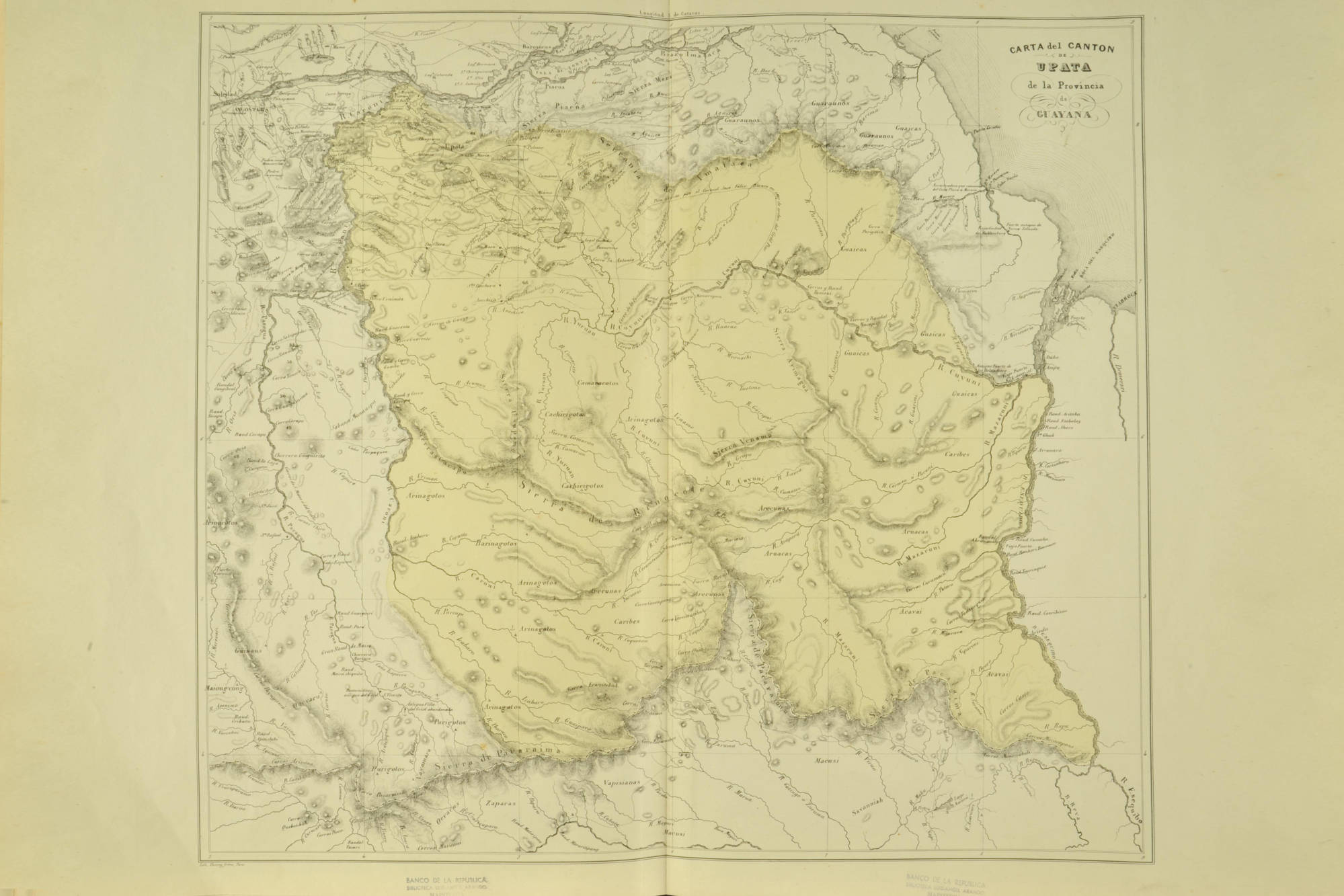
Dispossesions in the Americas

Dispossesions in the Americas

  • Home
  • Explore
  • About
  • Authors
  • Art
  • Bodies
  • Curricula
  • Cultural Heritage
  • Maps
  • Territories
Back to Explore
Map 1840

CARTA del CANTON DE UPATA de la Provincia de GUAYANA

  • CODAZZI;AGUSTÍN

Published: 1840

  • Download Image

Peoples

  • GUARUANA
  • GUAICAS
  • CACHIRIGOTOS
  • PEMON
  • ARNACOTO
  • CARIBE
  • ARUACA
  • ARECUNAS
  • GUINAUS
  • MAIONGEONG
  • QUEVACU
  • PURIGOTOS
  • MAKUSHI
  • ZAPARA
  • ACAVI
  • OEVACUS
  • VAPISANAS

Citation

Codazzi;Agustín. Carta de Cantón de Upata de la Provincia de Guayana. Map. Caracas;1840. Accessed January 25;2023. https://babel.banrepcultural.org/digital/collection/p17054coll13/id/126/rec/56.

  • Download Image

Reading in Spanish

Map 1840

CARTA del CANTON DE UPATA de la Provincia de GUAYANA

  • CODAZZI;AGUSTÍN

Published: 1840

  • Download Image
  • Download Image

Reading in Portuguese

Map 1840

CARTA del CANTON DE UPATA de la Provincia de GUAYANA

  • CODAZZI;AGUSTÍN

Published: 1840

  • Download Image

Peoples

  • GUARUANA
  • GUAICAS
  • CACHIRIGOTOS
  • PEMON
  • ARNACOTO
  • CARIBE
  • ARUACA
  • ARECUNAS
  • GUINAUS
  • MAIONGEONG
  • QUEVACU
  • PURIGOTOS
  • MAKUSHI
  • ZAPARA
  • ACAVI
  • OEVACUS
  • VAPISANAS

Citation

Codazzi;Agustín. Carta de Cantón de Upata de la Provincia de Guayana. Map. Caracas;1840. Accessed January 25;2023. https://babel.banrepcultural.org/digital/collection/p17054coll13/id/126/rec/56.

  • Download Image

Related Content

LOCALIZACIÓN DE LOS PUEBLOS INDÍGENAS EN LA ARGENTINA

LOCALIZACIÓN DE LOS PUEBLOS INDÍGENAS EN LA ARGENTINA

Map 2004
The modern departments of Ahuachapán, La Libertad, Santa Ana, and Sonsonate (highlighted in red) now contain the highest concentration of Indigenous communities in El Salvador.

The modern departments of Ahuachapán, La Libertad, Santa Ana, and Sonsonate (highlighted in red) now contain the highest concentration of Indigenous communities in El Salvador.

Map 2010
Guiana Shewing the Localities of the Principal Indian Nations

Guiana Shewing the Localities of the Principal Indian Nations

Map 1800 - 1899
PUEBLO AIMARA

PUEBLO AIMARA

Map 2021
"Territorio Indígena Cabécar de Bajo Chrirripó"

"Territorio Indígena Cabécar de Bajo Chrirripó"

Map 2010
Colton's ARG Republic;Chili;Uruguay & Paraguay

Colton's ARG Republic;Chili;Uruguay & Paraguay

Map 1855
Geographic Distribution of the Huastec

Geographic Distribution of the Huastec

Map 1969
Cette Carte de Californie et du Nouveau Mexique

Cette Carte de Californie et du Nouveau Mexique

Map 1705

Dispossessions in the Americas

A project by

University of Pennsylvania

Copyright 2024

With support from

Mellon Foundation

Site design & development

Element 84

Art Credits

Codazzi;Agustín. Carta de Cantón de Upata de la Provincia de Guayana. Map. Caracas;1840. Accessed January 25;2023. https://babel.banrepcultural.org/digital/collection/p17054coll13/id/126/rec/56.

Site Pages

  • Home
  • Explore
  • About
  • Authors
  • Art
  • Bodies
  • Curricula
  • Cultural Heritage
  • Maps
  • Territories