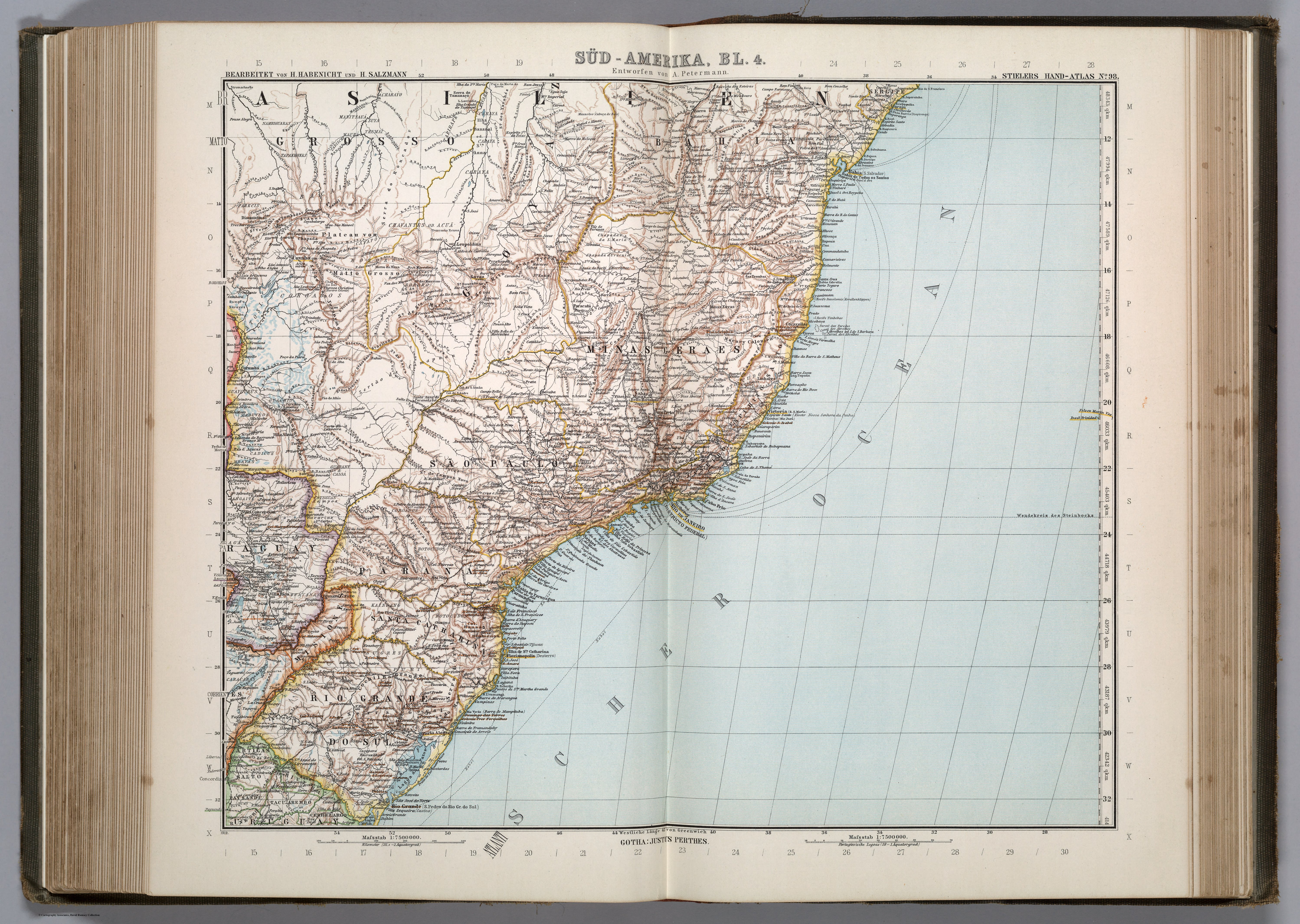
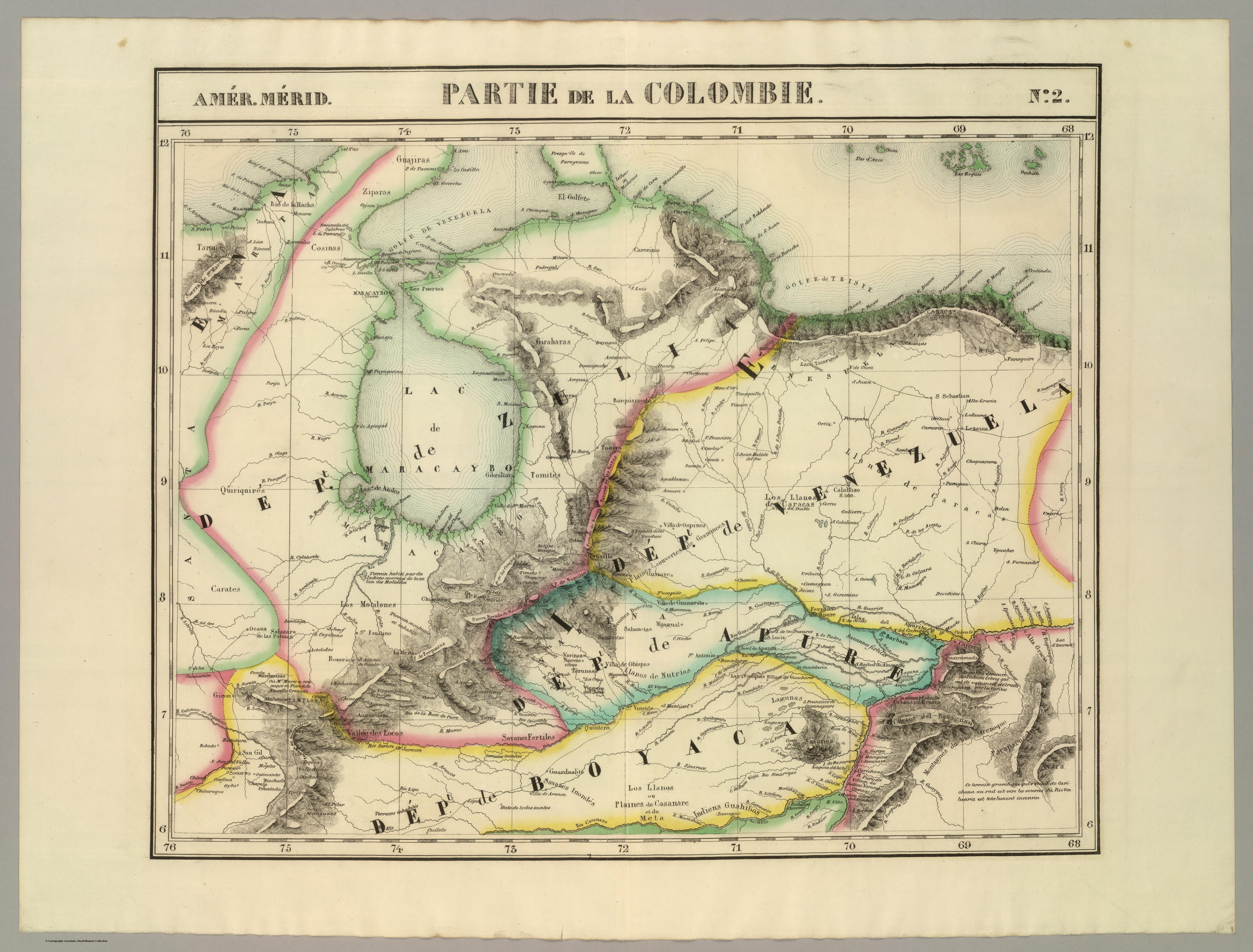
Dispossesions in the Americas

Dispossesions in the Americas

  • Home
  • Explore
  • About
  • Authors
  • Art
  • Bodies
  • Curricula
  • Cultural Heritage
  • Maps
  • Territories
Back to Explore
Map 1827

PARTIE DE LA COLOMBIE

  • VANDERMAELEN;PHILIPPE

Published: 1827

  • Download Image

Peoples

  • JIVI
  • ZAPARA
  • COSINAS
  • JIRAJARA
  • QUIRIQUIRES
  • TIMOTE
  • BARI
  • AVIRA
  • PARAPARUCOTA
  • GUAHIVAS
  • TARONAS
  • CARATES

Citation

Vandermaelen;Philippe. Partie de la Colombie. Amer. Merid. no. 2. Map. Brussels: Ph. Vandermaelen;1827. Accessed December 27;2022. https://www.davidrumsey.com/luna/servlet/detail/RUMSEY~8~1~25240~5500100:Partie%2C-Colombie--Amer--Merid--2-?sort=pub_list_no_initialsort%2Cpub_date%2Cpub_list_no%2Cseries_no&qvq=w4s:/where%2FVenezuela;q:venezuela;sort:pub_list_no_initialsort%2Cpub_date%2Cpub_list_no%2Cseries_no;lc:RUMSEY~8~1&mi=167&trs=267#.

  • Download Image

Reading in Spanish

Map 1827

PARTIE DE LA COLOMBIE

  • VANDERMAELEN;PHILIPPE

Published: 1827

  • Download Image
  • Download Image

Related Content

Risaralda

Risaralda

Map 2012
"Territorio Indígena Brunka de Rey Curré"

"Territorio Indígena Brunka de Rey Curré"

Map 2010
SOUTH AMERICA SHEET III. SOUTH BRAZIL WITH PARAGUAY AND URUGUAY

SOUTH AMERICA SHEET III. SOUTH BRAZIL WITH PARAGUAY AND URUGUAY

Map 1837
Silver Creek

Silver Creek

Map 1997
PRINCIPALES GRUPOS ÉTNICOS DEL TERRITORIO ESEQUIBO

PRINCIPALES GRUPOS ÉTNICOS DEL TERRITORIO ESEQUIBO

Map 1979
Indigenous peoples of the coast of Brazil, (c. 16th C.)

Indigenous peoples of the coast of Brazil, (c. 16th C.)

Map 1500 - 1599
Carte particulière de la colonie de Cayenne. Levée et présentée à Monseigneur le Comte de Pontchartrain, Ministre et secrétaire d'Etat ;Par son très humble serviteur et très obéissant serviteur De Créanton officier de la marine

Carte particulière de la colonie de Cayenne. Levée et présentée à Monseigneur le Comte de Pontchartrain, Ministre et secrétaire d'Etat ;Par son très humble serviteur et très obéissant serviteur De Créanton officier de la marine

Map 1701
A TERRE FERME ET LE PEROU AVEC LE PAYS DES AMAZONES ET LE BRESIL

A TERRE FERME ET LE PEROU AVEC LE PAYS DES AMAZONES ET LE BRESIL

Map 1705

Dispossessions in the Americas

A project by

University of Pennsylvania

Copyright 2024

With support from

Mellon Foundation

Site design & development

Element 84

Art Credits

Vandermaelen;Philippe. Partie de la Colombie. Amer. Merid. no. 2. Map. Brussels: Ph. Vandermaelen;1827. Accessed December 27;2022. https://www.davidrumsey.com/luna/servlet/detail/RUMSEY~8~1~25240~5500100:Partie%2C-Colombie--Amer--Merid--2-?sort=pub_list_no_initialsort%2Cpub_date%2Cpub_list_no%2Cseries_no&qvq=w4s:/where%2FVenezuela;q:venezuela;sort:pub_list_no_initialsort%2Cpub_date%2Cpub_list_no%2Cseries_no;lc:RUMSEY~8~1&mi=167&trs=267#.

Site Pages

  • Home
  • Explore
  • About
  • Authors
  • Art
  • Bodies
  • Curricula
  • Cultural Heritage
  • Maps
  • Territories