Peoples- CARIBE
- GUARANOS
- WARAO
- ARAWACAS
- GUAYANAS
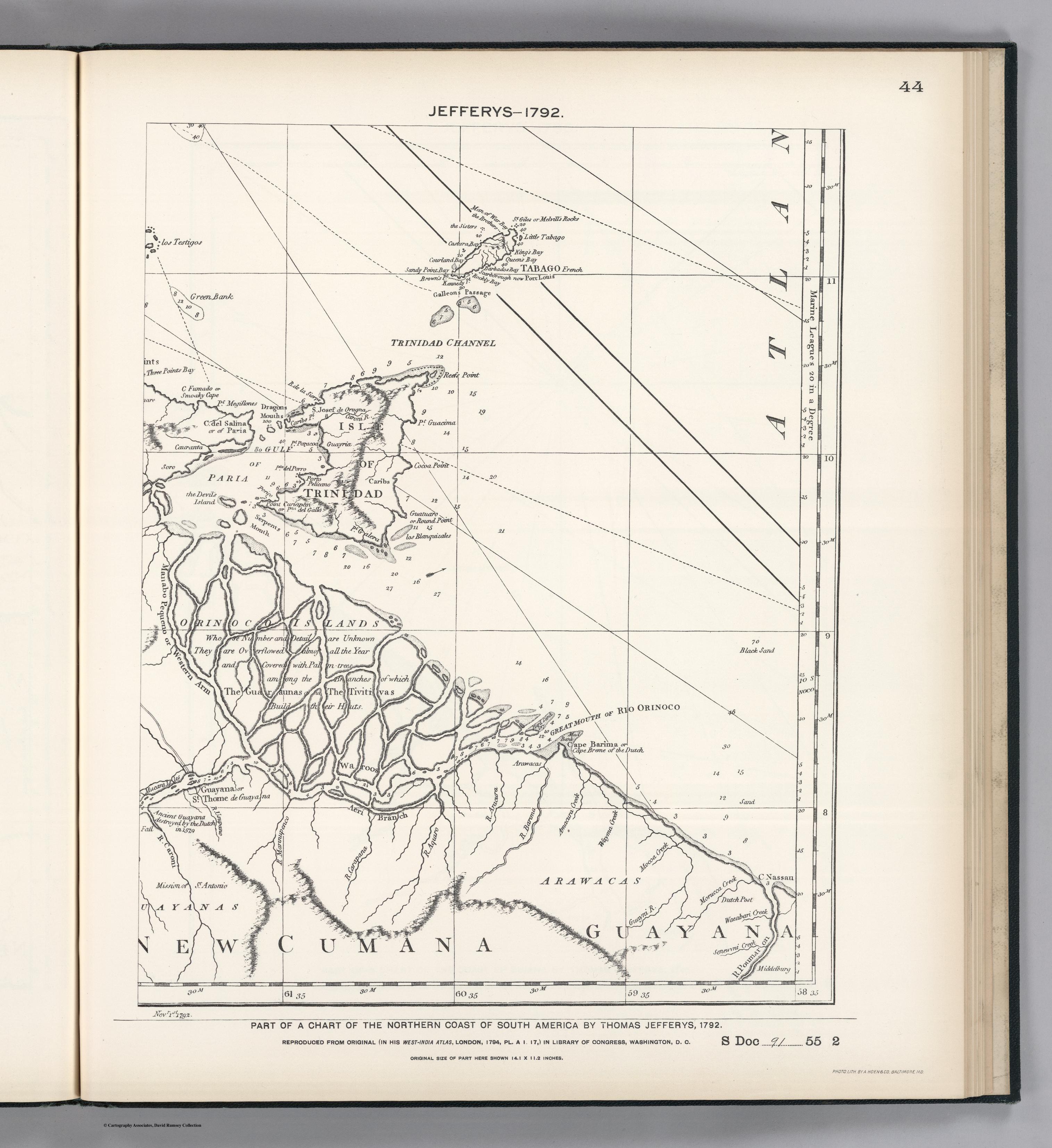
CitationJefferys;Thomas. Facsimile: Part of Northern Coast of South America by Jefferys. Map. Washington;D.C.: United States of America;1792. Accessed October 28;2022. https://www.davidrumsey.com/luna/servlet/detail/RUMSEY~8~1~204010~3001763:Facsimile--Part-of-Northern-Coast-o?sort=pub_list_no_initialsort%2Cpub_date%2Cpub_list_no%2Cseries_no#.
Jefferys;Thomas. Facsimile: Part of Northern Coast of South America by Jefferys. Map. Washington;D.C.: United States of America;1792. Accessed October 28;2022. https://www.davidrumsey.com/luna/servlet/detail/RUMSEY~8~1~204010~3001763:Facsimile--Part-of-Northern-Coast-o?sort=pub_list_no_initialsort%2Cpub_date%2Cpub_list_no%2Cseries_no#.
![Preliminary Map;portion of north east [sic] Nicaragua: Brown's Camp to Pis Pis District.](https://dnet8ble6lm7w.cloudfront.net/maps/NIC/NIC0040.jpg)