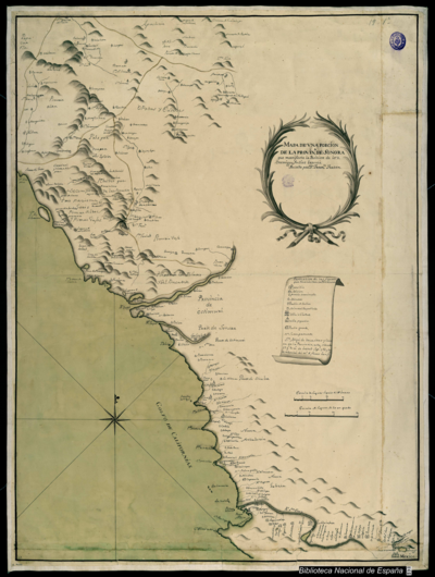
Dispossesions in the Americas

Dispossesions in the Americas

  • Home
  • Explore
  • About
  • Authors
  • Art
  • Bodies
  • Curricula
  • Cultural Heritage
  • Maps
  • Territories
Back to Explore
Map 1725

No Title

    Published: 1725

    • Download Image

    Peoples

    • WARIKERI

    Citation

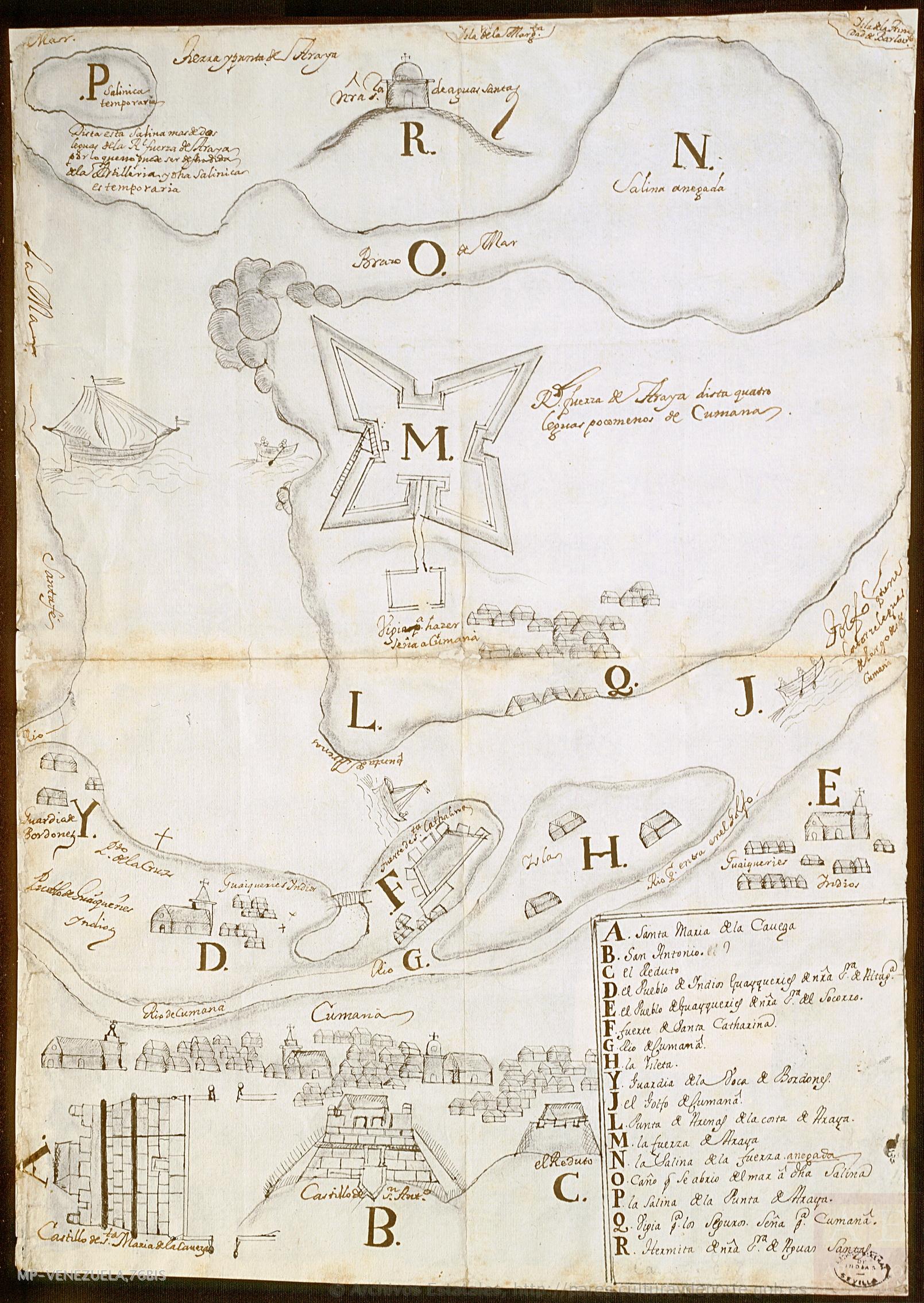
    "Plano de Cumaná y sus fortificaciones." Map. 1725. Accessed August 21;2022. http://pares.mcu.es/ParesBusquedas20/catalogo/show/25992.

    • Download Image

    Reading in Spanish

    Map 1725

    No Title

      Published: 1725

      • Download Image
      • Download Image

      Related Content

      Map of El Salvador with Specific indigenous communities in El Salvador, and the archaeological zone of Chalchuapa in western El Salvador. The Department of San Vicente is also highlighted.

      Map of El Salvador with Specific indigenous communities in El Salvador, and the archaeological zone of Chalchuapa in western El Salvador. The Department of San Vicente is also highlighted.

      Map 2010
      Sunday Wood

      Sunday Wood

      Map 1997
      Principales grupos indígenas cuando ocurrió el contacto con los españoles

      Principales grupos indígenas cuando ocurrió el contacto con los españoles

      Map 1530
      PUEBLO HUASTECO

      PUEBLO HUASTECO

      Map 2020
      PLANO DEL HATO DEL TAMBO;ADJUNTO A LA ESCRITURA DE DONACIÓN QUE OTORGA PABLO CHIRIBOGA A FAVOR DE LOS INDÍGENAS DE PAPALLACTA

      PLANO DEL HATO DEL TAMBO;ADJUNTO A LA ESCRITURA DE DONACIÓN QUE OTORGA PABLO CHIRIBOGA A FAVOR DE LOS INDÍGENAS DE PAPALLACTA

      Map 1903
      Carte réduite des Côtes de la Guyane comprises entre les Bouches de la Rivière des Amazones et celles du Maroni. D'après des Plans levés par les Ingénieurs Français et Portugais.

      Carte réduite des Côtes de la Guyane comprises entre les Bouches de la Rivière des Amazones et celles du Maroni. D'après des Plans levés par les Ingénieurs Français et Portugais.

      Map 1817
      Territorio ancestral y territorio agrario 2015

      Territorio ancestral y territorio agrario 2015

      Map 2015
      Lugares sagrados y seculares asociados a los caminos del Kuwai

      Lugares sagrados y seculares asociados a los caminos del Kuwai

      Map 1399

      Dispossessions in the Americas

      A project by

      University of Pennsylvania

      Copyright 2024

      With support from

      Mellon Foundation

      Site design & development

      Element 84

      Art Credits

      “Plano de Cumaná y sus fortificaciones.” Map. 1725. Accessed August 21;2022. http://pares.mcu.es/ParesBusquedas20/catalogo/show/25992.

      Site Pages

      • Home
      • Explore
      • About
      • Authors
      • Art
      • Bodies
      • Curricula
      • Cultural Heritage
      • Maps
      • Territories