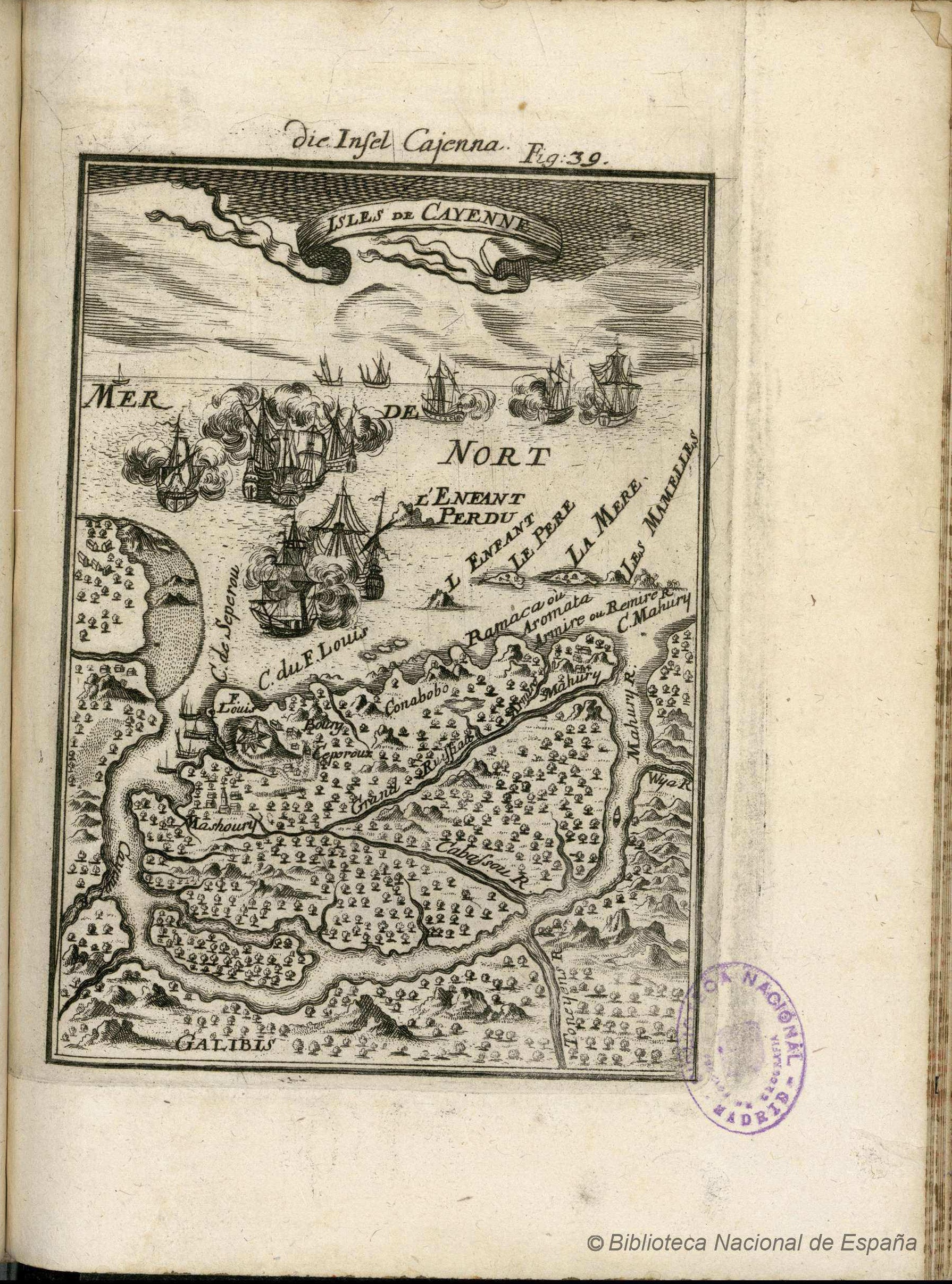
Dispossesions in the Americas

Dispossesions in the Americas

  • Home
  • Explore
  • About
  • Authors
  • Art
  • Bodies
  • Curricula
  • Cultural Heritage
  • Maps
  • Territories
Back to Explore
Map 1634

DESCRIPCIÓN GEOGRAPHICA E HIDORGRÁPHICA DEL GOVIERNO DE VENEZUELA I SUS PROVINCIAS

  • DE RUESTA;FRANCISCO

Published: 1634

  • Download Image

Peoples

  • KUMANAGOTO

Citation

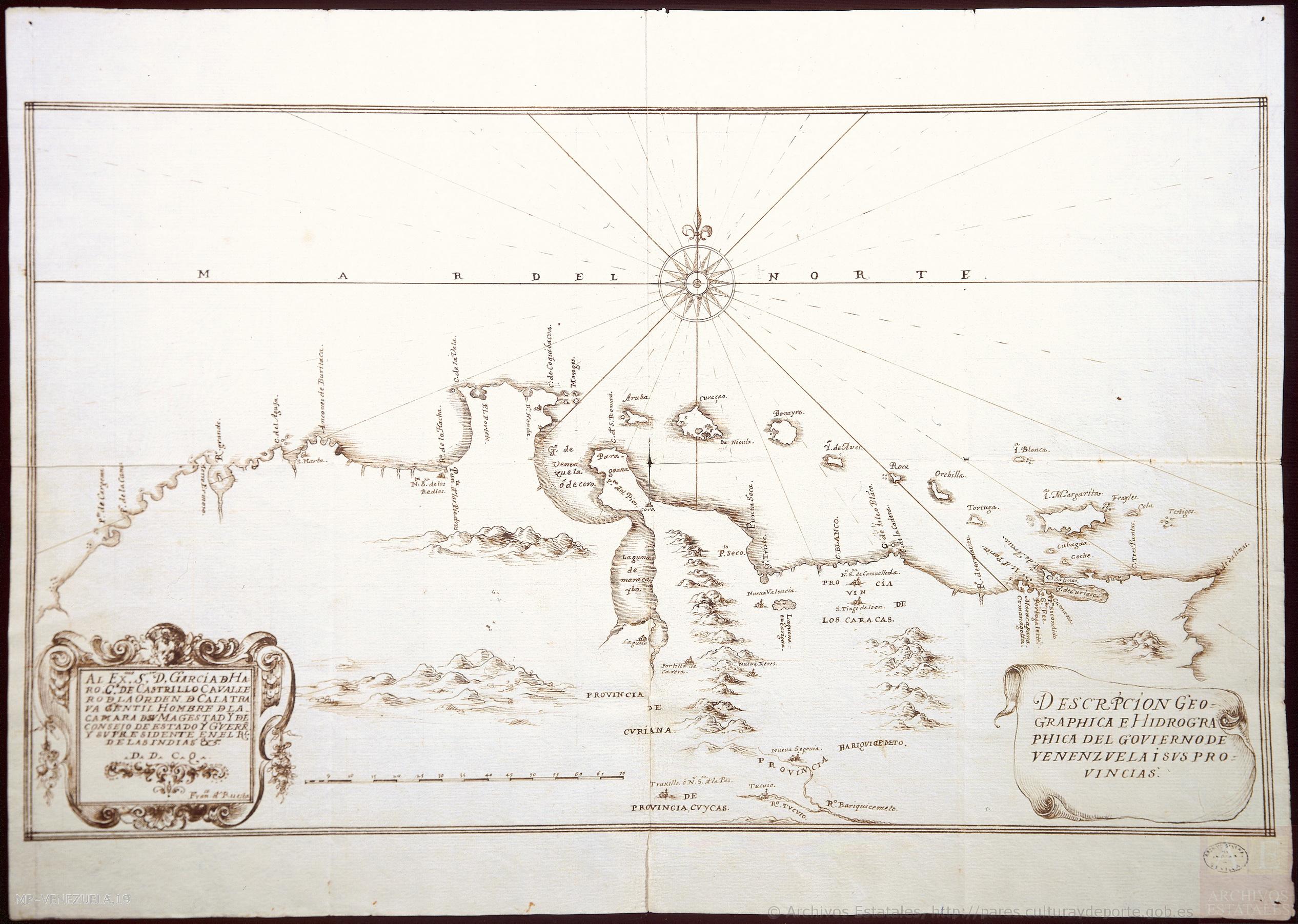
de Ruesta;Francisco. "Descripción geográphica e hidorgráphica del govierno de Venezuela i sus provinciaS." Map. 1634. Accessed August 19;2022. http://pares.mcu.es/ParesBusquedas20/catalogo/show/25929.

  • Download Image

Reading in Spanish

Map 1634

DESCRIPCIÓN GEOGRAPHICA E HIDORGRÁPHICA DEL GOVIERNO DE VENEZUELA I SUS PROVINCIAS

  • DE RUESTA;FRANCISCO

Published: 1634

  • Download Image
  • Download Image

Related Content

PUEBLO KILIWA

PUEBLO KILIWA

Map 2020
Map of Tenango (Valley of Mexico), 1587, Archivo General de la Nación, no. 1822

Map of Tenango (Valley of Mexico), 1587, Archivo General de la Nación, no. 1822

Map 1587
Le Cours de la Riviere des Amazones

Le Cours de la Riviere des Amazones

Map 1680
MAPPA da PROVINCIA DE SANTA CATHARINA do imperio do Brasil come as partes adjacentes das Provincias PARANA E DE SAO PEDRO DO RIO GRANDE DO SUL

MAPPA da PROVINCIA DE SANTA CATHARINA do imperio do Brasil come as partes adjacentes das Provincias PARANA E DE SAO PEDRO DO RIO GRANDE DO SUL

Map 1859 - 1860
Guatemala Maya Ethnicity Year 2018

Guatemala Maya Ethnicity Year 2018

Map 2000
Map of the Mosquito Coast;Nicaragua

Map of the Mosquito Coast;Nicaragua

Map 1894
SAN LUIS POTOSÍ

SAN LUIS POTOSÍ

Map 2015
Outlines of the physical and political division of South America: Delineated by A. Arrowsmith partly from scarce and original documents, published before the year 1806 but principally from manuscript maps & surveys made between the years 1771 and 1806, corrected from accurate astronomical observations to 1810.

Outlines of the physical and political division of South America: Delineated by A. Arrowsmith partly from scarce and original documents, published before the year 1806 but principally from manuscript maps & surveys made between the years 1771 and 1806, corrected from accurate astronomical observations to 1810.

Map 1800 - 1899

Dispossessions in the Americas

A project by

University of Pennsylvania

Copyright 2024

With support from

Mellon Foundation

Site design & development

Element 84

Art Credits

de Ruesta;Francisco. “Descripción geográphica e hidorgráphica del govierno de Venezuela i sus provinciaS.” Map. 1634. Accessed August 19;2022. http://pares.mcu.es/ParesBusquedas20/catalogo/show/25929.

Site Pages

  • Home
  • Explore
  • About
  • Authors
  • Art
  • Bodies
  • Curricula
  • Cultural Heritage
  • Maps
  • Territories