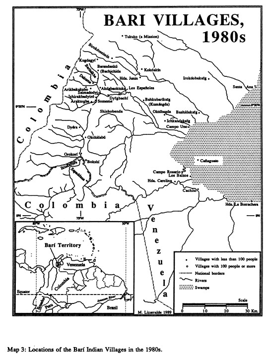
Peoples- BARI
CitationLizarralde;Manuel. "500 Years of Invasion: Eco-Colonialism in Indigenous Venezuela." Kroeber Anthropological Society Papers 75-76 (1992): 62-79. Accessed September 12;2021. https://digitalassets.lib.berkeley.edu/anthpubs/ucb/text/kas075_076-006.pdf.
Lizarralde;Manuel. "500 Years of Invasion: Eco-Colonialism in Indigenous Venezuela." Kroeber Anthropological Society Papers 75-76 (1992): 62-79. Accessed September 12;2021. https://digitalassets.lib.berkeley.edu/anthpubs/ucb/text/kas075_076-006.pdf.
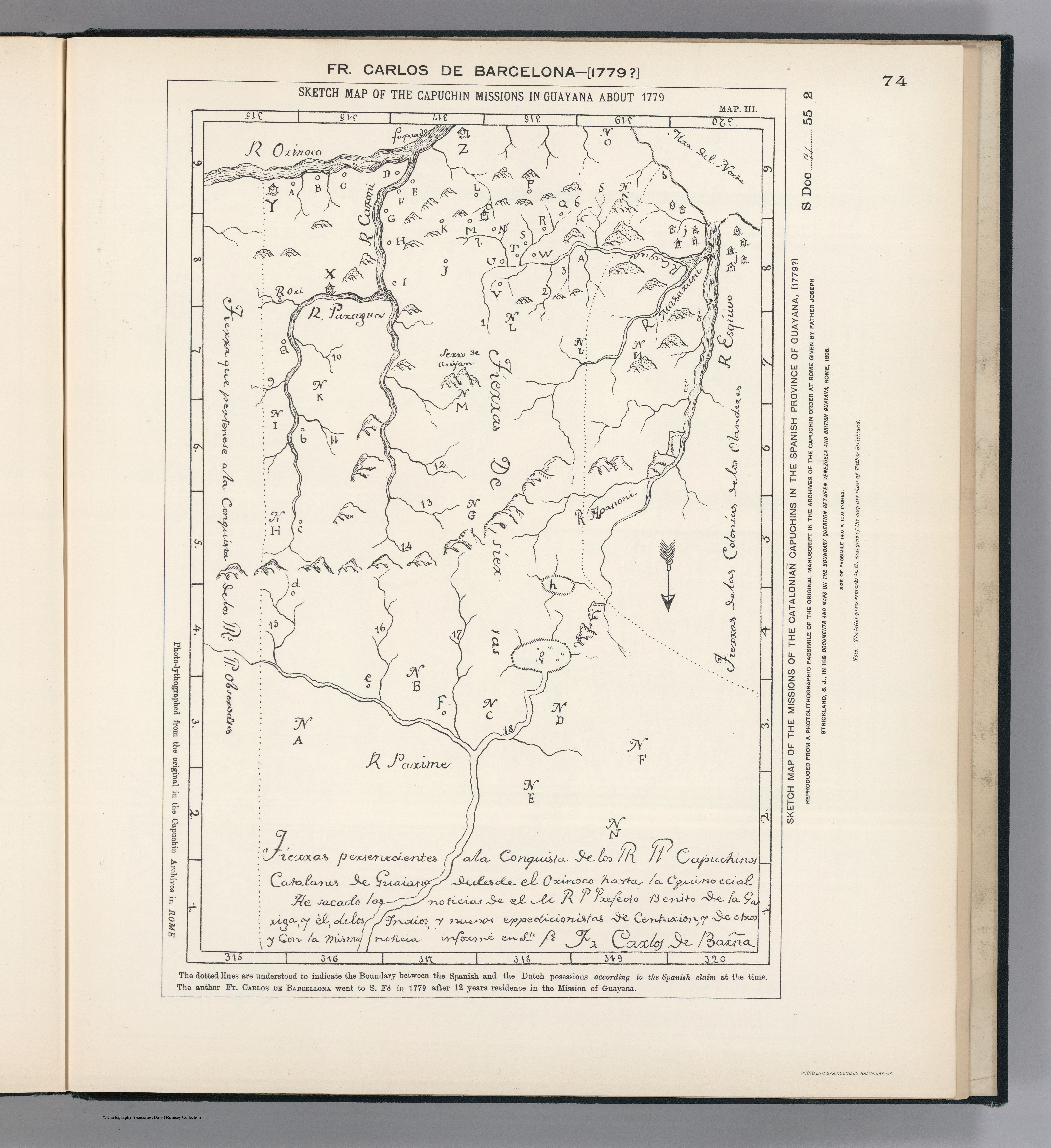
![[Carte de la Guyane, des bassins de l'Orénoque et de l'Amazone]](https://dnet8ble6lm7w.cloudfront.net/maps/CNT/CNT0174.jpeg)