Dispossesions in the Americas

Dispossesions in the Americas

  • Home
  • Explore
  • About
  • Authors
  • Art
  • Bodies
  • Curricula
  • Cultural Heritage
  • Maps
  • Territories
Back to Explore
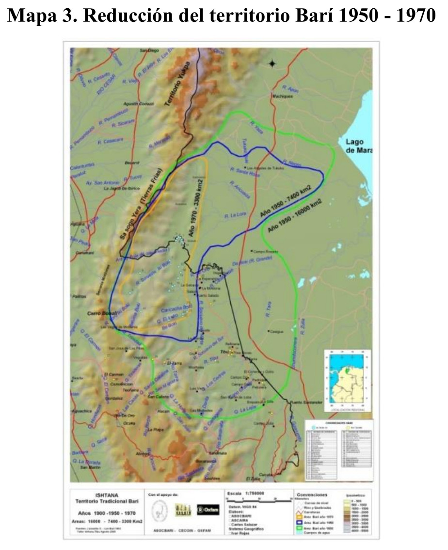
Map 1950 - 1970

Reducción del territorio Barí 1950 -1970

  • ASOCBARI

Published: 2017

  • Download Image

Peoples

  • BARI

Citation

Eduardo Dussan Salas;Oscar. "Prácticas Comunitarias de Ordenamiento en el Marco de la Formulación de Territorios Interculturales en Colombia." PhDdiss.;Universidad Distrital Francisco José de Caldas;2018. Accessed August 9;2021. https://repository.udistrital.edu.co/bitstream/handle/11349/15309/DussanSalasOscarEduardo2018.pdf?sequence=1&isAllowed=y.
  • Download Image

Reading in Spanish

Map 1950 - 1970

Reducción del territorio Barí 1950 -1970

  • ASOCBARI

Published: 2017

  • Download Image
  • Download Image

Related Content

Present Distribution of the Otomi Family

Present Distribution of the Otomi Family

Map 1969
Mexico at the time of the conquest (1519), showing the extent of the Culhua Mexica (Aztec Empire) and of the Maya holdings

Mexico at the time of the conquest (1519), showing the extent of the Culhua Mexica (Aztec Empire) and of the Maya holdings

Map 1519
A NEW MAP OF BRAZIL, COMPILED FROM THE LATEST Government & other Authentic Surveys.

A NEW MAP OF BRAZIL, COMPILED FROM THE LATEST Government & other Authentic Surveys.

Map 1866
GUARANÍ OCCIDENTAL

GUARANÍ OCCIDENTAL

Map 2015
Cayenne représentée exactement dans toutes ses rivières, criques et habitations et ses dehors

Cayenne représentée exactement dans toutes ses rivières, criques et habitations et ses dehors

Map 1717
Totocanapan: Approximate Extension in Ancient and Recent Times

Totocanapan: Approximate Extension in Ancient and Recent Times

Map 1940
Sketch of the country from reduction to Buenos Ayres, shewing the movements of B. Genl. Beresford, when he captured that place June 1806. Drawn from memorandums furnished by Capt: Donnelly

Sketch of the country from reduction to Buenos Ayres, shewing the movements of B. Genl. Beresford, when he captured that place June 1806. Drawn from memorandums furnished by Capt: Donnelly

Map 1806
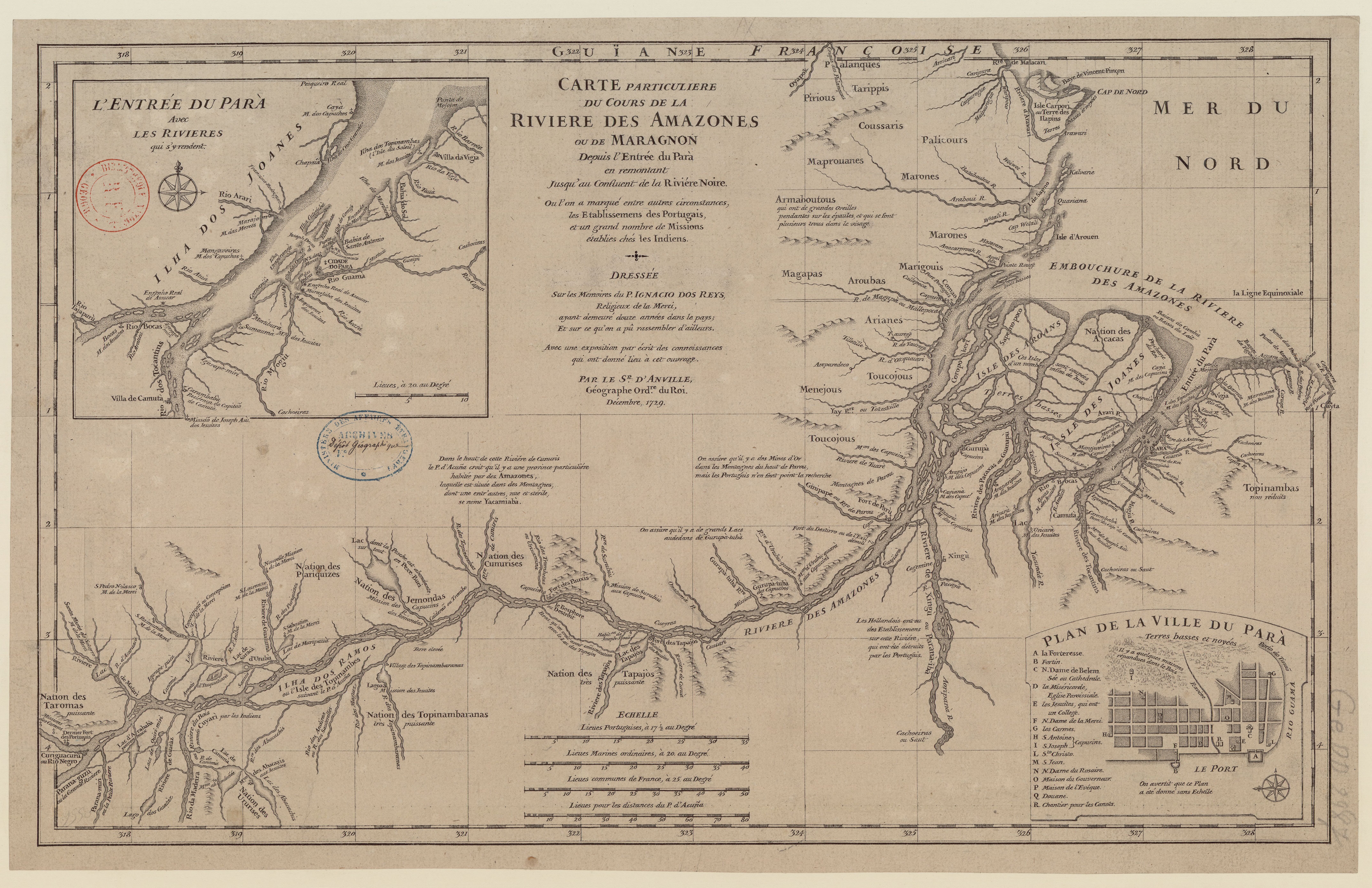
Carte du gouvernement de Cayenne jusqu'à la rivière des Amazones.

Carte du gouvernement de Cayenne jusqu'à la rivière des Amazones.

Map 1697

Dispossessions in the Americas

A project by

University of Pennsylvania

Copyright 2024

With support from

Mellon Foundation

Site design & development

Element 84

Art Credits

Eduardo Dussan Salas;Oscar. “Prácticas Comunitarias de Ordenamiento en el Marco de la Formulación de Territorios Interculturales en Colombia.” PhDdiss.;Universidad Distrital Francisco José de Caldas;2018. Accessed August 9;2021. https://repository.udistrital.edu.co/bitstream/handle/11349/15309/DussanSalasOscarEduardo2018.pdf?sequence=1&isAllowed=y.

Site Pages

  • Home
  • Explore
  • About
  • Authors
  • Art
  • Bodies
  • Curricula
  • Cultural Heritage
  • Maps
  • Territories