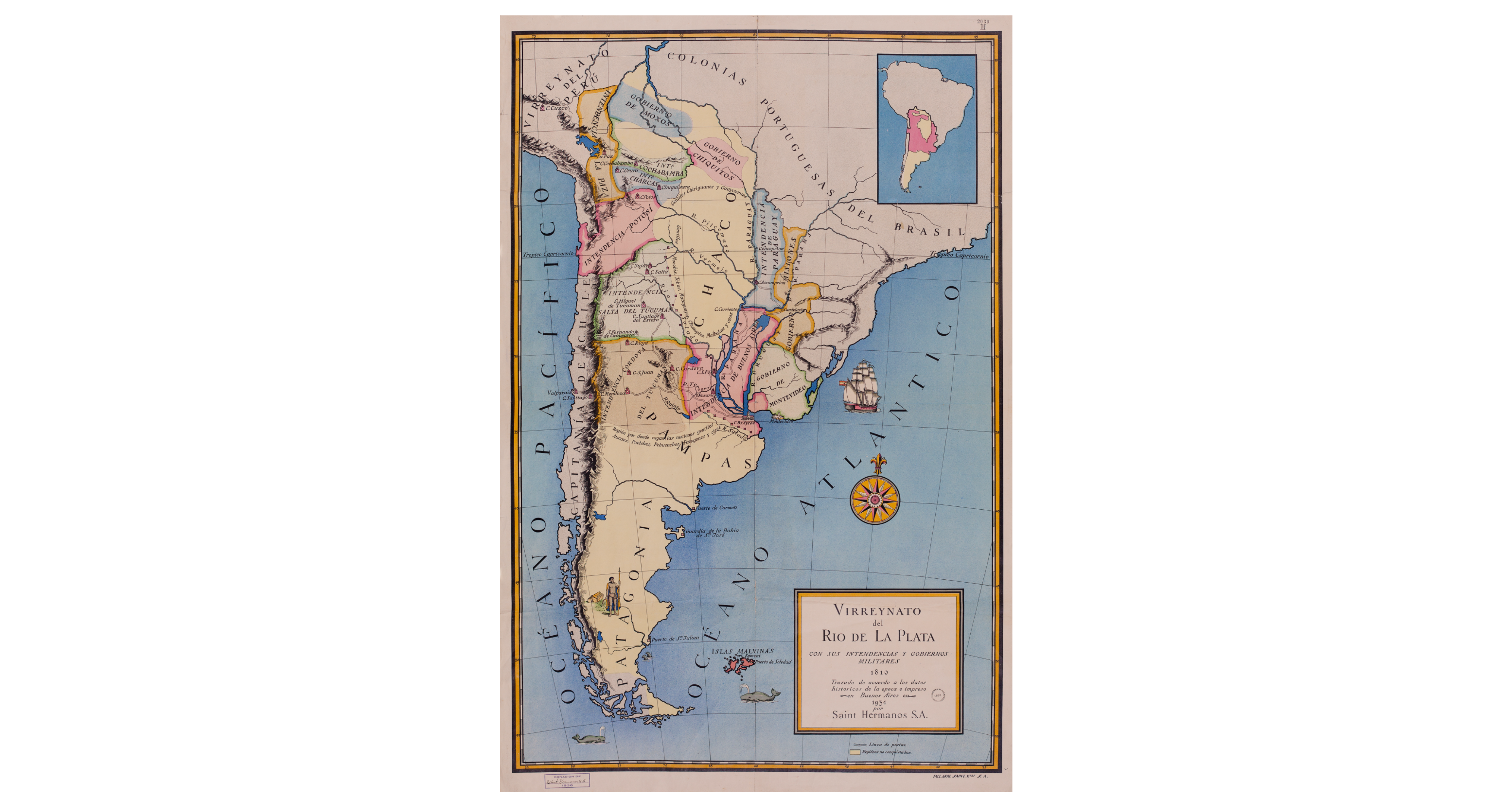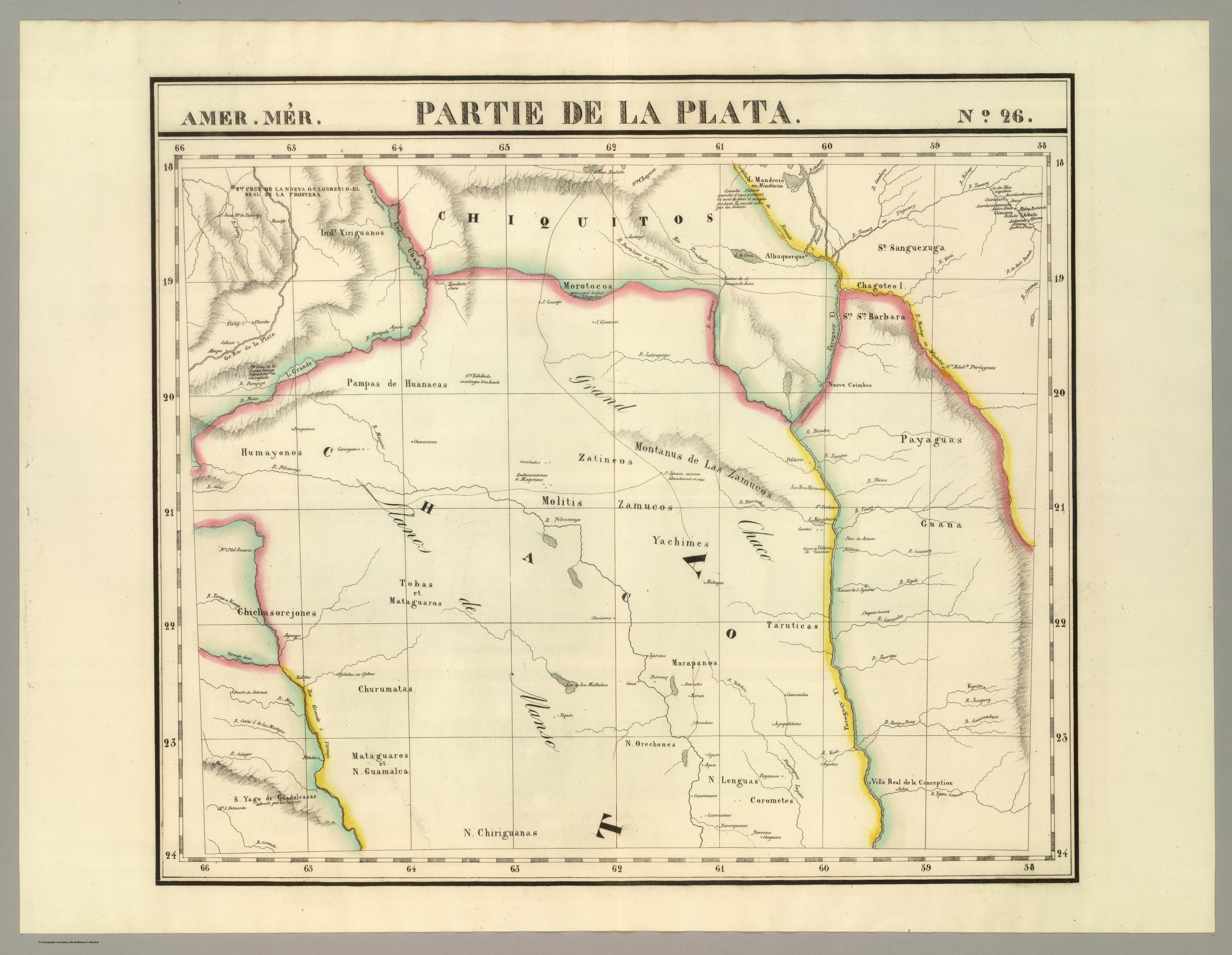
Peoples- YAROS
- MARTIDANES
- BOHANES
- MANCHADOS
- ABIPONES
- MOCOVI
- ORECHONES
- GUAMALCAS
- ORECHONES
- FRENTONES
- PALOMOS
- GUIPIOAS
- OCLOVAS
- MARACAYU
- YERBALES
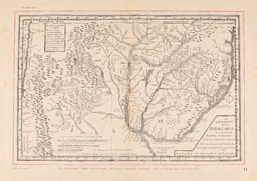
CitationDietell, Christoph. Die Landschaft nider=Paraguaria, Samt den Ländern Tucuman, Tscharvas, Tschaco, Mocobis, und einem Theil des Königreichs Tschili. Map. Augsburg & Graz: Heirs of Phillip, Martin & Johann Veith, 1728. https://jcb.lunaimaging.com/luna/servlet/detail/JCBMAPS~1~1~2190~109790004:Die-Landschaft-nider%3DParaguaria%2C-Sa%3Fsort%3DDate%252CTitle?qvq=w4s:/who%2FGraecij%2F%255BHeirs%2Bof%2BPhillip%2C%2BMartin%2B%26%2BJohann%2BVeith%255D%2Fwhere%2FSouth%2BAmerica;sort:Date%2CTitle&mi=1&trs=2.
Dietell, Christoph. Die Landschaft nider=Paraguaria, Samt den Ländern Tucuman, Tscharvas, Tschaco, Mocobis, und einem Theil des Königreichs Tschili. Map. Augsburg & Graz: Heirs of Phillip, Martin & Johann Veith, 1728. https://jcb.lunaimaging.com/luna/servlet/detail/JCBMAPS~1~1~2190~109790004:Die-Landschaft-nider%3DParaguaria%2C-Sa%3Fsort%3DDate%252CTitle?qvq=w4s:/who%2FGraecij%2F%255BHeirs%2Bof%2BPhillip%2C%2BMartin%2B%26%2BJohann%2BVeith%255D%2Fwhere%2FSouth%2BAmerica;sort:Date%2CTitle&mi=1&trs=2.