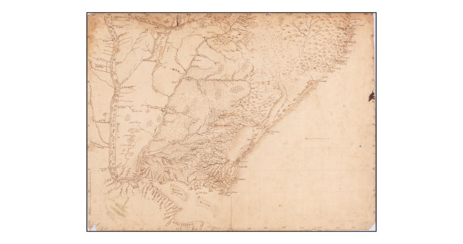
Peoples
- BOHANES
- MINUANES
- CHARRUAS
- MANCHADOS
Citation
"[Rio De La Plata, Uruguay, Southern Brazil]." Map. 1765. Accessed May 1, 2022. https://www.raremaps.com/gallery/detail/59814/rio-de-la-plata-uruguay-southern-brazil-anonymous.
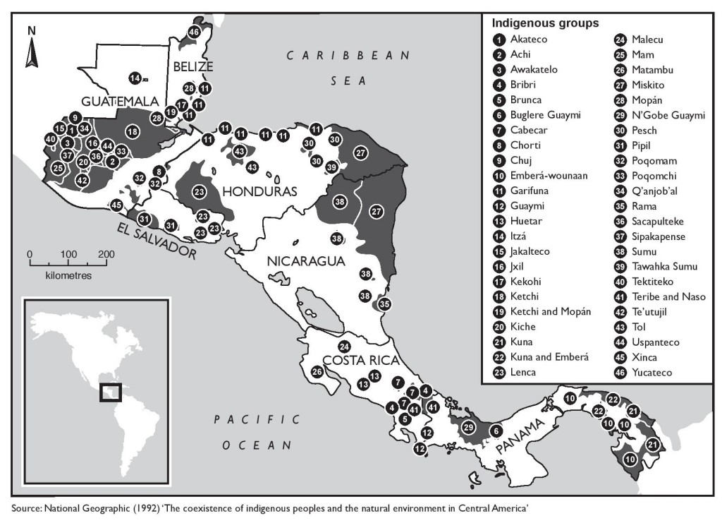
The coexistence of indigenous peoples and the natural environment in Central America
Map 1900 - 1999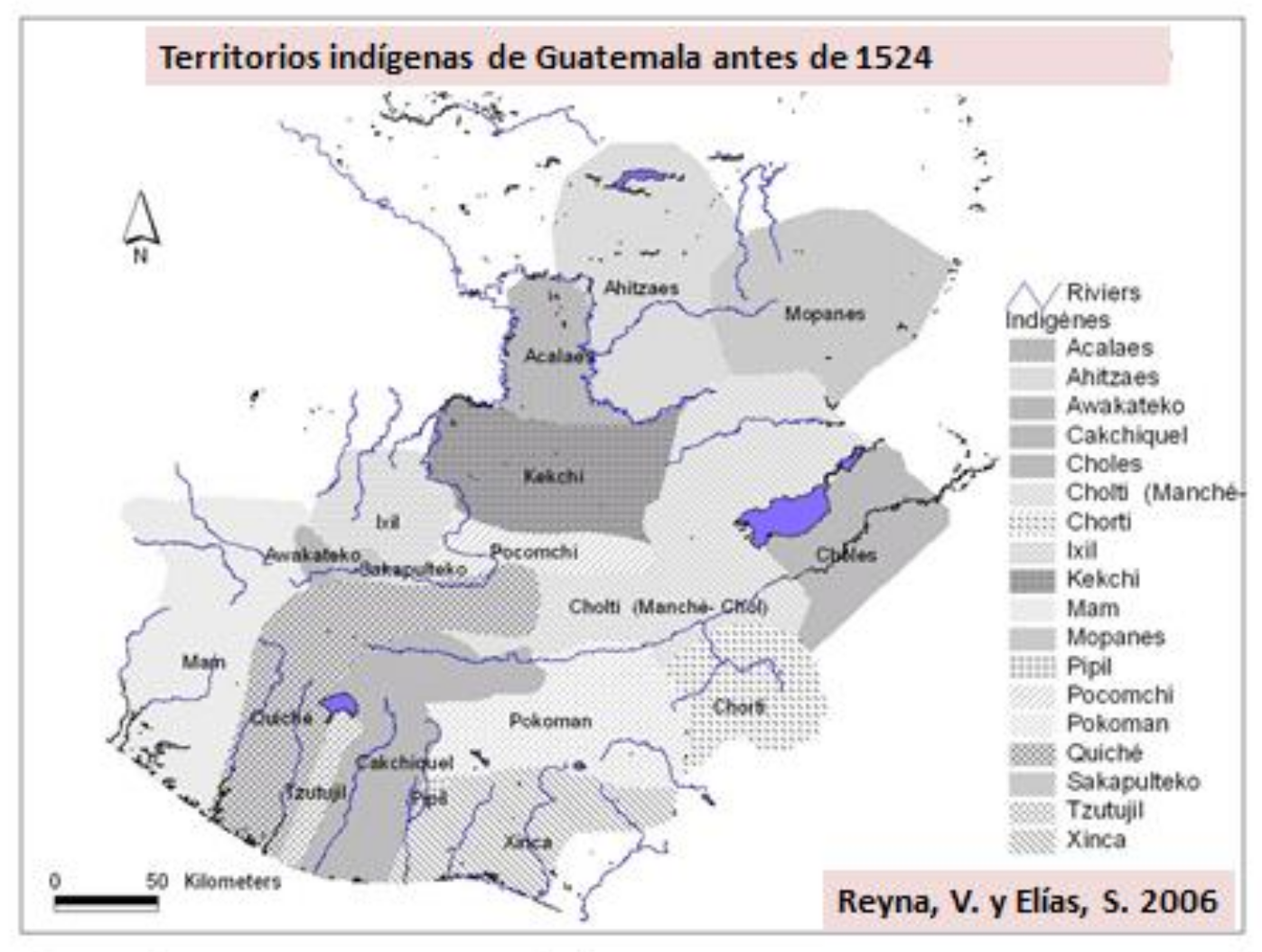
Territorios indígenas de Guatemala antes de 1524
Map 1523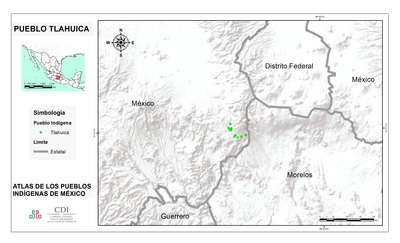
PUEBLO TLAHUICA
Map 2020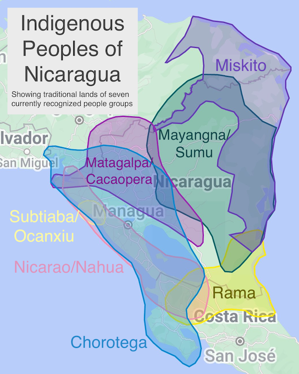
Indigenous Peoples of Nicaragua: Showing traditional lands of seven currently recognized people and groups.
Map 2022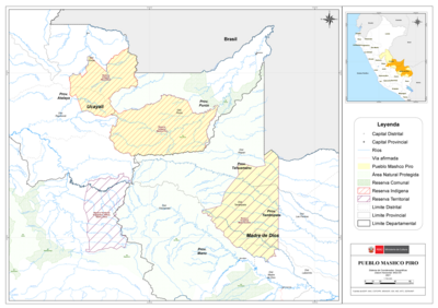
PUEBLO MASHCO PIRO
Map 2021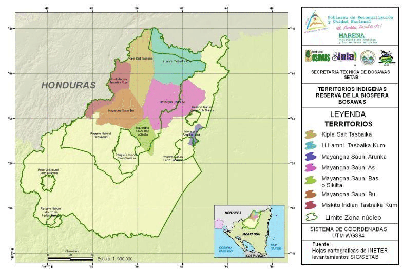
Indigenous territories and Bosawás in Nicaragua.
Map 2000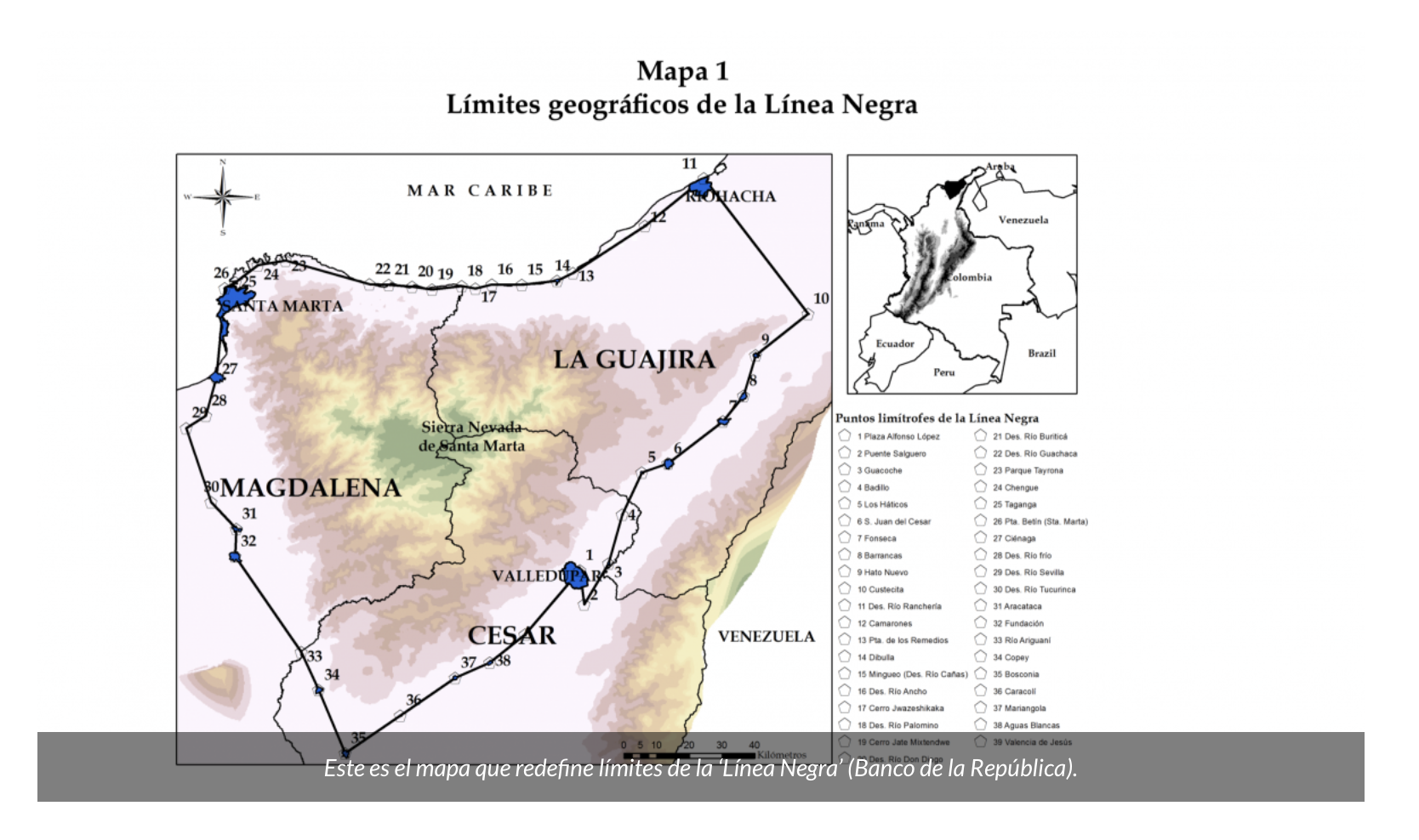
MAPA 1 LÍMITES GEOGRAFICOS DE LA LÍNEA NEGRA
Map 2018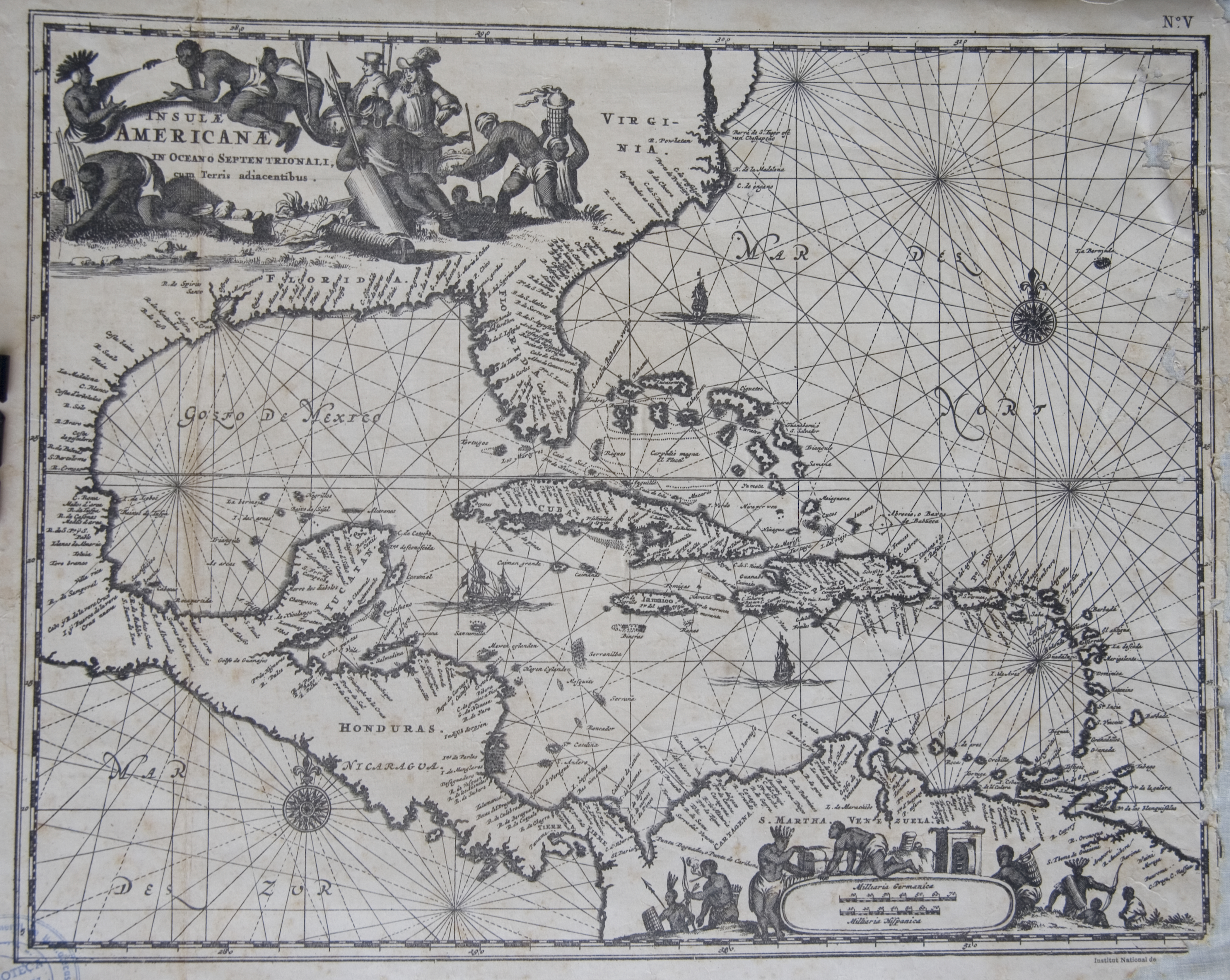
Islas Antillas y costas de tierra firme.
Map 1500 - 1599