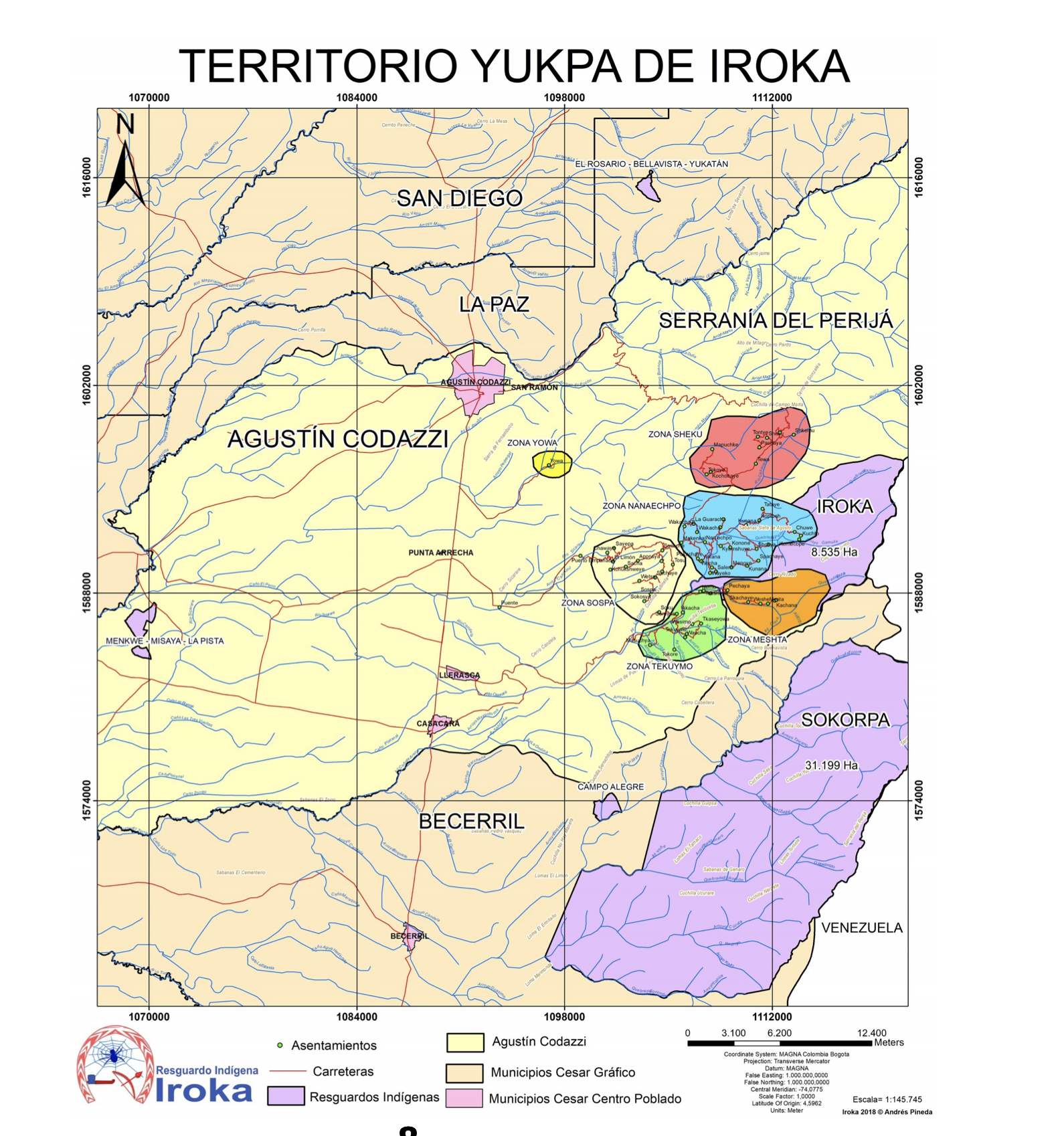
Peoples
- SIPABOS
- CHIPES
- MANAMABOBOS
- UNIGUESAS
- MOCHOVOS PICHAMBIO Y SOBOYAS
- CANIPAS
- CATAPCHOS
- CALLISECAS
- AMAGES
- MARANCOCHAS
- PIRAS
- GETIBA
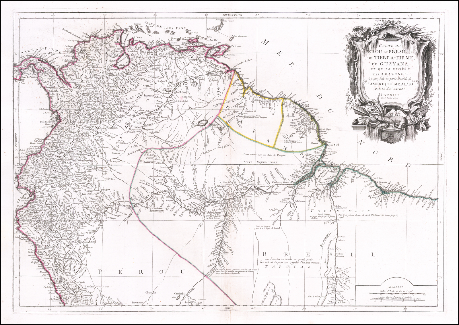
Citation
Vandermaelen, P. (Cartographer). (1827). Partie du Perou. Amer. Merid [Map]. Ph. Vandermaelen. David Rumsey. https://www.davidrumsey.com/luna/servlet/s/l01ya4
![O Vendedor de frutas [The Fruit Vendor]](https://dnet8ble6lm7w.cloudfront.net/art/ABRA045.jpeg)