Peoples
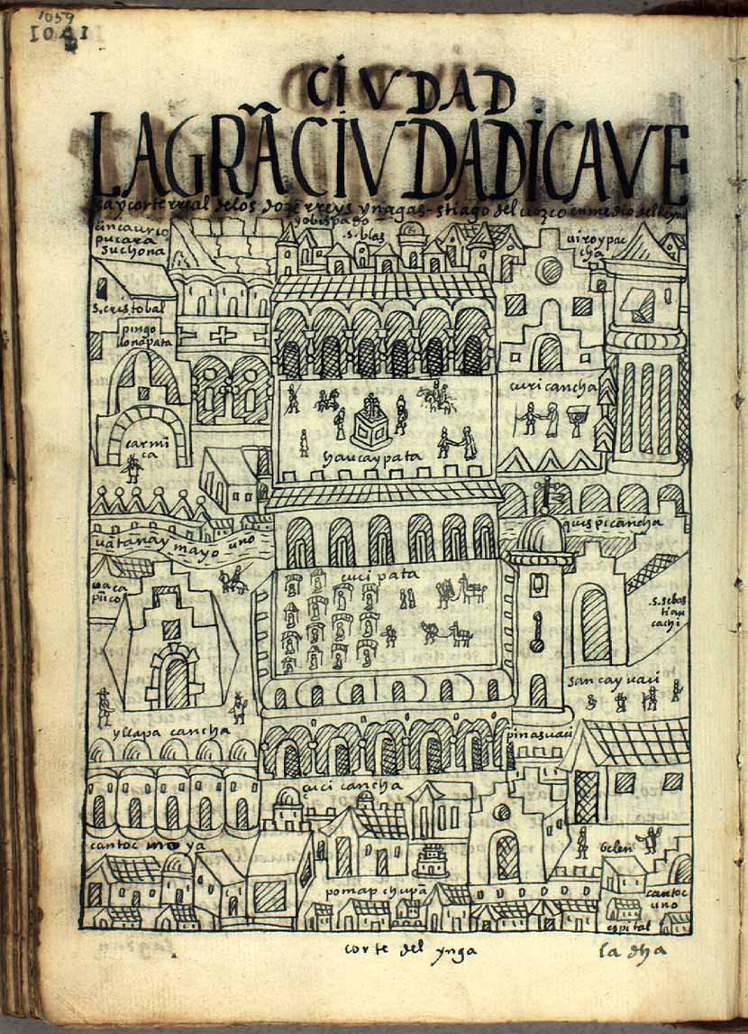
- CORTE DEL YNGA
Citation
Poma de Ayala, F. G. (Cartographer). (1615). LA GRAN CIVDAD [Map]. Det Kgl. Bibliotek. https://poma.kb.dk/permalink/2006/poma/1059/en/text/?open=idm656&imagesize=XL
![No nos culpes por lo que pasó [Do not blame us fow what happened]](https://dnet8ble6lm7w.cloudfront.net/art_sm/AECU010.png)
No nos culpes por lo que pasó [Do not blame us fow what happened]
Artwork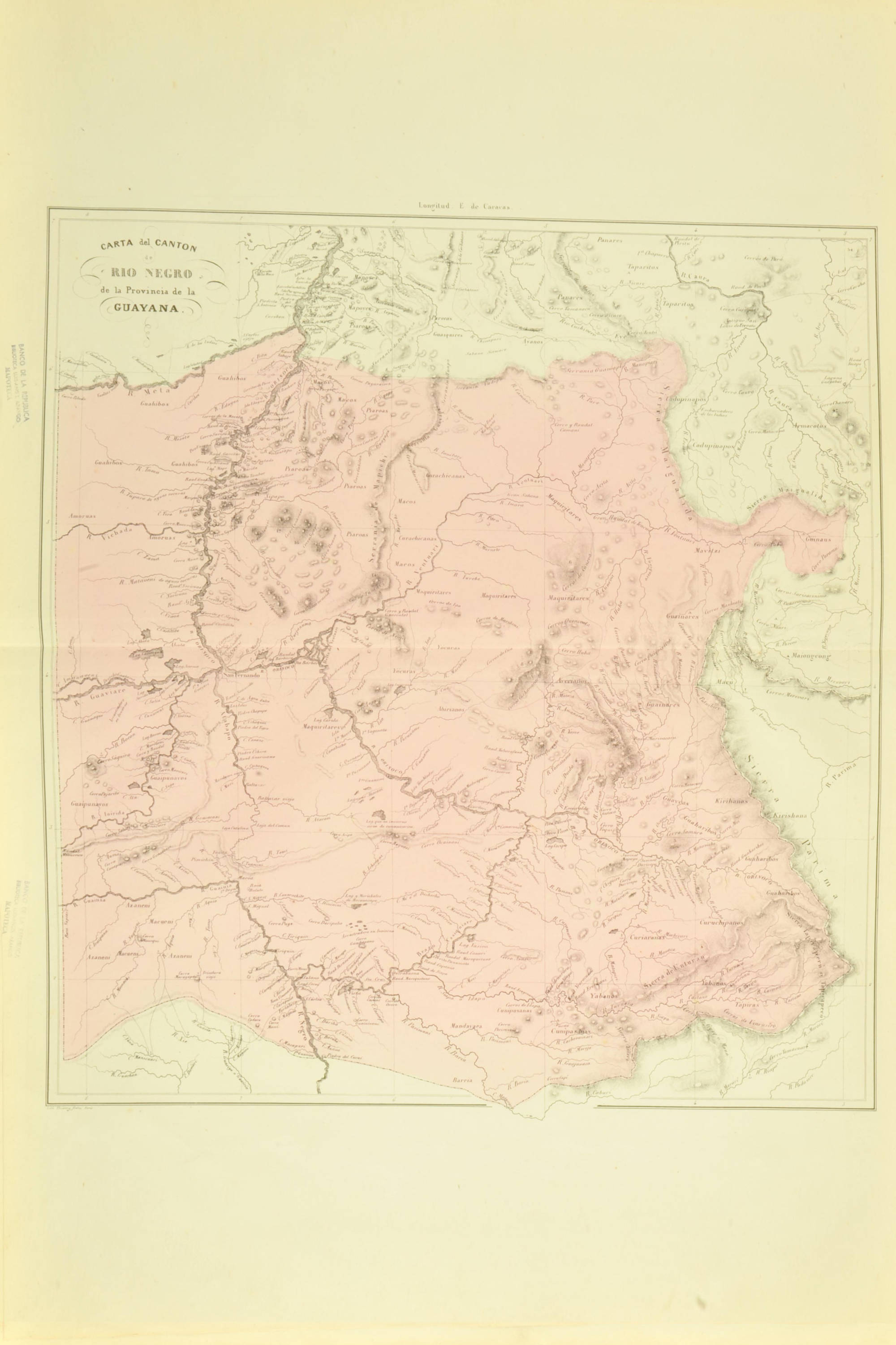
CARTA del CANTON de RÍO NEGRO de la Provincia de la GUAYANA
Map 1840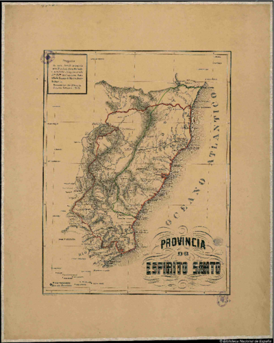
PROVINCIA DO ESPIRITO SANTO
Map 1873
PUEBLO MIXE
Map 2020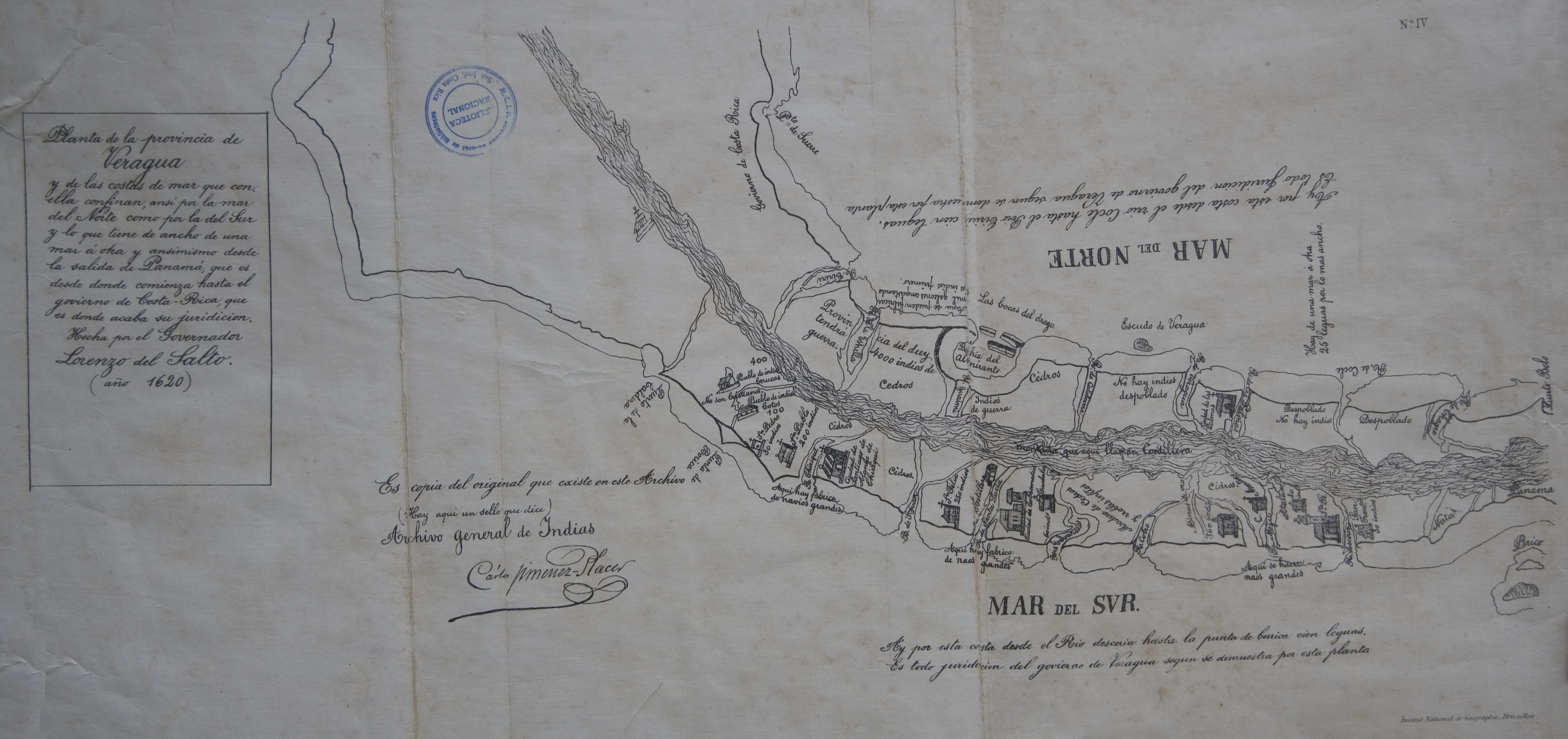
Veragua y parte de Costa-Rica
Map 1600 - 1699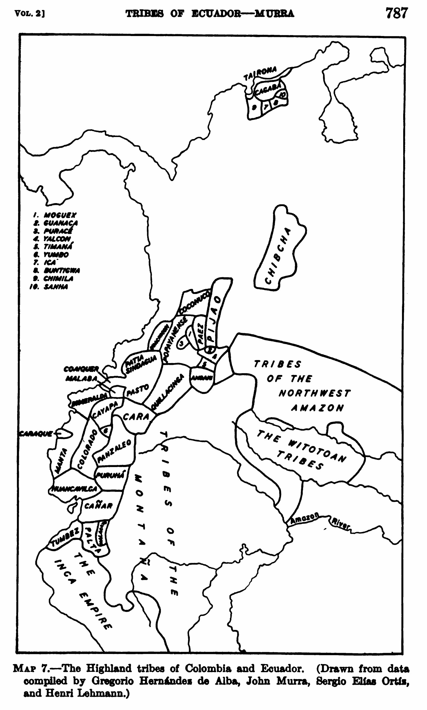
MAP 7.—The Highland tribes of Colombia and Ecuador. (Drawn from data compiled by Gregorio Hernández de Alba;John Murra;Sergio Elías Ortíz;and Henri Lehmann.)
Map 1400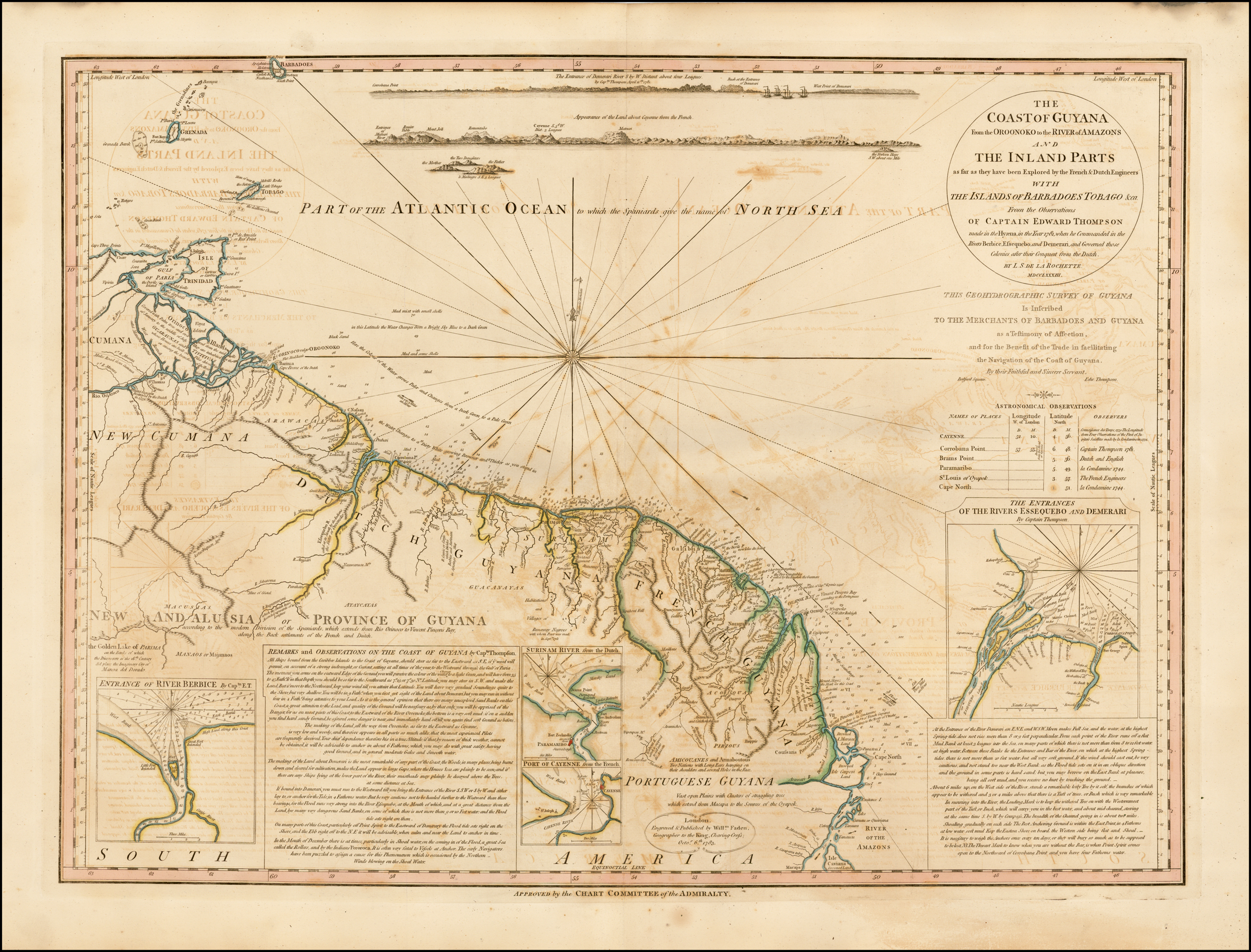
COAST OF GUYANA FROM THE OROONOKO TO THE RIVER OF AMAZONS AND THE INLAND PARTS AS FAR AS THEY HAVE BEEN EXPLORED BY THE FRENCH & DUTCH ENGINEERS WITH THE ISLANDS OF BARBADOS TOBAGO & CA.
Map 1781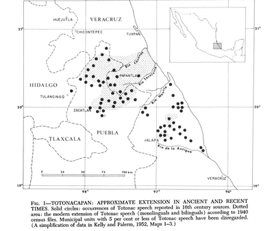
Totocanapan: Approximate Extension in Ancient and Recent Times
Map 1940