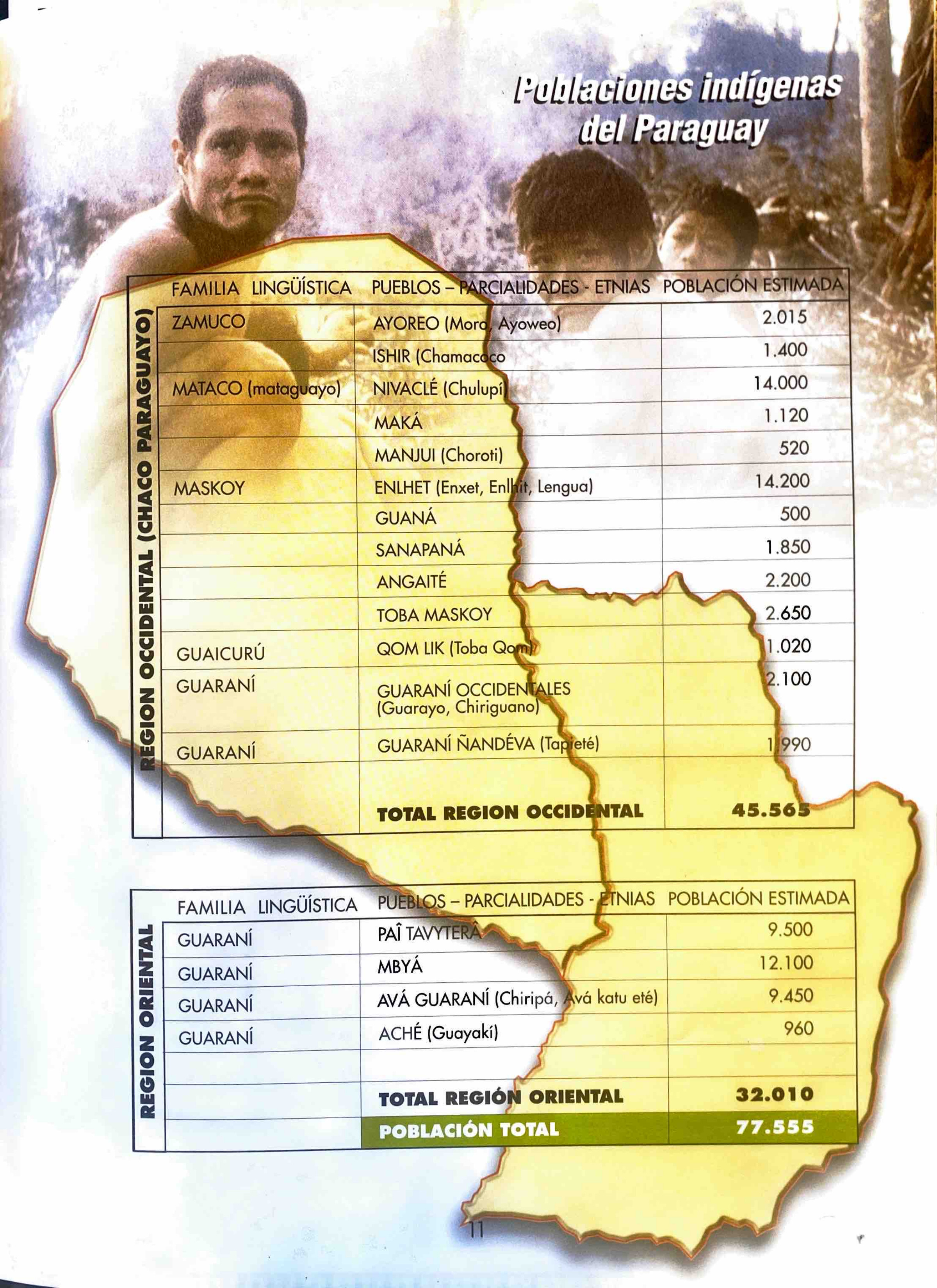
Peoples
- MARCO
Citation
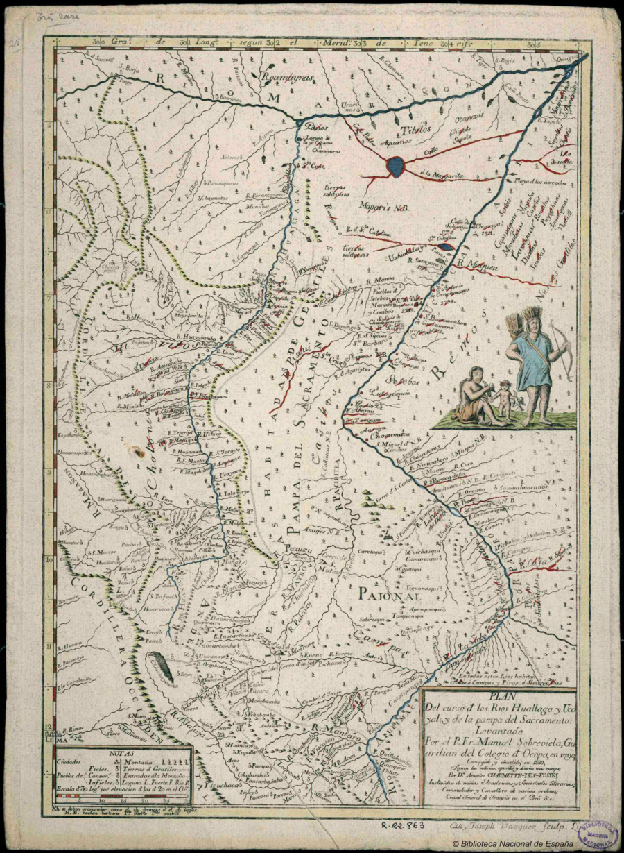
Vázquez, J., Amedée, J. B. G., & Cabello, M. (Cartographers). (1830). Plan Del curso de los Rios Huallaga y Ucayali, y de la pampa del Sacramento [Map]. Biblioteca Digital Hispánica. http://bdh.bne.es/bnesearch/detalle/bdh0000018271