Peoples- VITICO
- GUANCAS
- ATTIAVALLOS
- CONCHUCOS
- MOTILONES
- GUAYLAS
- AIMARES
- LUCANAS
- CANAS
- CANCHES
- MINES
Citationde Fer, N. (Cartographer). (1719). Le Perou dans l'Amerique Meridionale [Map]. David Rumsey. https://www.davidrumsey.com/luna/servlet/detail/RUMSEY~8~1~279602~90052589:Le-Perou-dans-l-Ame%EF%BF%BD%EF%BF%BDrique-Me%EF%BF%BD%EF%BF%BDridi?sort=Pub_List_No_InitialSort
de Fer, N. (Cartographer). (1719). Le Perou dans l'Amerique Meridionale [Map]. David Rumsey. https://www.davidrumsey.com/luna/servlet/detail/RUMSEY~8~1~279602~90052589:Le-Perou-dans-l-Ame%EF%BF%BD%EF%BF%BDrique-Me%EF%BF%BD%EF%BF%BDridi?sort=Pub_List_No_InitialSort
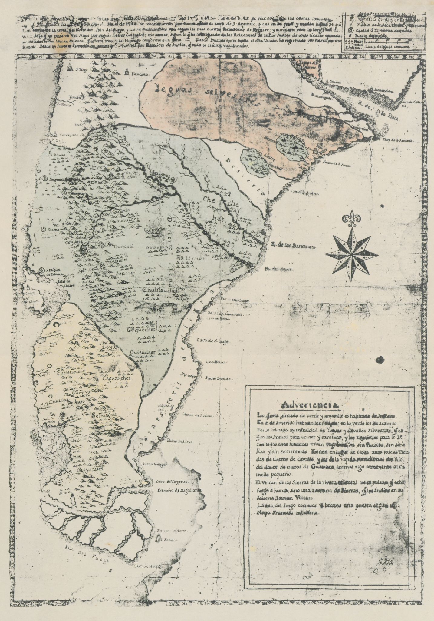
![Carte du Chili Méridional du Rio de la Plata, des Patagons, et
du Détroit de Magellan;Ce qui fait l'extremité Australe de l'Amerique
Merid[iona]le.](https://dnet8ble6lm7w.cloudfront.net/maps/ARG/ARG0069.jpg)