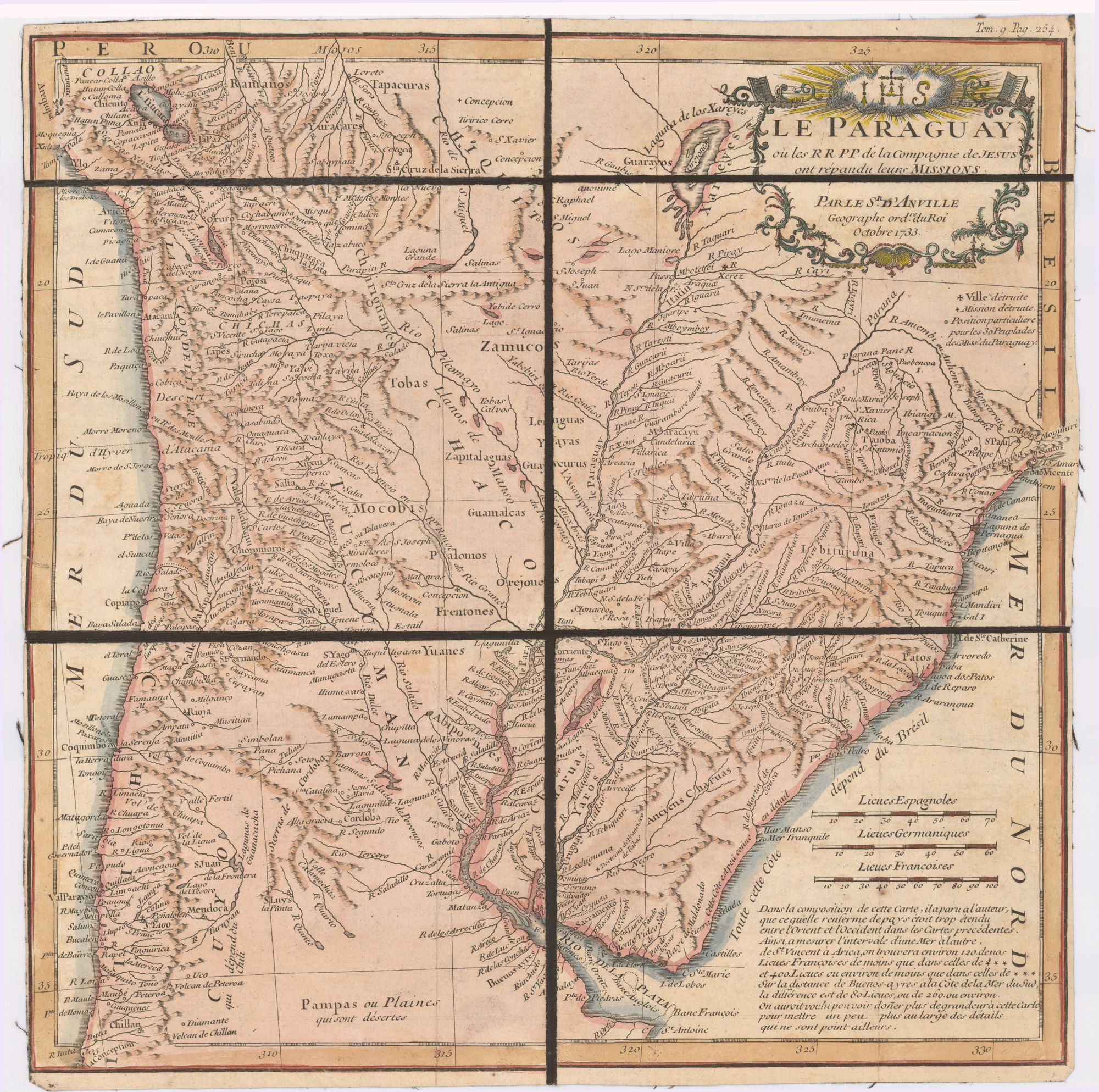
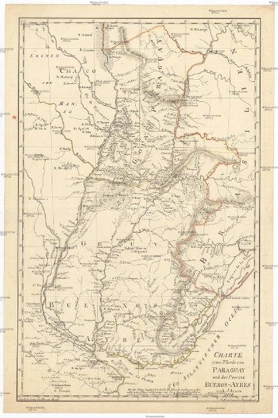
Dispossesions in the Americas

Dispossesions in the Americas

  • Home
  • Explore
  • About
  • Authors
  • Art
  • Bodies
  • Curricula
  • Cultural Heritage
  • Maps
  • Territories
Back to Explore
Map 1809

CHARTE eines Theils von PARAGUAY und der Provinz BUENOS-AYRES

  • AZARA, FELIX DE

Published: 1809

  • Download Image

Peoples

  • GUANA
  • MBYA
  • MACHICUIS
  • GUENTUSE
  • ENIMAGA
  • AGUILOT
  • VILELA
  • CHUNUPI
  • TOBA
  • PILAGA
  • GUAICURU
  • PAYAGUA
  • MBOCOBIS
  • NALICUEGAS
  • GUARANI
  • TUPA
  • TUPY
  • GUYANA
  • ABIPON
  • PAMPAS
  • QUILMES
  • CALIANOS
  • CHARRUAS
  • GUENOA-MINUANES
  • BOHANES
  • YAROS
  • CHANAS

Citation

Azara, Félix de. "Charte eines Theils von Paraguay und der Provinz Buenos-Ayres." Map. 1809. Accessed May 13, 2023. http://digitool.is.cuni.cz/R/-?func=dbin-jump-full&object_id=1013413&silo_library=GEN01.

  • Download Image

Reading in Spanish

Map 1809

CHARTE eines Theils von PARAGUAY und der Provinz BUENOS-AYRES

  • AZARA, FELIX DE

Published: 1809

  • Download Image
  • Download Image

Related Content

PROVINCIA DE MINAS GERAES

PROVINCIA DE MINAS GERAES

Map 1873
Language Groups of Baja California

Language Groups of Baja California

Map 1981
Geographic Distribution of Huichol and Cora, Showing State Names

Geographic Distribution of Huichol and Cora, Showing State Names

Map 1969
Le Paraguay;où les R.R.P.P. de la Compagnie de Jesus ont répandu leurs missions par le Sr. d'Anville;geographe ordre. du Roi;Octobre 1733

Le Paraguay;où les R.R.P.P. de la Compagnie de Jesus ont répandu leurs missions par le Sr. d'Anville;geographe ordre. du Roi;Octobre 1733

Map 1733
A Map of part of Yucatan or of that Part of the Eastern Shore Within the Bay of Honduras Alloted to Great Britain for the Cutting of Logwood, in consequence of the Convention Signed with Spain on the 14th July 1786.

A Map of part of Yucatan or of that Part of the Eastern Shore Within the Bay of Honduras Alloted to Great Britain for the Cutting of Logwood, in consequence of the Convention Signed with Spain on the 14th July 1786.

Map 1700
"Territorio Indígena Cabécar de Ujarrás"

"Territorio Indígena Cabécar de Ujarrás"

Map 2010
Carte du Gouvernement de Cayenne.

Carte du Gouvernement de Cayenne.

Map 1700 - 1799
DistribuciĂłn actual de las culturas indĂ­genas de Venezuela

DistribuciĂłn actual de las culturas indĂ­genas de Venezuela

Map 2007

Dispossessions in the Americas

A project by

University of Pennsylvania

Copyright 2024

With support from

Mellon Foundation

Site design & development

Element 84

Art Credits

Azara, FĂ©lix de. “Charte eines Theils von Paraguay und der Provinz Buenos-Ayres.” Map. 1809. Accessed May 13, 2023. http://digitool.is.cuni.cz/R/-?func=dbin-jump-full&object_id=1013413&silo_library=GEN01.

Site Pages

  • Home
  • Explore
  • About
  • Authors
  • Art
  • Bodies
  • Curricula
  • Cultural Heritage
  • Maps
  • Territories