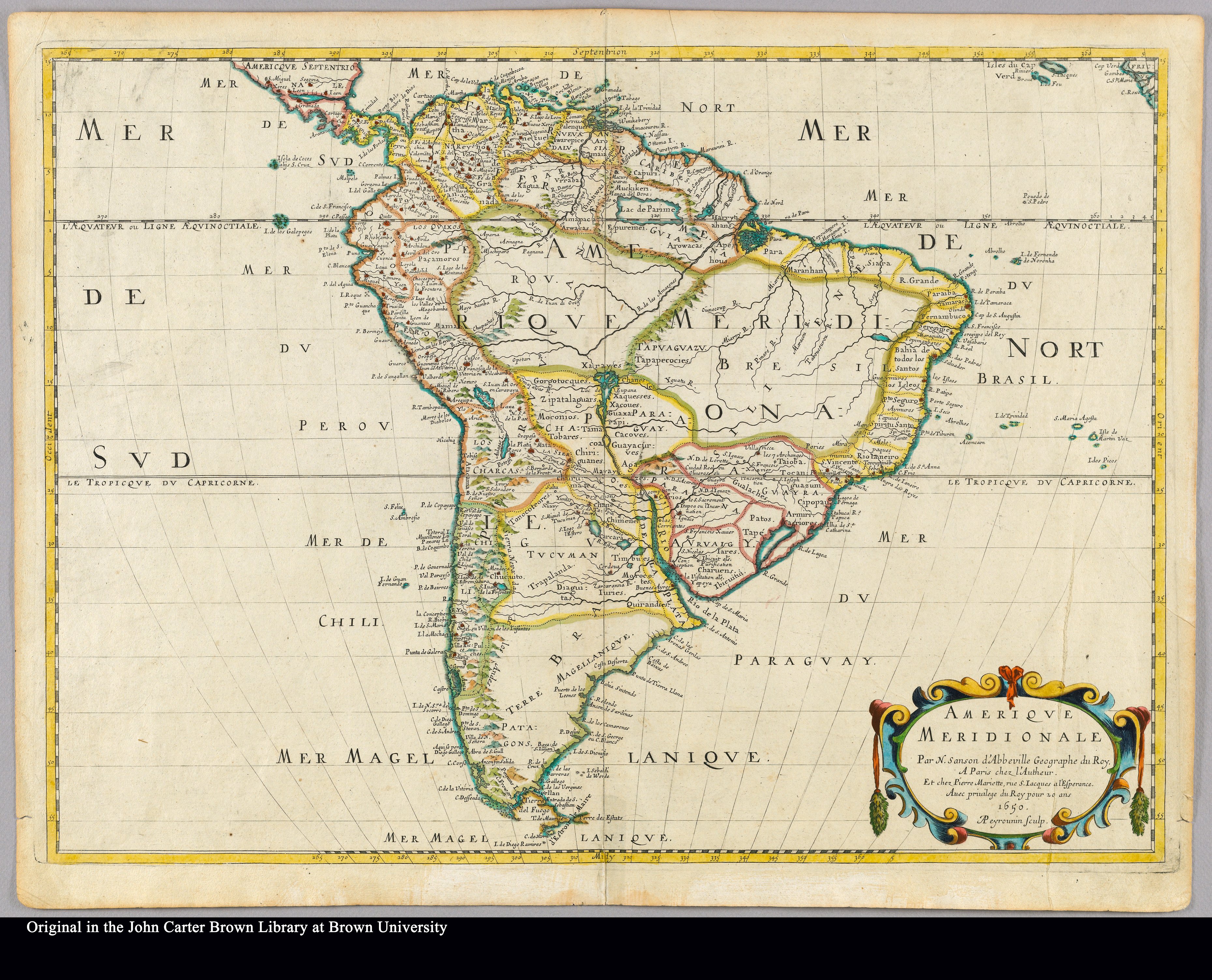
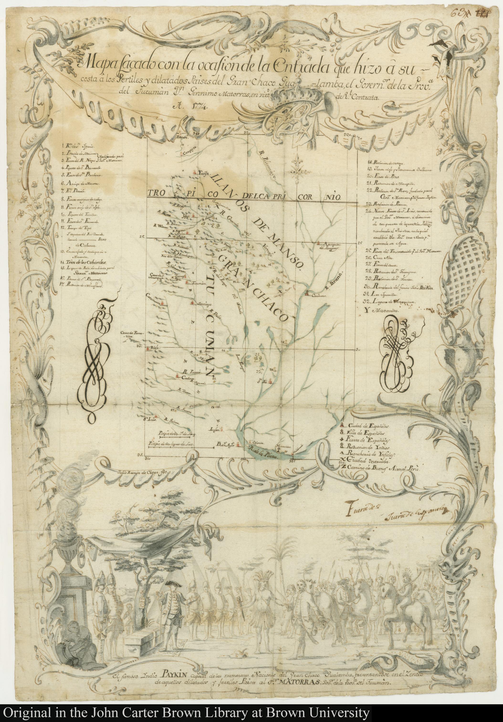
Dispossesions in the Americas

Dispossesions in the Americas

  • Home
  • Explore
  • About
  • Authors
  • Art
  • Bodies
  • Curricula
  • Cultural Heritage
  • Maps
  • Territories
Back to Explore
Map 1774

MAPA SACADO CON LA OCASION DE LA ENTRADA QUI HIZO Â SU COSTA Â LOS FERTILES Y DILATADOS PAISES DEL GRAN CHACO GUALAMBA

  • RAMON DE CESAR, JULIO

Published: 1774

  • Download Image

Peoples

  • YNDIOS
  • MBOCOBIS

Citation

Ramón de César, Julio. "Mapa sacado con la ocasion de la Entrada qui hizo â su costa â los Fertiles y dilatados Paises del Gran Chaco Gualamba." Map. JCB Map Collection. 1774. Accessed May 13, 2023. https://jcb.lunaimaging.com/luna/servlet/s/33nmd5.

  • Download Image

Reading in Spanish

Map 1774

MAPA SACADO CON LA OCASION DE LA ENTRADA QUI HIZO Â SU COSTA Â LOS FERTILES Y DILATADOS PAISES DEL GRAN CHACO GUALAMBA

  • RAMON DE CESAR, JULIO

Published: 1774

  • Download Image
  • Download Image

Reading in Portuguese

Map 1774

MAPA SACADO CON LA OCASION DE LA ENTRADA QUI HIZO Â SU COSTA Â LOS FERTILES Y DILATADOS PAISES DEL GRAN CHACO GUALAMBA

  • RAMON DE CESAR, JULIO

Published: 1774

  • Download Image

Peoples

  • YNDIOS
  • MBOCOBIS

Citation

Ramón de César, Julio. "Mapa sacado con la ocasion de la Entrada qui hizo â su costa â los Fertiles y dilatados Paises del Gran Chaco Gualamba." Map. JCB Map Collection. 1774. Accessed May 13, 2023. https://jcb.lunaimaging.com/luna/servlet/s/33nmd5.

  • Download Image

Related Content

PRINCIPALES PALENQUES DEL CARIBE

PRINCIPALES PALENQUES DEL CARIBE

Map 1600 - 1699
GUANAJUATO

GUANAJUATO

Map 2015
Amerique Meridionale

Amerique Meridionale

Map 1650
Guaraní Reta 2008: Pueblos guaraníes en las fronteras de Argentina, Brasil y Paraguay

Guaraní Reta 2008: Pueblos guaraníes en las fronteras de Argentina, Brasil y Paraguay

Map 2008
Location of the Ancient Cuitlatec Province

Location of the Ancient Cuitlatec Province

Map 1969
Carte de la Guyane Francoise ou France Equinoxiale. Grand, beau et très fertile Pays de l'Amerique Meridionale, située entre la Riviere de Marauny et le Cap Nord

Carte de la Guyane Francoise ou France Equinoxiale. Grand, beau et très fertile Pays de l'Amerique Meridionale, située entre la Riviere de Marauny et le Cap Nord

Map 1763
Ruatan or Rattan

Ruatan or Rattan

Map 1775
PRIMERAS CULTURAS QUITENAS - LA AMAZONIA - GENEALOGÍA - INVASIONES MAYAS

PRIMERAS CULTURAS QUITENAS - LA AMAZONIA - GENEALOGÍA - INVASIONES MAYAS

Map

Dispossessions in the Americas

A project by

University of Pennsylvania

Copyright 2024

With support from

Mellon Foundation

Site design & development

Element 84

Art Credits

Ramón de César, Julio. “Mapa sacado con la ocasion de la Entrada qui hizo â su costa â los Fertiles y dilatados Paises del Gran Chaco Gualamba.” Map. JCB Map Collection. 1774. Accessed May 13, 2023. https://jcb.lunaimaging.com/luna/servlet/s/33nmd5.

Site Pages

  • Home
  • Explore
  • About
  • Authors
  • Art
  • Bodies
  • Curricula
  • Cultural Heritage
  • Maps
  • Territories