
Peoples
- COMOYENES
- SAMAQUIONOS
- IVIRAYAS
- ZAMUCO
- TOBA
- MATACO
- GUAYCURU
- GUATATAS
- GUAYCURUTISI
- PAYAGUA
- CHURUMATAS
- CHIRIGUANO
- CHANE
- LULES
- TONOCOTES
Citation
Maeder, Ernesto J.A. La Población Indígena del Gran Chaco a mediados del Siglo XVII. August 1984. Accessed April 26, 2023. http://www.ernesto-maeder.com.ar/assets/files/04AC11.pdf.
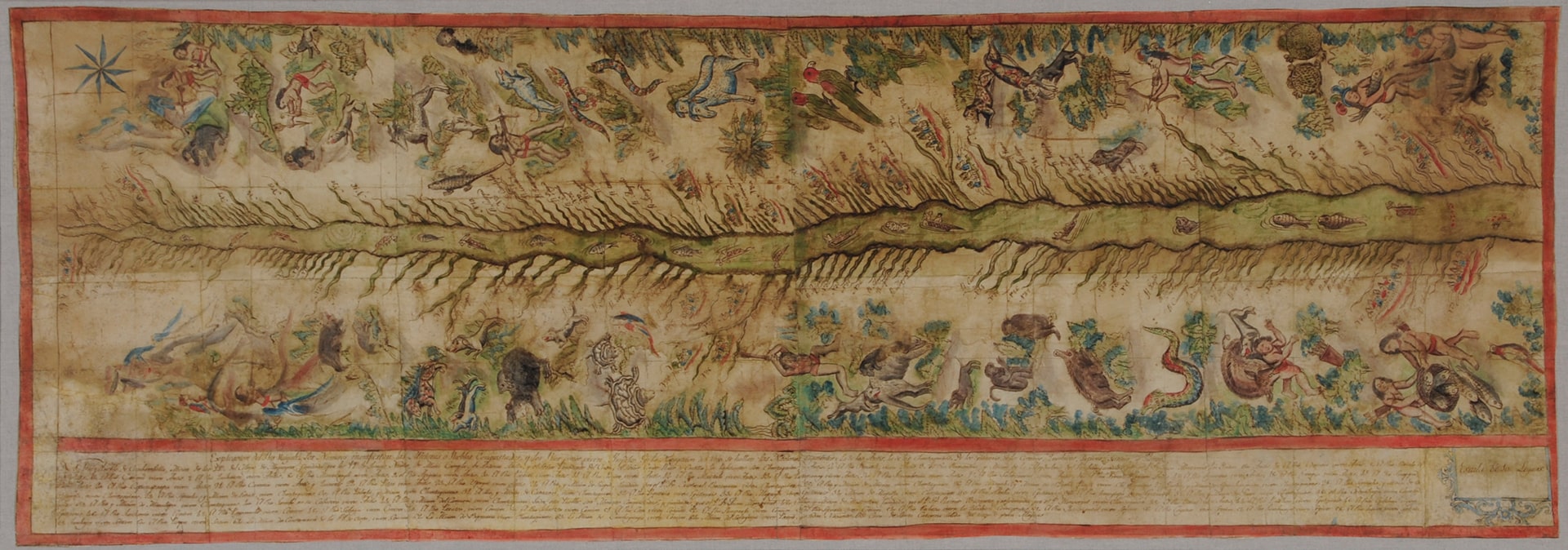
![Cosmovisión asháninka [Asháninka Cosmovision]](https://dnet8ble6lm7w.cloudfront.net/art_sm/APER033.png)