Dispossesions in the Americas

Dispossesions in the Americas

  • Home
  • Explore
  • About
  • Authors
  • Art
  • Bodies
  • Curricula
  • Cultural Heritage
  • Maps
  • Territories
Back to Explore
Map 1520

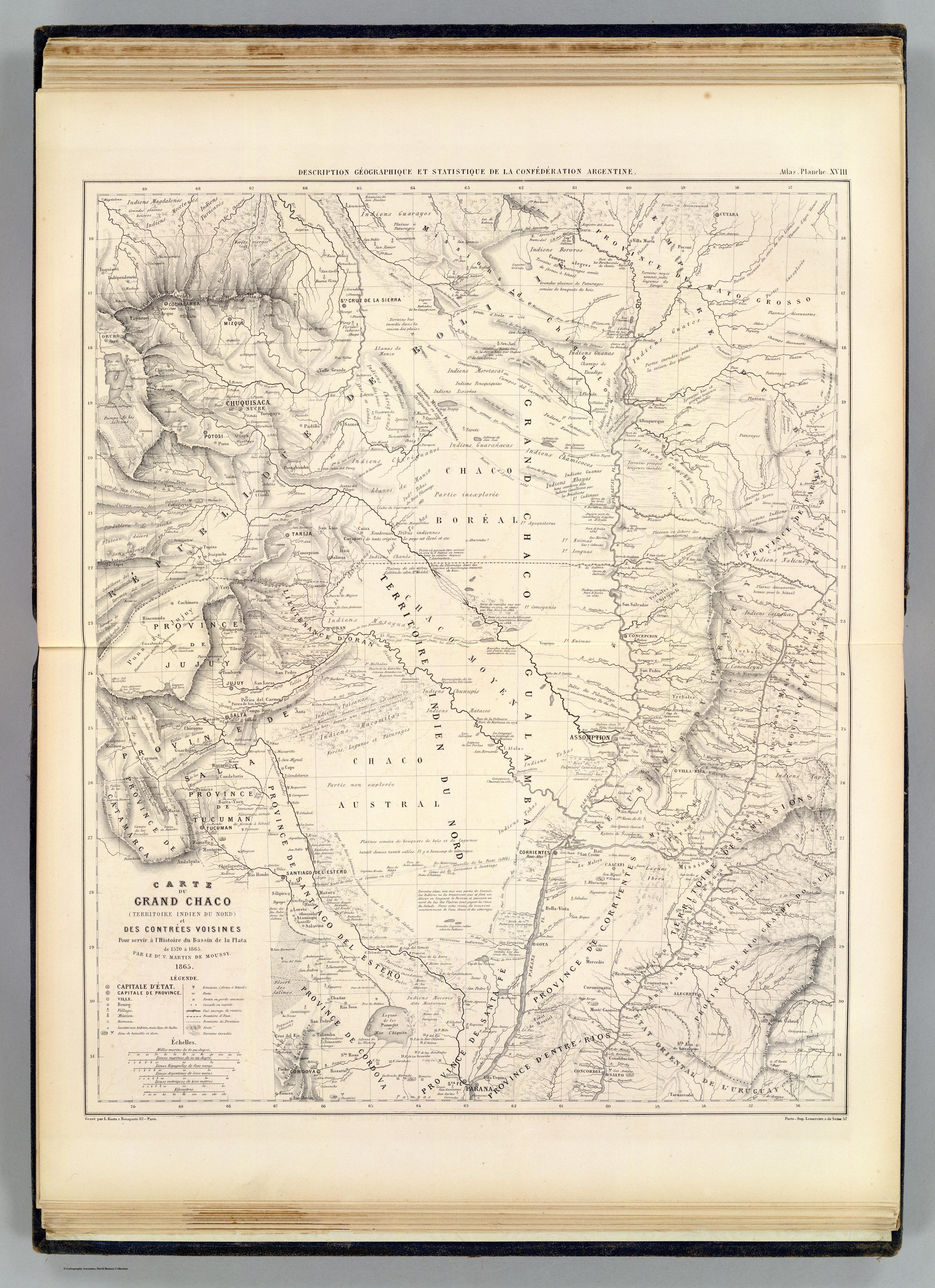
CARTE DU GRAND CHACO (TERRITOIRE INDIEN DU NORD) et DES CONTRÉES VOISINES

  • MARTIN DE MOUSSY, VICTOR

Published: 1865

  • Download Image

Peoples

  • GUARAYO
  • GUATOS
  • AYOREO
  • GUARANOCA
  • CHAMACOCOS
  • ZAMUCO
  • ENIMAGA
  • CHANE
  • GUANA
  • CHIRIGUANO
  • ITATINES
  • MBYA
  • GUAICURU
  • TOBA
  • LENGUA
  • NALICUEGAS
  • PAI TAVYTERA
  • MATACO
  • CHUNUPI
  • CANENDEYU
  • GUACHIS
  • CADIENOS
  • COMOYANES
  • PAISANAS
  • MALBALAS
  • TUPI
  • MOCOVIS
  • MOCETENES
  • YURACARES
  • BOROROS
  • CHIQUITOS
  • IZOZENOS
  • AYAQUITERAS
  • POTEROROS

Citation

Martin de Moussy, Victor. Carte du Grand Chaco et contrees voisines. Map. Paris: Firmin Didot Freres, 1865. Accessed April 18, 2023. https://www.davidrumsey.com/luna/servlet/detail/RUMSEY~8~1~20546~510072:Carte-du-Grand-Chaco-et-contrees-vo?sort=pub_list_no_initialsort%2Cpub_date%2Cpub_list_no%2Cseries_no#.
  • Download Image

Reading in Spanish

Map 1520

CARTE DU GRAND CHACO (TERRITOIRE INDIEN DU NORD) et DES CONTRÉES VOISINES

  • MARTIN DE MOUSSY, VICTOR

Published: 1865

  • Download Image
  • Download Image

Related Content

Guyane française. Carte géographo-géologique, dressée d'après les reconnaissances faites de 1867 à 1878 par le bureau du cadastre de Cayenne.

Guyane française. Carte géographo-géologique, dressée d'après les reconnaissances faites de 1867 à 1878 par le bureau du cadastre de Cayenne.

Map 1867 - 1878
"Territorio Indígena Cabécar de Ujarrás"

"Territorio Indígena Cabécar de Ujarrás"

Map 2010
TABULA geographica del rio Maranon o Amazonas

TABULA geographica del rio Maranon o Amazonas

Map 1690
A Map of part of Yucatan or of that Part of the Eastern Shore Within the Bay of Honduras Alloted to Great Britain for the Cutting of Logwood, in consequence of the Convention Signed with Spain on the 14th July 1786.

A Map of part of Yucatan or of that Part of the Eastern Shore Within the Bay of Honduras Alloted to Great Britain for the Cutting of Logwood, in consequence of the Convention Signed with Spain on the 14th July 1786.

Map 1700
LOCALIZACIÓN DE LOS PUEBLOS INDÍGENAS EN LA ARGENTINA

LOCALIZACIÓN DE LOS PUEBLOS INDÍGENAS EN LA ARGENTINA

Map 2004
Delimitación de la Gran Nación Wayuu

Delimitación de la Gran Nación Wayuu

Map 2015
AYMARA POLITIES AROUND THE TITICACA LAKE IN THE 15TH AND 16TH CENTURIES

AYMARA POLITIES AROUND THE TITICACA LAKE IN THE 15TH AND 16TH CENTURIES

Map 1548 - 1610
Carta ó Mapa Geográfico de una gran parte del Reino de N. E. [Nueva España], comprendido entre los 19 y 42 grados de latitud Septentrional y entre 249 y 289 grados de longitud del Meridiano de Tenerife, formado de orden del Exc[elentísi]mo S[eño]r B[eilí]o Fr[ey] D[o]n Ant[oni]o Maria Bucarely y Vrsúa p[ar]a indicar la division del Virreinato de México y de las Provincias internas erigidas en Comandancia General en virtud de Reales Órdenes el año 1770

Carta ó Mapa Geográfico de una gran parte del Reino de N. E. [Nueva España], comprendido entre los 19 y 42 grados de latitud Septentrional y entre 249 y 289 grados de longitud del Meridiano de Tenerife, formado de orden del Exc[elentísi]mo S[eño]r B[eilí]o Fr[ey] D[o]n Ant[oni]o Maria Bucarely y Vrsúa p[ar]a indicar la division del Virreinato de México y de las Provincias internas erigidas en Comandancia General en virtud de Reales Órdenes el año 1770

Map 1770

Dispossessions in the Americas

A project by

University of Pennsylvania

Copyright 2024

With support from

Mellon Foundation

Site design & development

Element 84

Art Credits

Martin de Moussy, Victor. Carte du Grand Chaco et contrees voisines. Map. Paris: Firmin Didot Freres, 1865. Accessed April 18, 2023. https://www.davidrumsey.com/luna/servlet/detail/RUMSEY~8~1~20546~510072:Carte-du-Grand-Chaco-et-contrees-vo?sort=pub_list_no_initialsort%2Cpub_date%2Cpub_list_no%2Cseries_no#.
Site Pages

  • Home
  • Explore
  • About
  • Authors
  • Art
  • Bodies
  • Curricula
  • Cultural Heritage
  • Maps
  • Territories