Peoples
- AYOREO
Citation
Zanardini, José, and Walter Biedermann. Los Indígenas Del Paraguay. 2nd ed. Asunción: ITAIPU Binacional, 2006.
CARTA DEL DEPARTAMENTO DEL ZULIA
Map 1827
Plan pour ouvrir une communication de la mer du Nord á la mer du Sud par la riviére San Juan;le lac de Nicaragua et la baie del Papagaye.
Map 1700
Terra Indígena Guarani do Aguapeú
Map 2011
CARTE que représente la Partie Méridionale DU BRÉSIL ET DU PEROU;LE CHILI SEPTENTRIONAL;EL LE PARAGUAY;Ce qui fait la Pártie de milieu DE L’AMÉRIQUE MERIDIONALE PAR LE SR. D’ANVILLE À VENISE Par P. Santini 1779. Chez M’.Remondiri.
Map 1779
Côtes du Brésil de Bahia de todos los Sancts à Spirito Santo
Map 1779
INTENDENCIA DE SAN LUIS POTOSÍ
Map 1800
MAPA DE SAN PEDRO AZCAPOTZALTONGO
Map 1500 - 1599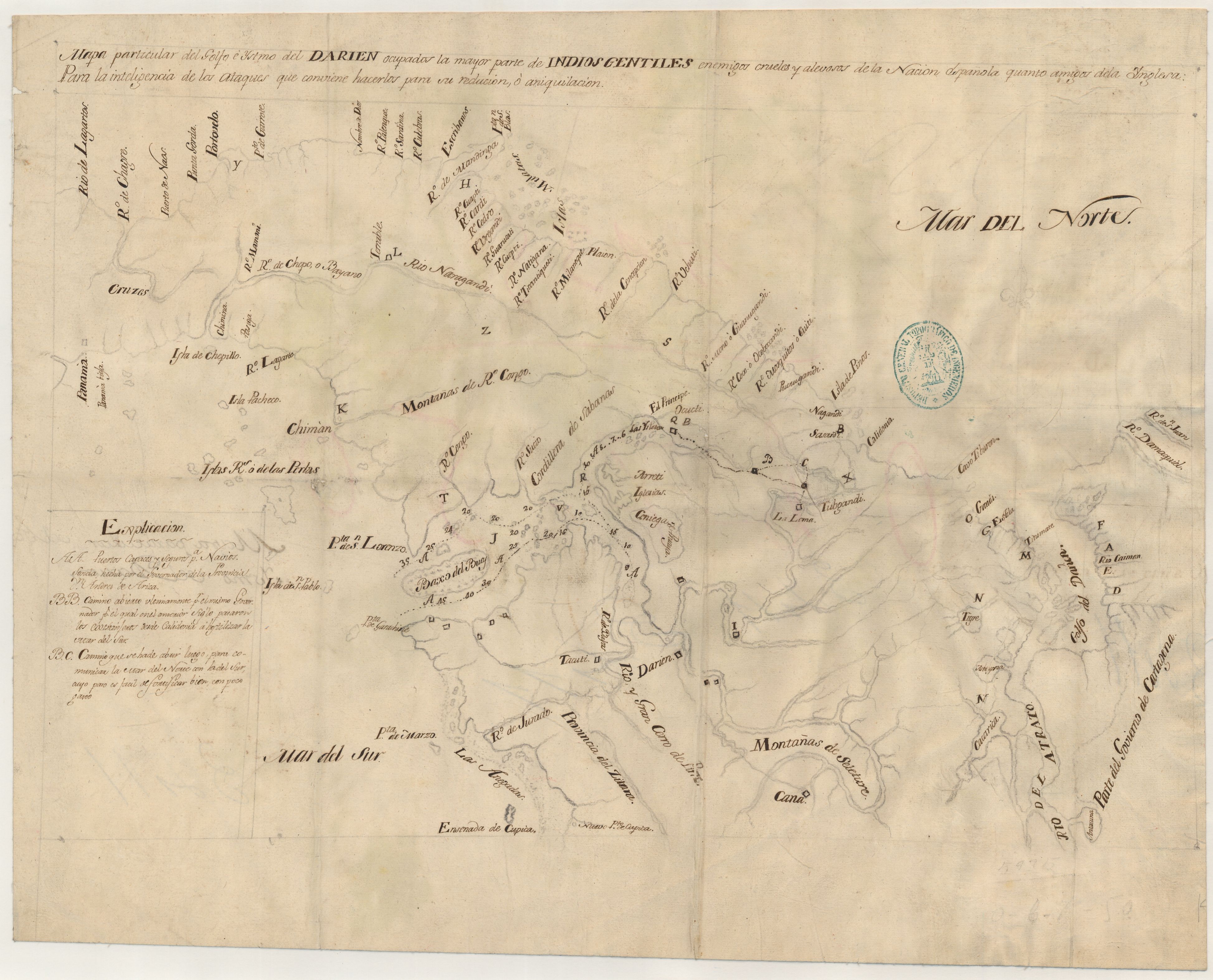
Mapa particular del Golfo e Ystmo del Darien ocupados por la mayor parte de los indios gentiles enemigos crueles y alevosos de la Nacion española quanto amigos dela inglesa : para la inteligencia de los ataques que conviene hacerlos para su reducion o aniquilacion
Map 1700 - 1799