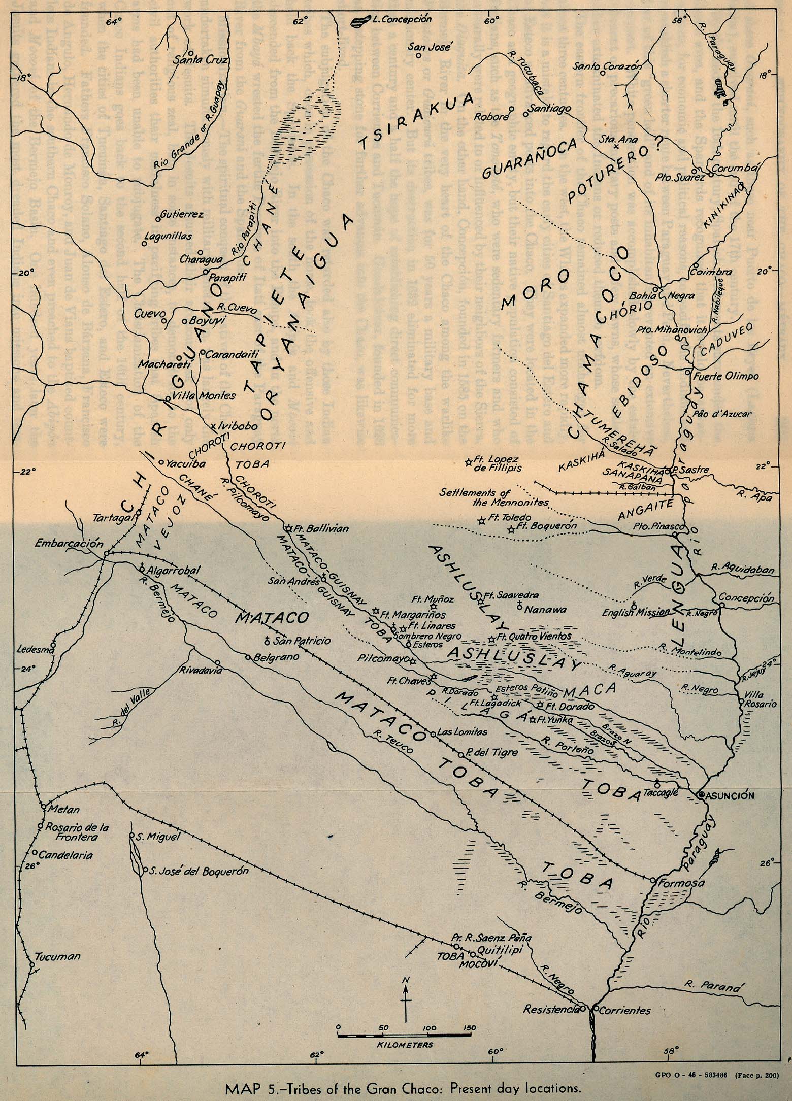
Peoples
- CHIRIGUANO
- ASHLUSLAY
- GUARANOCA
- CHANE
- TAPIETE
- MATACO
- TOBA
- LENGUA
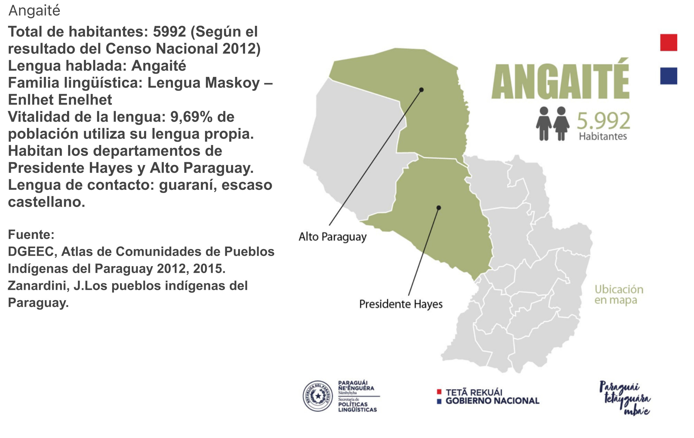
- ANGAITE
- CHAMACOCO
- AYOREO
- PILAGA
- GUANA
- SANAPANA
- POTURERO
- HORIO
- CADUVEO
- MOCOVI
Citation
Smithsonian Institution Bureau of American Ethnology. "Tribes of the Gran Chaco: Present day locations." Map. University of Texas Libraries. 1946. Accessed April 8, 2023. https://maps.lib.utexas.edu/maps/historical/gran_chaco_present_1946.jpg.
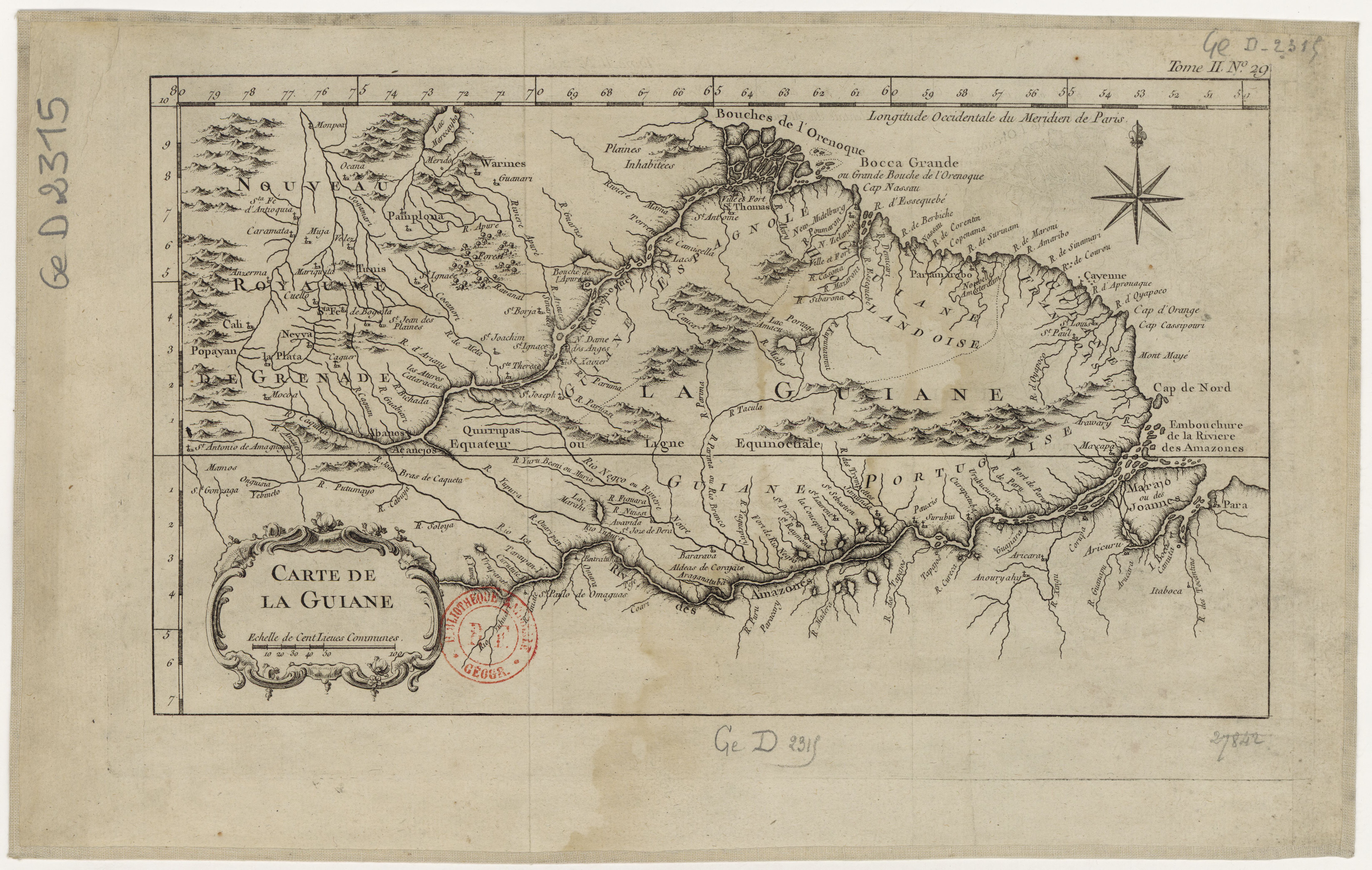
![Carte de la Guyane française (2ème édition). Service géographique des colonies. [Feuille 2]](https://dnet8ble6lm7w.cloudfront.net/maps_sm/FGU/FGU0012-0.png)