Citation
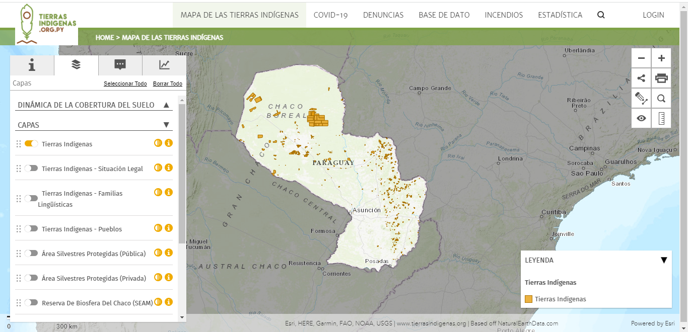
Federación por la Autodeterminación de los Pueblos Indígenas. "Mapa de las Tierras Indígenas." Map. Tierras Indígenas. 2017. Accessed April 8, 2023. https://www.tierrasindigenas.org/Mapa.
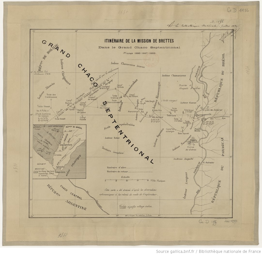
ITINÉRAIRES DE LA MISSION DE BRETTES Dans le Grand Chaco Septentrional (Voyage 1886, 1887-1888)
Map 1886 - 1888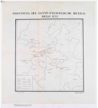
Provincia del Santo Evangelio de Mexico
Map 1500 - 1599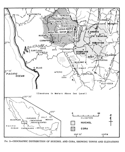
Geographic Distribution of Huichol and Cora, Showing Towns and Elevations
Map 1969
WESTINDIEN CENTRAL-AMERICA UND DAS NOERDLICHE UND NOERDWESTLICHE SUED AMERICA;NUEVA GRANADA UND VENEZUELA
Map 1866
CARTA COROGRAFICA DE LA REPÚBLICA DEL ECUADOR / MANUEL VILLAVICENCIO ;LIT. E IMP. DE F. MAYER Y CA.
Map 1817
PUEBLO IXCATECO
Map 2020
PUEBLO SERI
Map 2020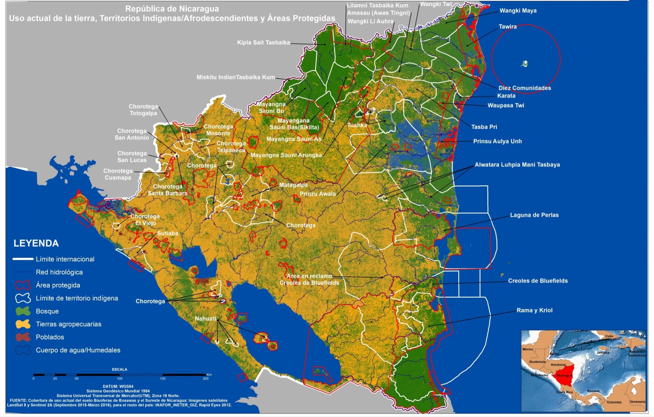
República de Nicaragua: uso actual de la tierra;Territorios Indígenas/Afrodescendientes y Areas Protegidas
Map 2012