Dispossesions in the Americas

Dispossesions in the Americas

  • Home
  • Explore
  • About
  • Authors
  • Art
  • Bodies
  • Curricula
  • Cultural Heritage
  • Maps
  • Territories
Back to Explore
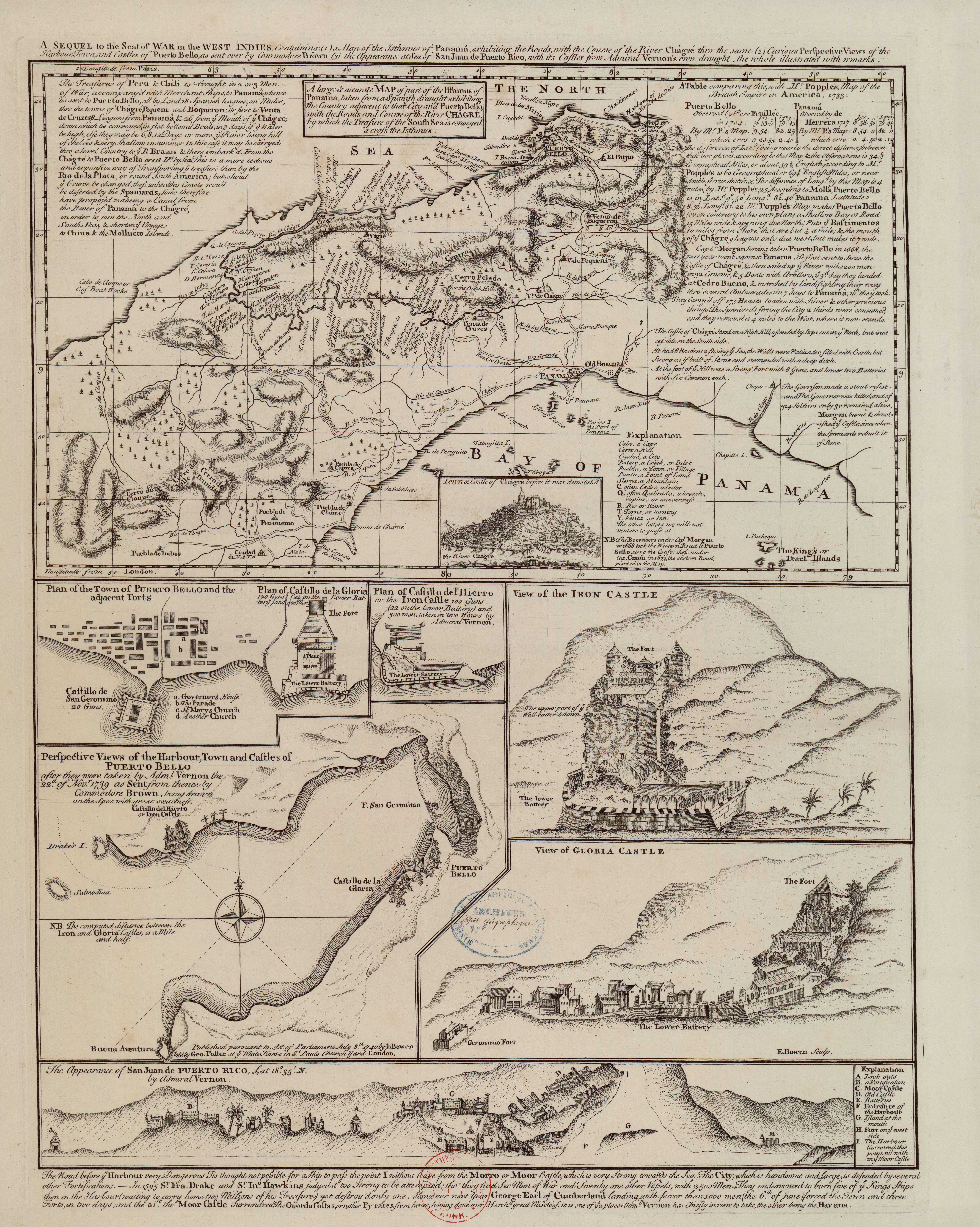
Map 1740

A Sequel of the Seat of War in the West Indies containing… Sub-map title: A large & accurate MAP of part of the Isthmus of Panama, taken from a Spanish drought exhibiting the Country adjacent to that City and Puerto Bello, with the Roads and Course of the River CHAGRE, by which the Treasure of the South Sea is conveyed a cross the Isthmus

  • BOWEN, EMANUEL

Published: 1740

  • Download Image

Peoples

  • PUEBLA DE INDIOS

Citation

Bowen, E. (1740). A large & accurate MAP of part of the Isthmus of Panama, taken from a Spanish drought exhibiting the Country adjacent to that City and Puerto Bello, with the Roads and Course of the River CHAGRE, by which the Treasure of the South Sea is conveyed a cross the Isthmus [Map]. Gallica. https://gallica.bnf.fr/ark:/12148/btv1b8493166k/f1.item.r=Panama.zoom
  • Download Image

Reading in Spanish

Map 1740

A Sequel of the Seat of War in the West Indies containing… Sub-map title: A large & accurate MAP of part of the Isthmus of Panama, taken from a Spanish drought exhibiting the Country adjacent to that City and Puerto Bello, with the Roads and Course of the River CHAGRE, by which the Treasure of the South Sea is conveyed a cross the Isthmus

  • BOWEN, EMANUEL

Published: 1740

  • Download Image
  • Download Image

Related Content

Lamento KayapĂł [KayapĂł Lament]

Lamento KayapĂł [KayapĂł Lament]

Artwork
Da barra de Maranhao, ate a barra do Cuma sao tres legoas

Da barra de Maranhao, ate a barra do Cuma sao tres legoas

Map 1600 - 1640
Los GarĂ­funa: Most important municipios, 2001

Los GarĂ­funa: Most important municipios, 2001

Map 2001
Carte de la Guyane française (2ème édition). Service géographique des colonies. [Feuille 1]

Carte de la Guyane française (2ème édition). Service géographique des colonies. [Feuille 1]

Map 1926
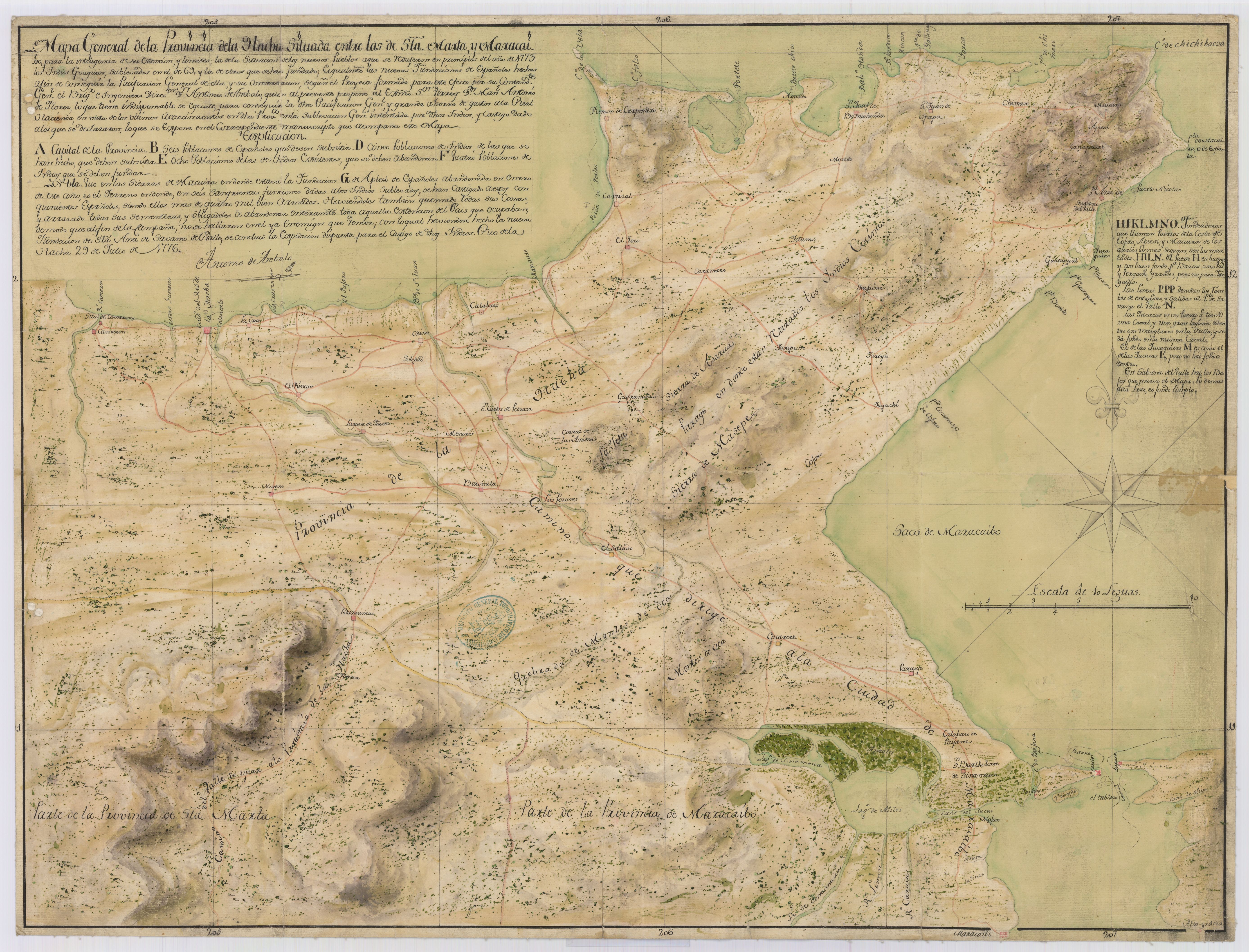
ATLAS de VENEZUELA ESTADO ZULIA

ATLAS de VENEZUELA ESTADO ZULIA

Map 1916
PUEBLO CHITONAHUA

PUEBLO CHITONAHUA

Map 2021
LINGUISTIC MAP OF MEXICO AND CENTRAL AMERICA

LINGUISTIC MAP OF MEXICO AND CENTRAL AMERICA

Map 1909
MAP 4. DISTRIBUTION OF ETHNIC GROUPS IN THE ORIENTE ON THE EVE OF SPANISH CONQUEST

MAP 4. DISTRIBUTION OF ETHNIC GROUPS IN THE ORIENTE ON THE EVE OF SPANISH CONQUEST

Map 1535

Dispossessions in the Americas

A project by

University of Pennsylvania

Copyright 2024

With support from

Mellon Foundation

Site design & development

Element 84

Art Credits

Bowen, E. (1740). A large & accurate MAP of part of the Isthmus of Panama, taken from a Spanish drought exhibiting the Country adjacent to that City and Puerto Bello, with the Roads and Course of the River CHAGRE, by which the Treasure of the South Sea is conveyed a cross the Isthmus [Map]. Gallica. https://gallica.bnf.fr/ark:/12148/btv1b8493166k/f1.item.r=Panama.zoom
Site Pages

  • Home
  • Explore
  • About
  • Authors
  • Art
  • Bodies
  • Curricula
  • Cultural Heritage
  • Maps
  • Territories