Peoples
- YNDYOS ZAMBOS
- YNDYOS MOSQUITOS
Citation
Arrowsmith;Aaron. Map of Guatemala: reduced from the survey in the archives of that country. [London: Published by A. Arrowsmith;to His Majesty;1826] Map. https://www.loc.gov/item/2004629011/.
Comunidades indígenas y Áreas protegidas del Chaco paraguayo
Map 2020
Partie de la coste de la Guyane depuis la Rivière de Mahury jusqu'à celle de Macouria ou se trouve comprise la Rade de Cayenne
Map 1765
DESCRIPCIÓN GEOGRAPHICA E HIDORGRÁPHICA DEL GOVIERNO DE VENEZUELA I SUS PROVINCIAS
Map 1634
Cayenne représentée exactement dans toutes ses rivières, criques et habitations et ses dehors
Map 1717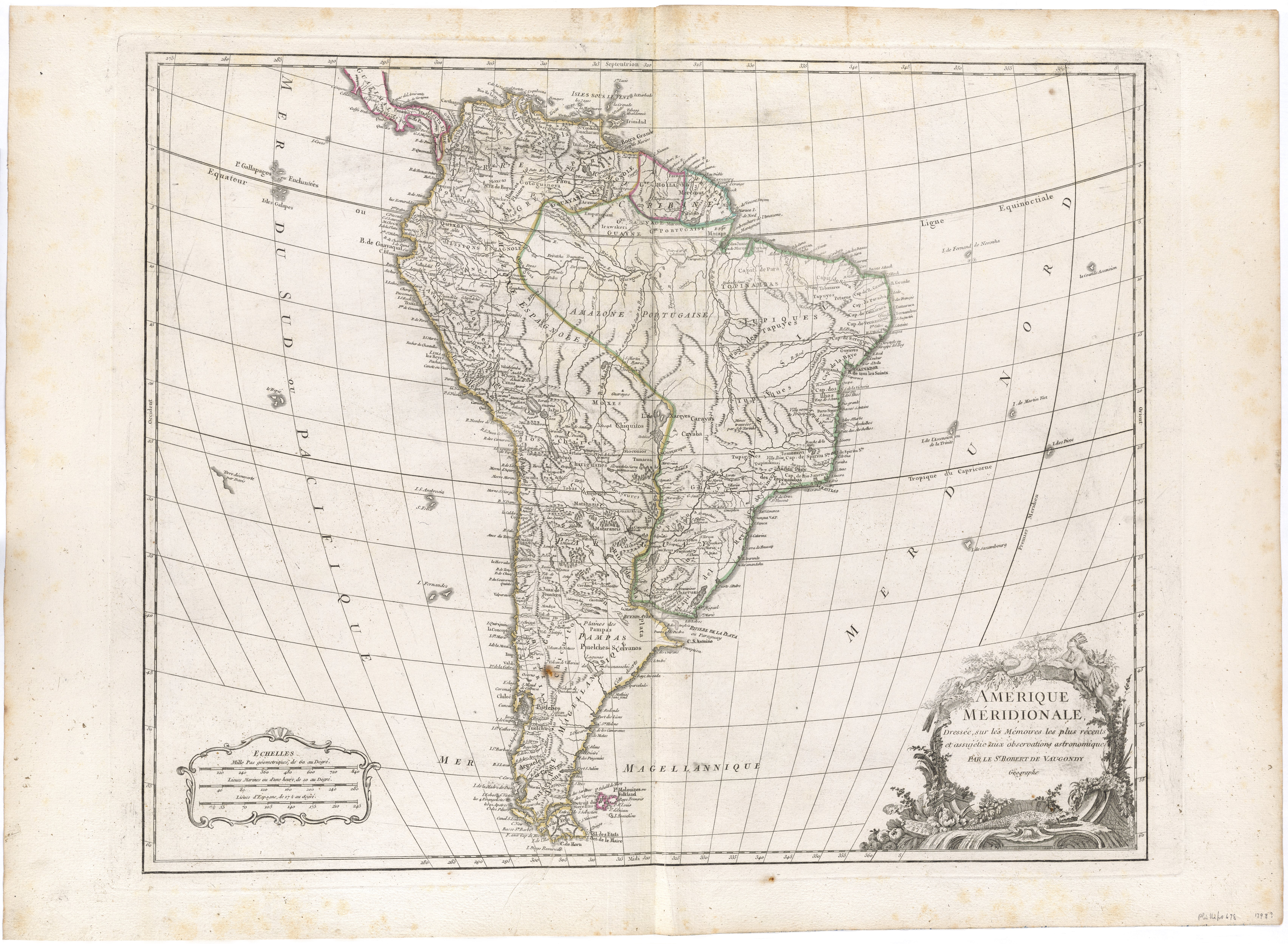
Amerique Méridionale, Dressée, sur les Mémoires les plus récents et assujétie aux observations astronomique
Map 1786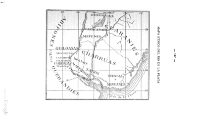
MAPA ÉTNICO DEL RÍO DE LA PLATA
Map 1500 - 1900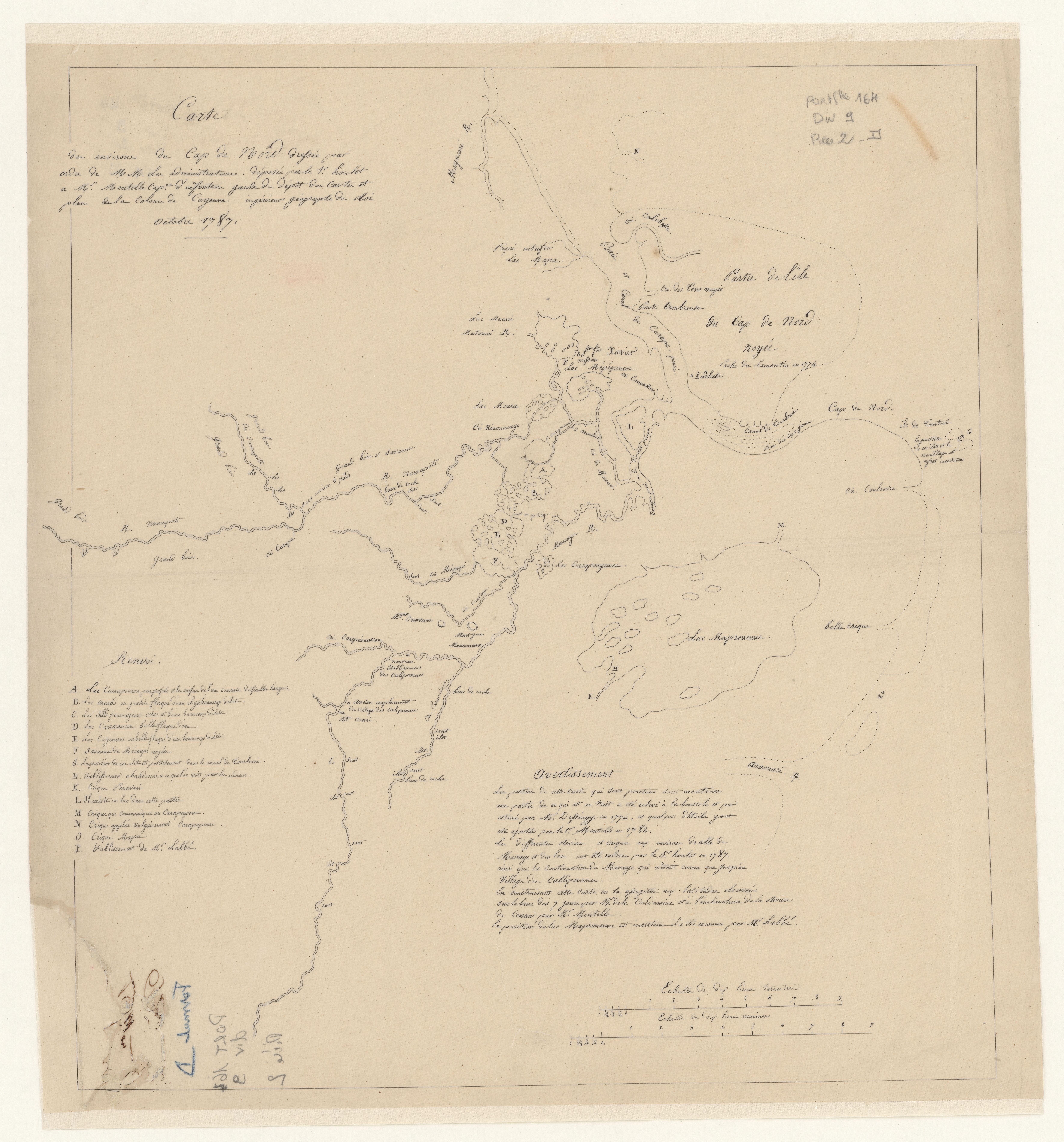
Carte des environs de Cap de Nord
Map 1774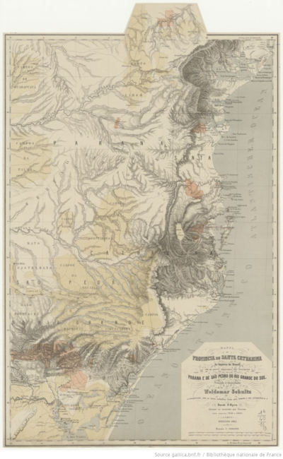
MAPPA da PROVINCIA DE SANTA CATHARINA do imperio do Brasil come as partes adjacentes das Provincias PARANA E DE SAO PEDRO DO RIO GRANDE DO SUL
Map 1859 - 1860