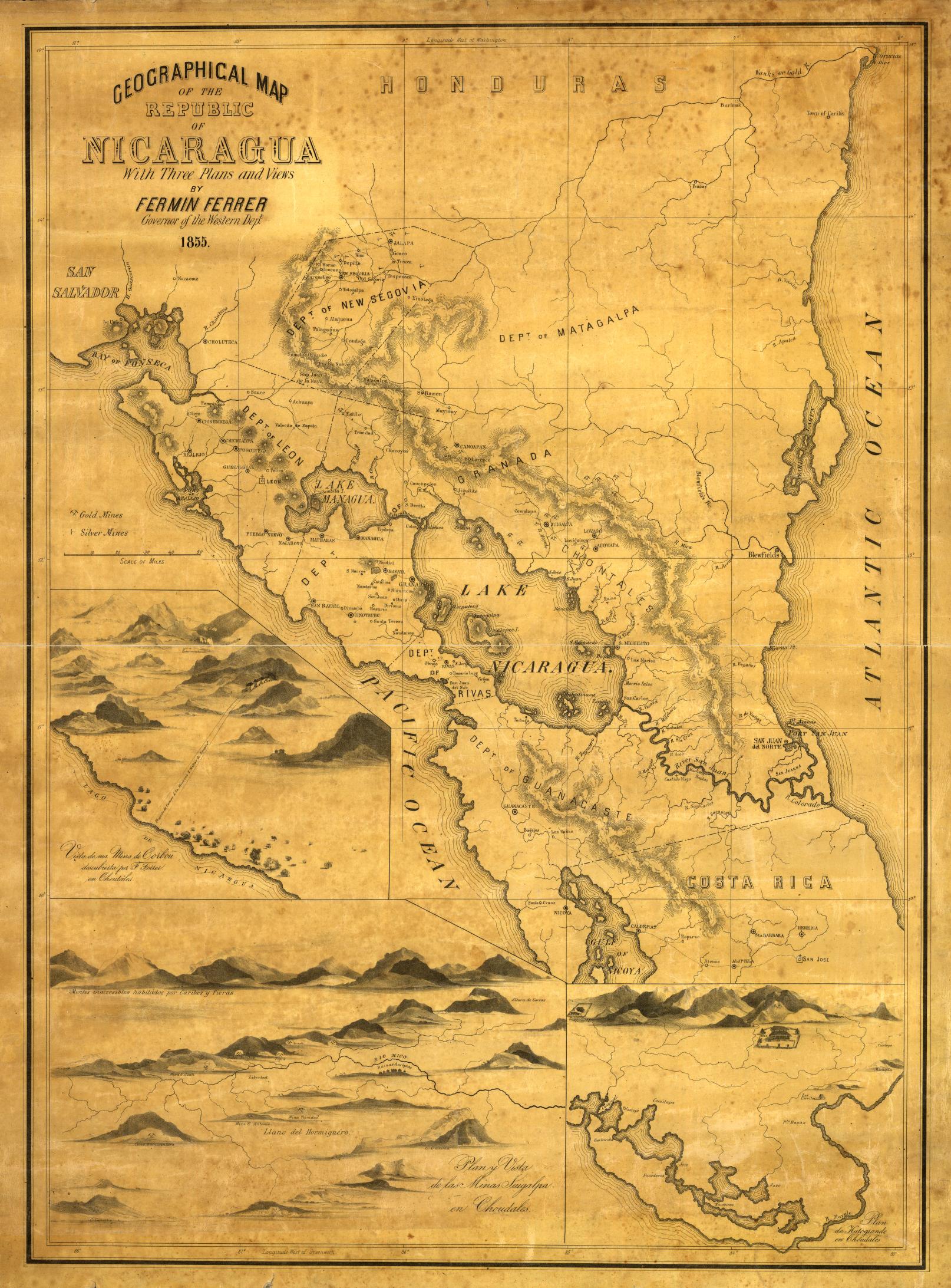
Mapa que comprehende la mayor parte del distrito de la Audiencia de Quito;y los Corregimientos con que confina por el Sur pertenecientes á la de Lima y Virreynato del Perú : En que se manifiesta las entradas que en el dia se practican para llegar a embarcarse desde esta Ciudad de Quito en el rio Marañon;o en los que a este tributan su Caudal;y que la más larga aunque nomenos incomoda que las otras por los Corregimientos de Latacunga;Ambato;Riobamba;Chimbo;Guayquil;Piura;y Jaen;es la unica por donde se puede llevar el Exercito para la Expedicion;que ha mandado S.M. ejecutar contra los Portugueses de aquel mismo Río;señalado este camino de amarillo. Los que se desprecian por impracticables con la Tropa;de Color Rojo y à los demas que sirven para adorno de este mapa;de color de Tierra. En la descripción que se acompaña para la más clara inteligencia de todos estos Caminos;se demuestran las razones que se han tenido presentes para la elección de esta entrada / Echo uno;y otro por el Yngeniero Ordinario Dn. Franco. Requena Quartel Mre. Gral. de la misma Exped.n.
Map
1778