Peoples
- RAMA
- INDIANS
Citation
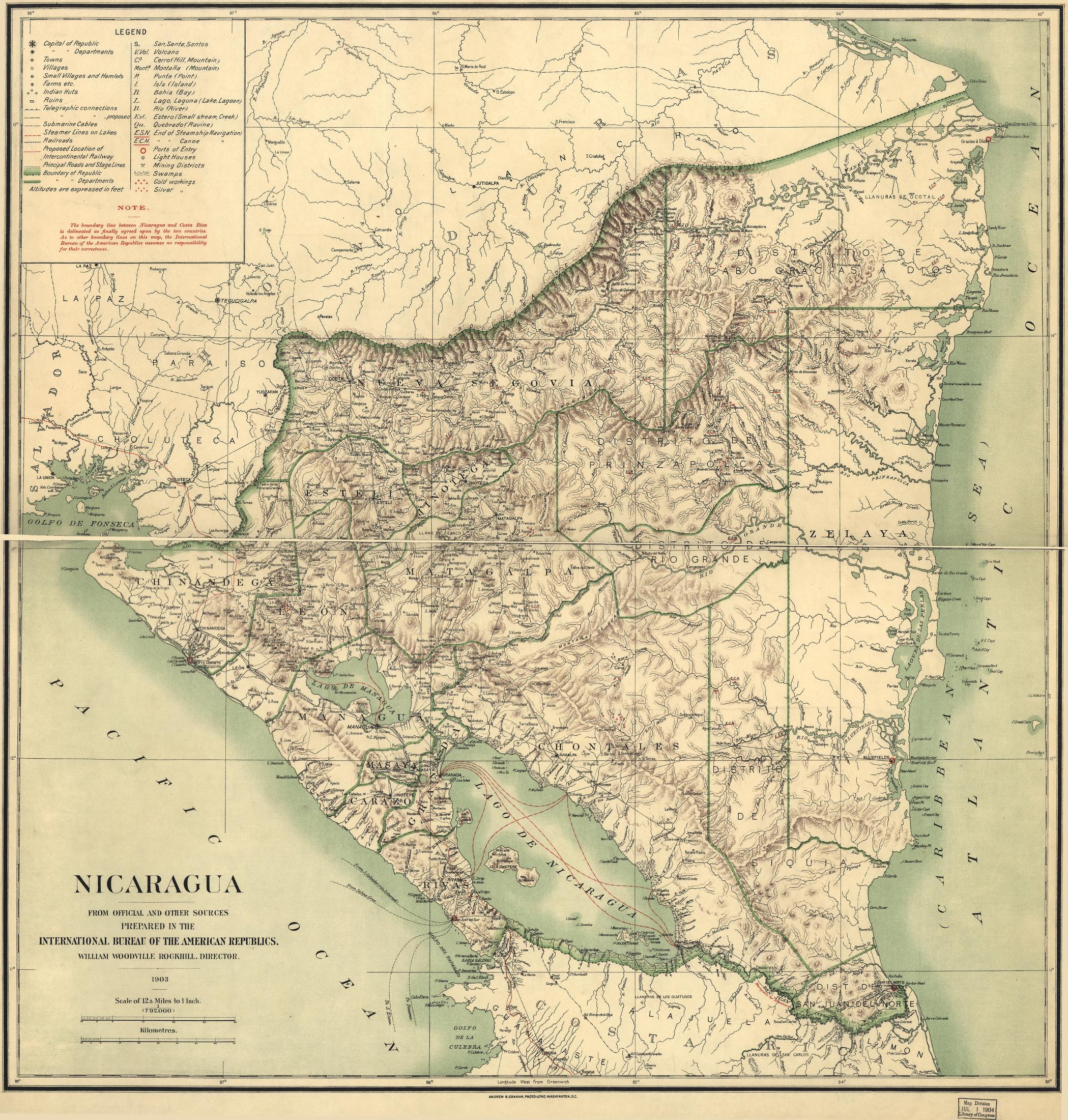
Nicaragua. International Bureau of the American Republics. Rockhill;William Woodville. International Bureau of the American Republics;1903. Library of Congress Geography and Map Division. G4850 1903 .I5. http://hdl.loc.gov/loc.gmd/g4850.ct000868.AccessedJuly242023.