Peoples
- RAMA
- RAMA INDIANS
- CARIB INDIANS
- POYAS INDIANS
- SUMO
Citation
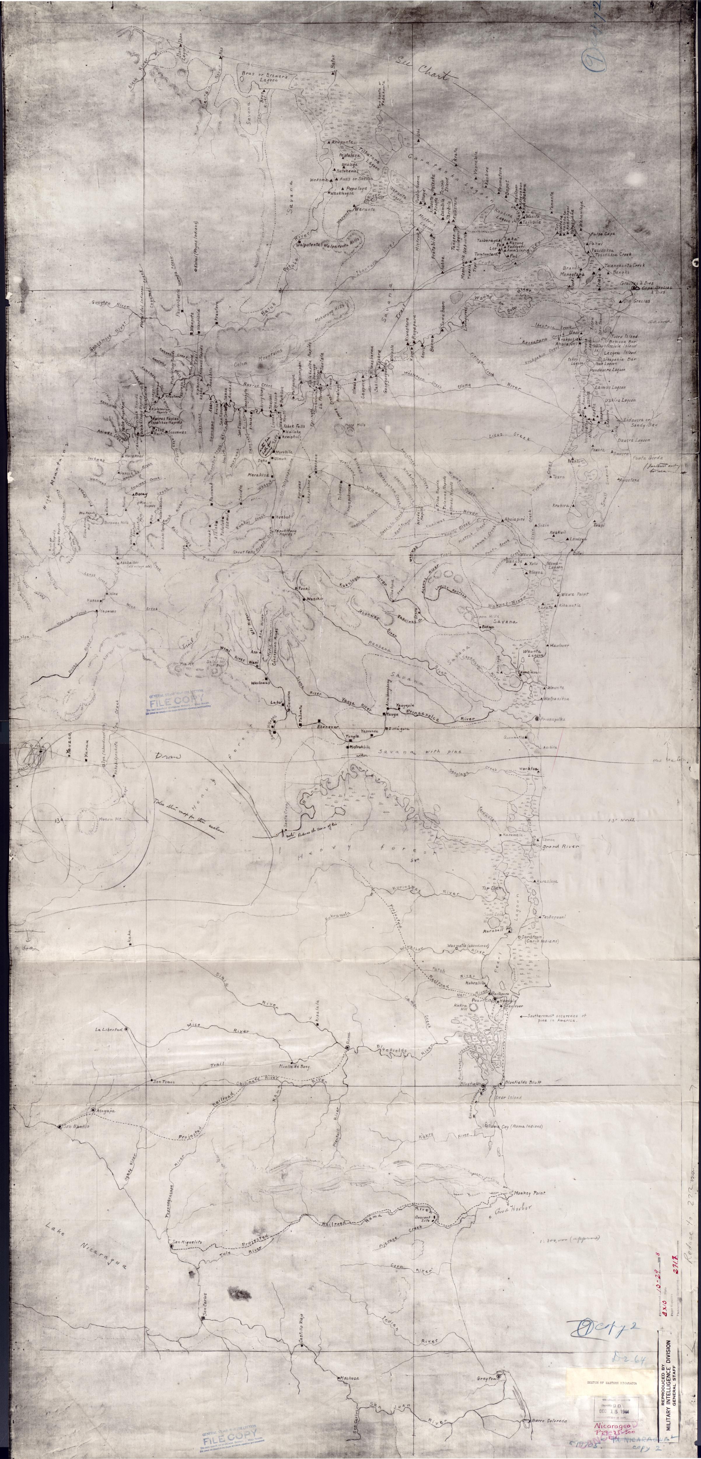
Eastern Nicaragua. 1928. Reproduced by Military Intelligence Division;General Staff. Library of Contress Geography and Map Division;Washington DC. G4850 1928 .E2. https://www.loc.gov/item/2006636638/AccessedJuly24;2023.