Peoples
- INDIANS
Citation
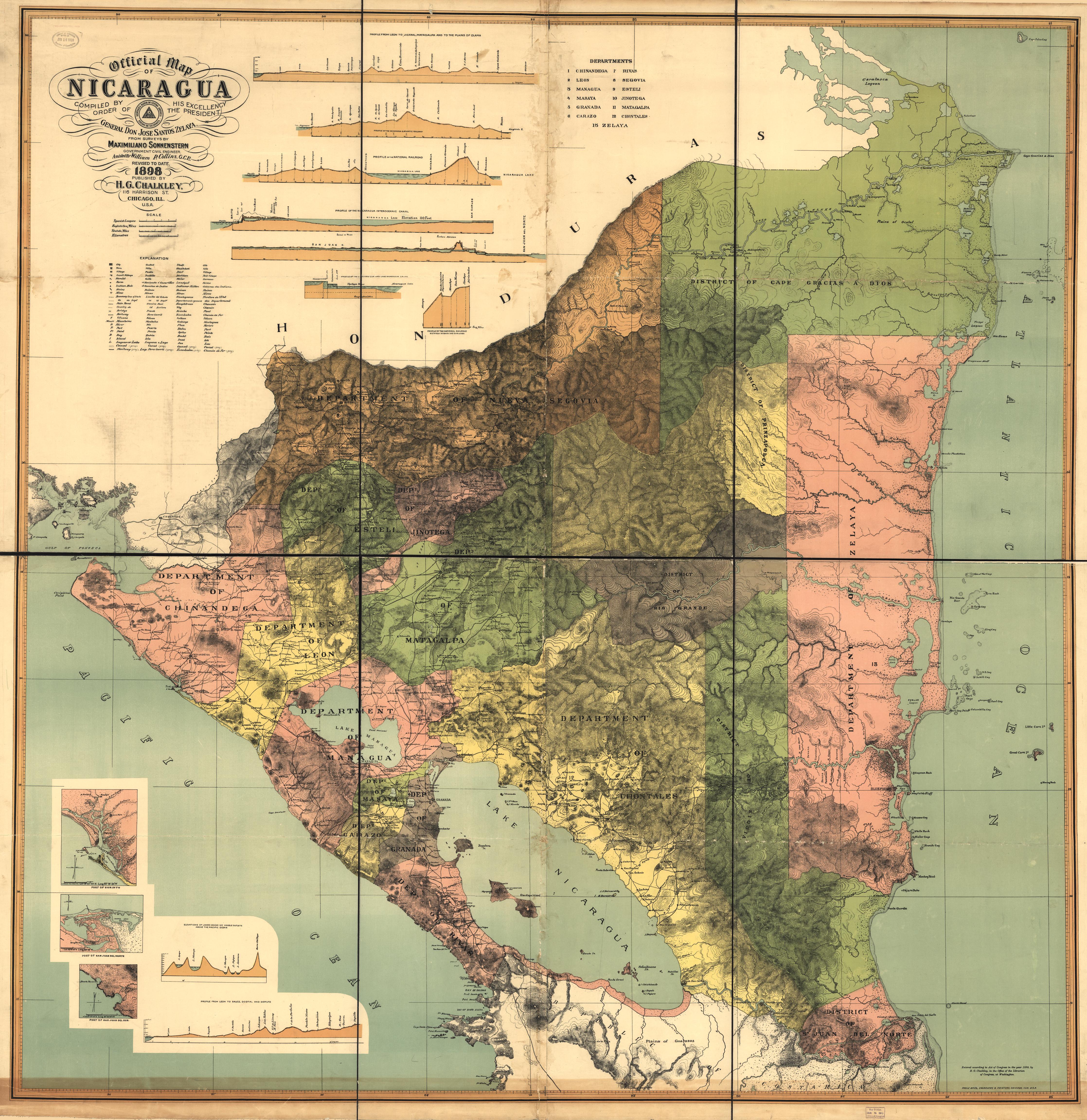
Official Map of Nicaragua. Sonnenstern;Maximilian von. and Collins;William P. Chicago: H.G. Chalkley. 1898. Library of Congress Geography and Map Division Washington DC. G4850 1898 .S6. http://hdl.loc.gov/loc.gmd/g4850.ct000862.AccessedJuly24;2023.