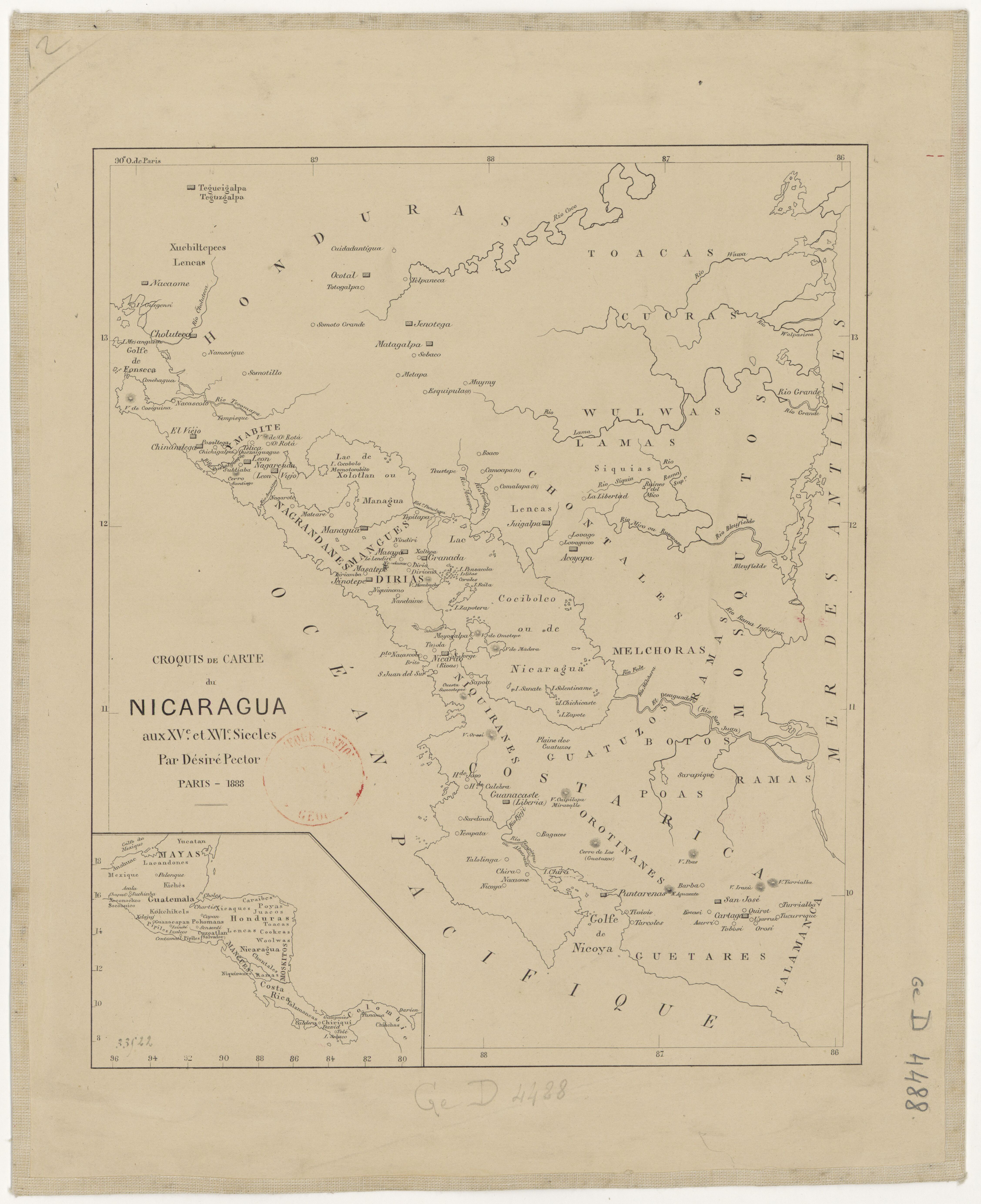
Peoples
- MANGUES
- CHONTALES
- MOSKITOS
Citation
Croquis de carte du Nicaragua aux XVe et XVIe siécles/ par Désiré Pector. Paris 1888. Gallica. https://gallica.bnf.fr/ark:/12148/btv1b84435581/f1.item.zoom#.AccessedJuly212023.
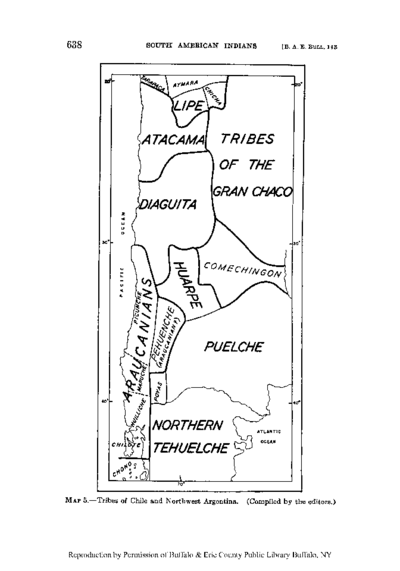
Tribes of Chile and Northwest Argentina
Map![Ordalía: el fin del cuerpo [Ordeal: The End of the Body]](https://dnet8ble6lm7w.cloudfront.net/art_sm/ACOL015.png)
Ordalía: el fin del cuerpo [Ordeal: The End of the Body]
Artwork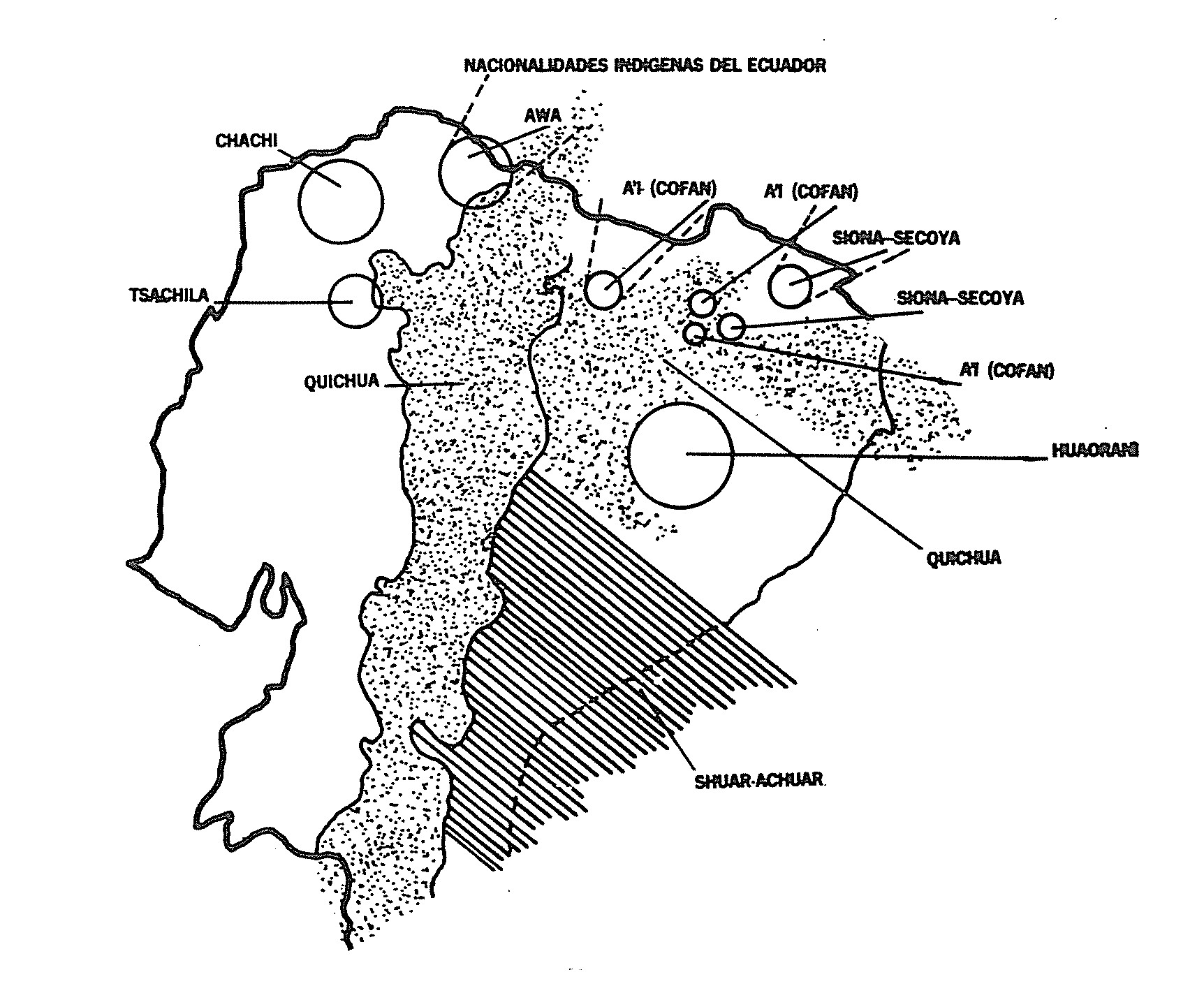
NACIONALIDADES INDÍGENAS DEL ECUADOR
Map 1988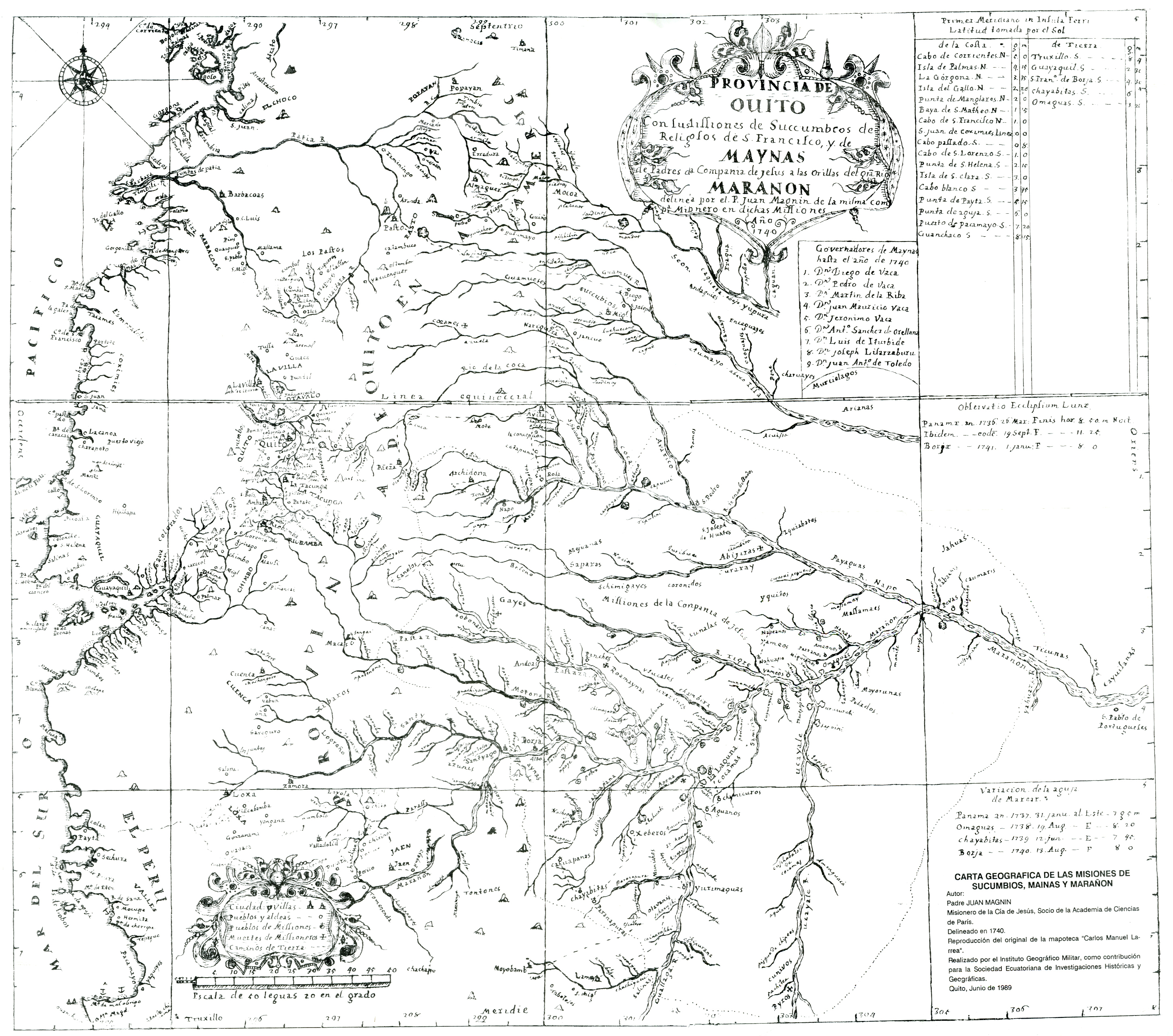
CARTA GEOGRAFICA DE LAS MISIONES DE SUCUMBIOS;MAINAS Y MARAÑON
Map 1740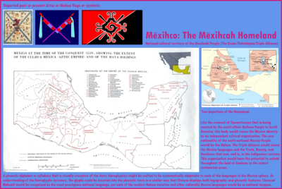
Mexico at the time of the conquest (1519), showing the extent of the Culhua Mexica (Aztec Empire) and of the Maya holdings
Map 1519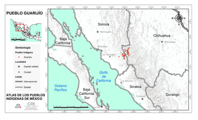
PUEBLO GUARIJIO
Map 2020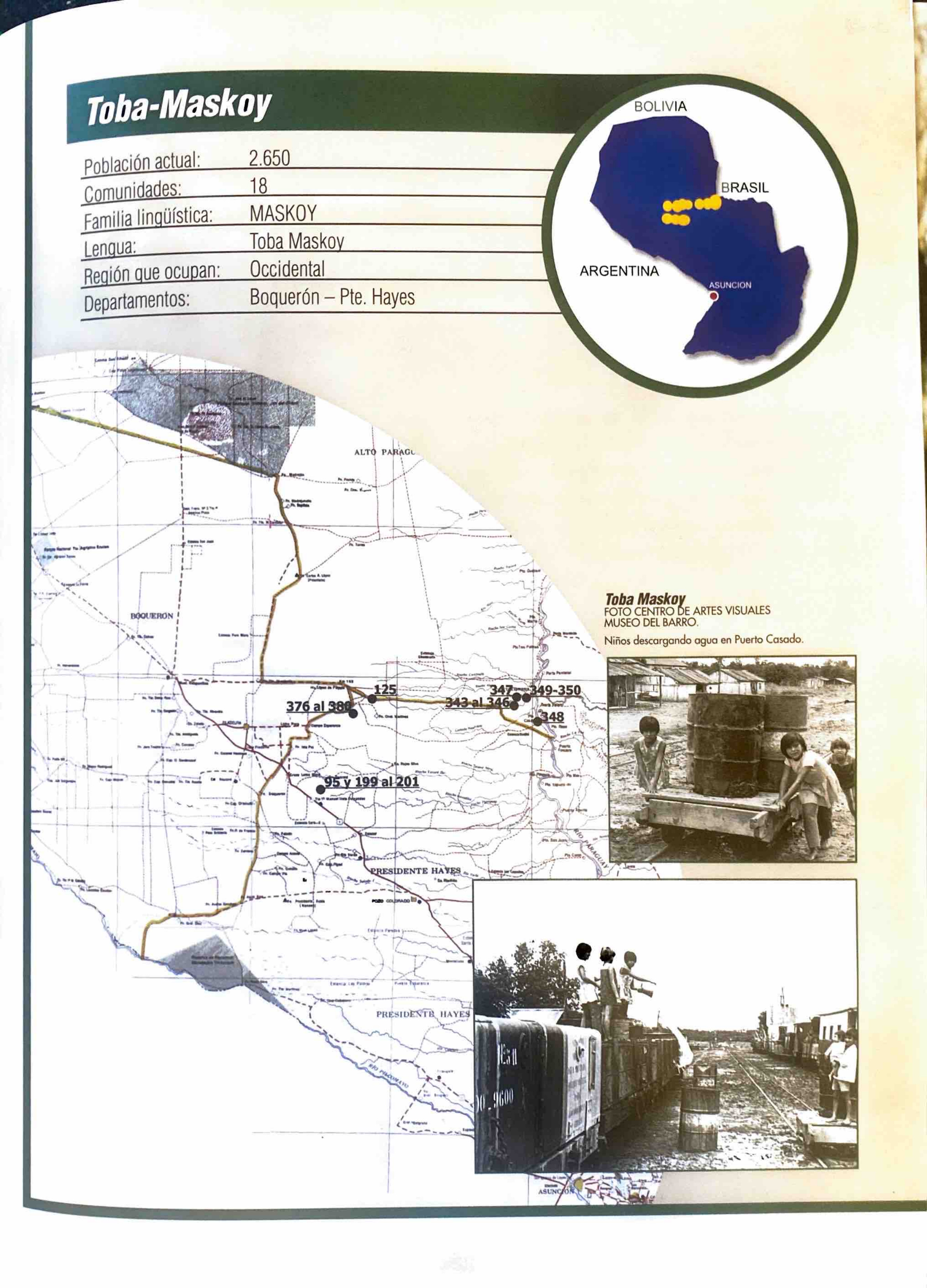
Toba-Maskoy
Map 2001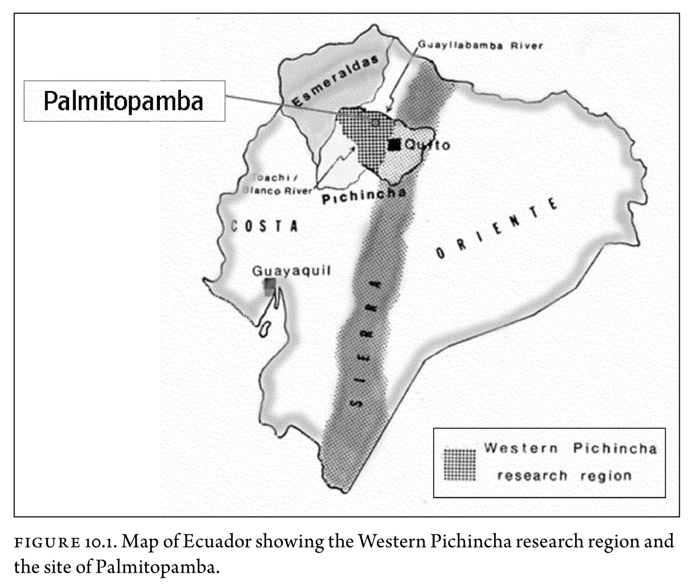
Figure 10.1. Map of Ecuador showing the Western Pichincha research region and the site of Palmitopamba.
Map -700 - 1534