Peoples
- CARIBES
- INDIOS
Citation
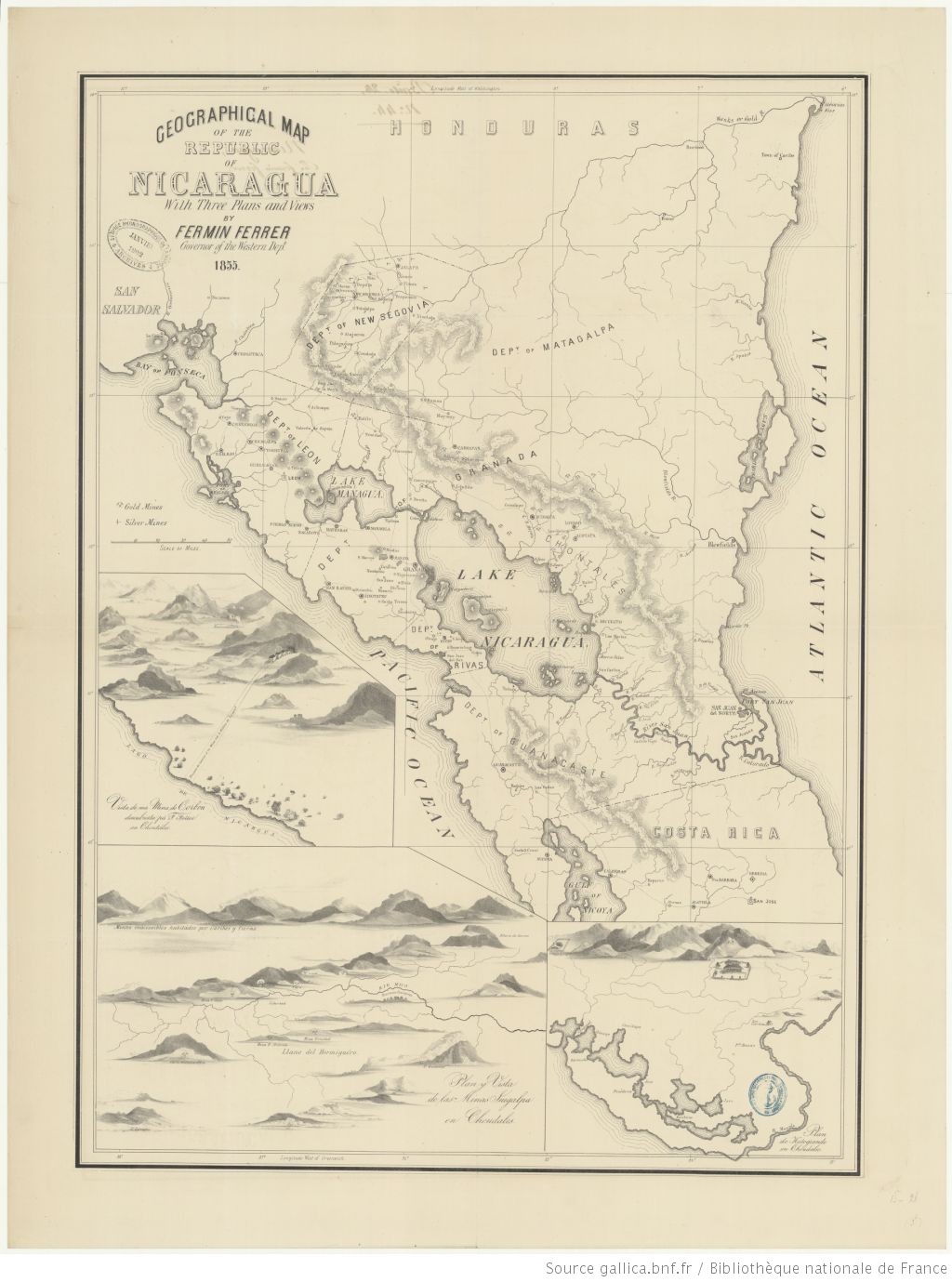
Geographic map of the NIcaragua: with three plans and views. Fermin Ferrer;Governor of the Western Department. 1855. Gallica. https://gallica.bnf.fr/ark:/12148/btv1b53171838v/f1.item.zoom#.AccessedJuly212023
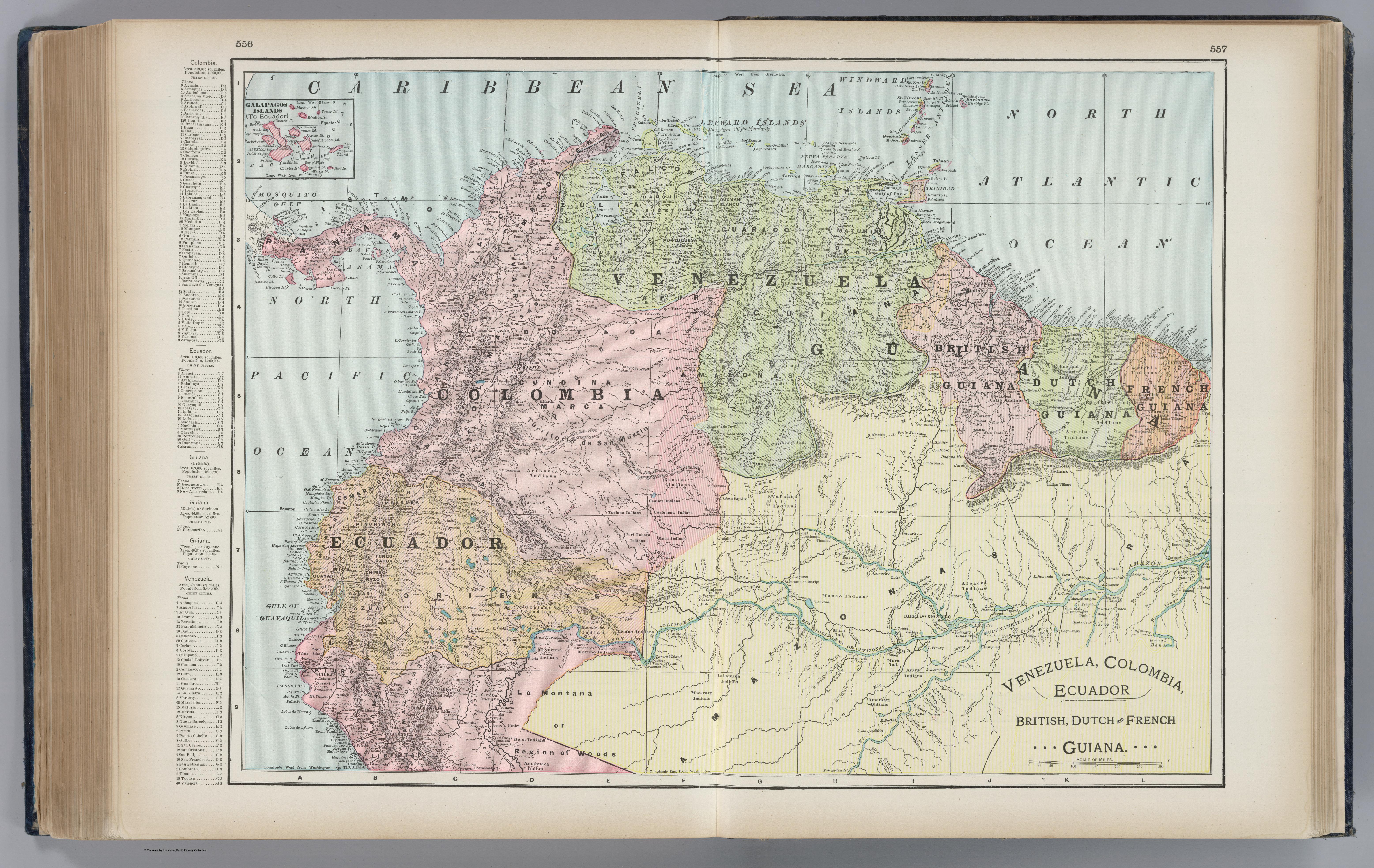
Venezuela, Colombia, Ecuador;British, Dutch, and French Guiana
Map 1901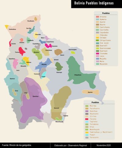
Bolivia Pueblos Indígenas
Map 2020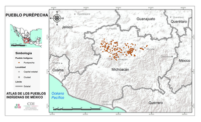
PUEBLO PUREPECHA
Map 2020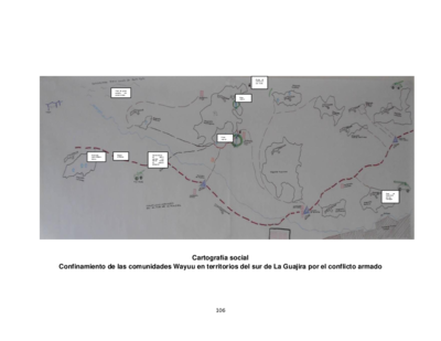
Cartografía social. Confinamiento de las comunidades Wayuu en territorios del sur de La Guajira por el conflicto armado
Map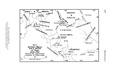
Northern Mexico and a Portion of Texas 1600-1750 Showing the approximate Locations of Indian tribes
Map 1600 - 1750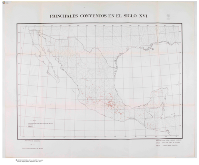
Principales Conventos en el Siglo XVI
Map 1500 - 1599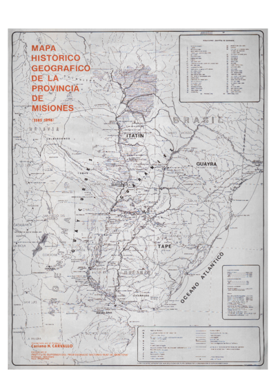
Mapa histórico geográfico de la provincia de Misiones (1585-1896)
Map 1585 - 1896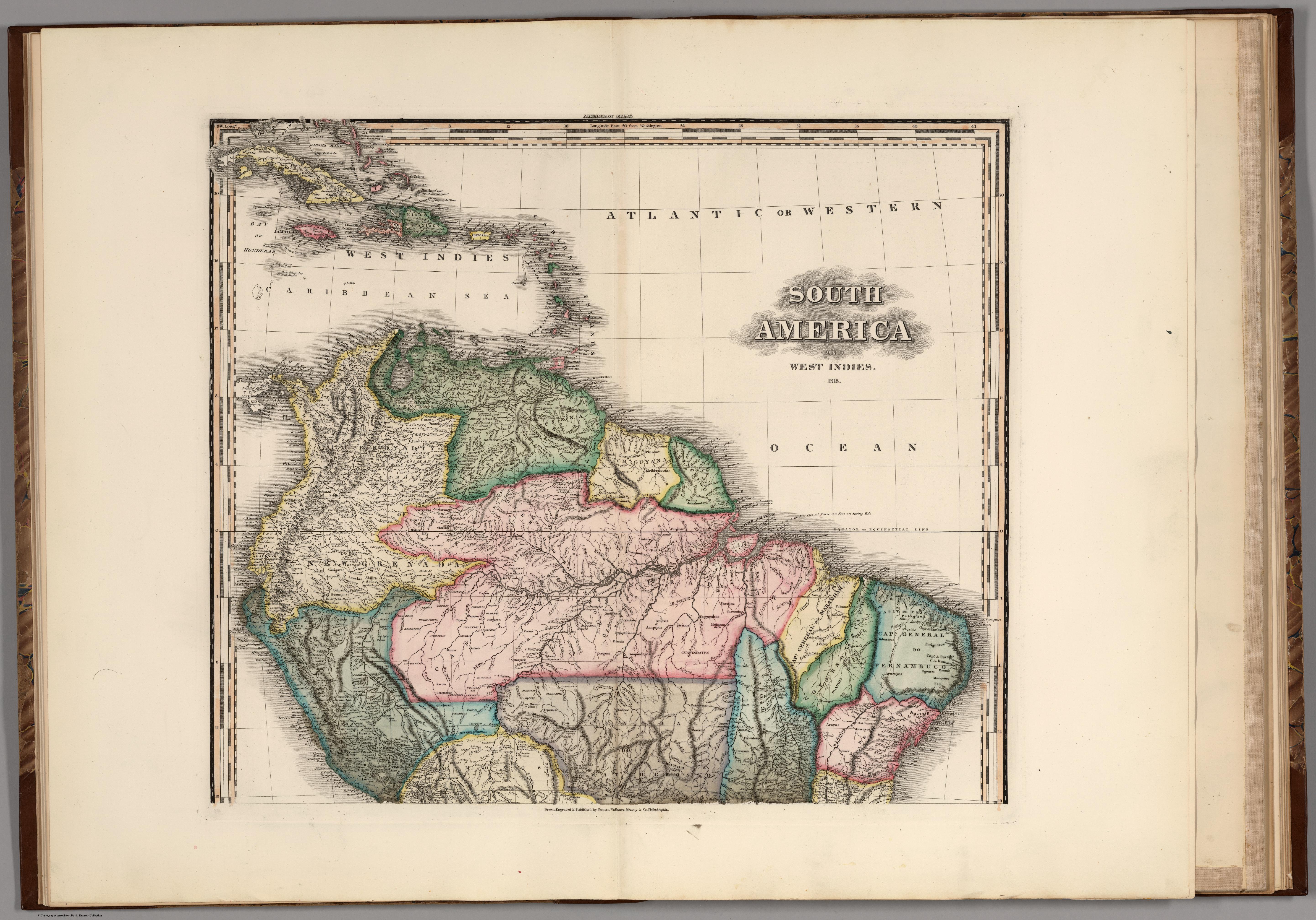
South America and West Indies. 1818
Map 1818