Peoples
- RAMA
- KRIOL
Citation
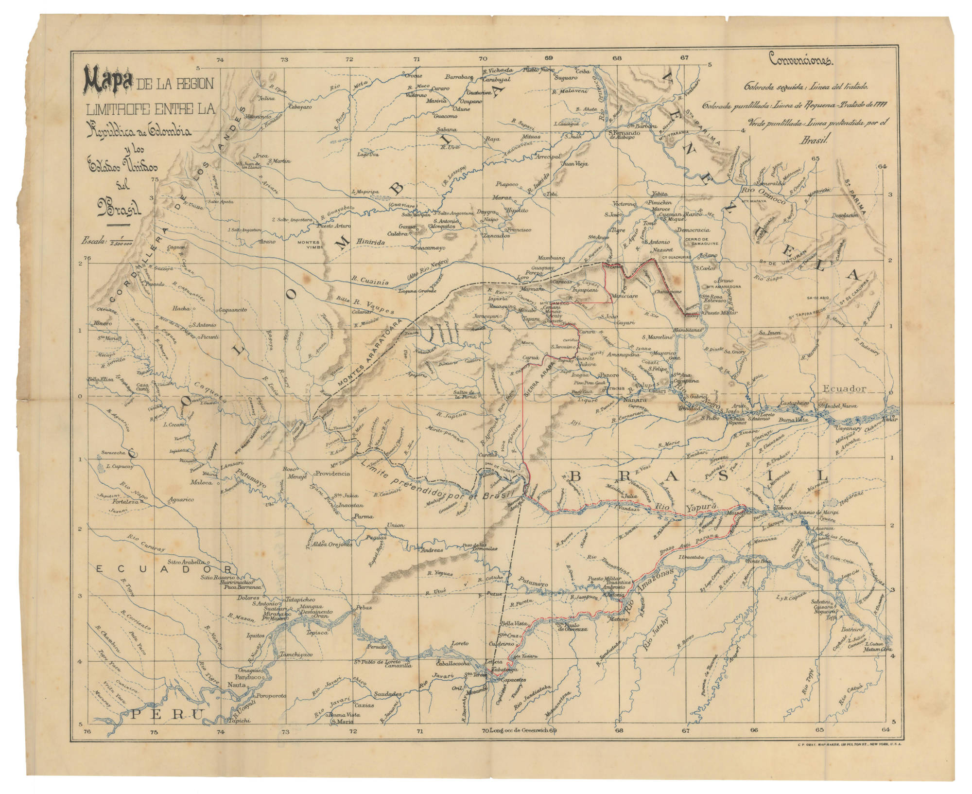
Territorio forestal de la Biosfera del Sureste de Nicaragua. Forests of the World. DATUM WGS84 Sistema GEODESICO Sistemo Geodésico Mundial 1984 . Fuente: Procesamiento de Imagenes Satelital LandSat 8 y Sentinal 2A. Fechas de Tomas: Enero-Junio 2019. Accessed July 10 2023 https://www.forestsoftheworld.org/files/International.forestsoftheworld.org/Kort/Ny%20Kort/NIC_ReservaSureste_RBIM_TRK_Uso2019.jpg
![Bogando [Rowing]](https://dnet8ble6lm7w.cloudfront.net/art_sm/APER024.png)
![Río Corrientes [Corrientes River]](https://dnet8ble6lm7w.cloudfront.net/art_sm/APER073.png)