Citation
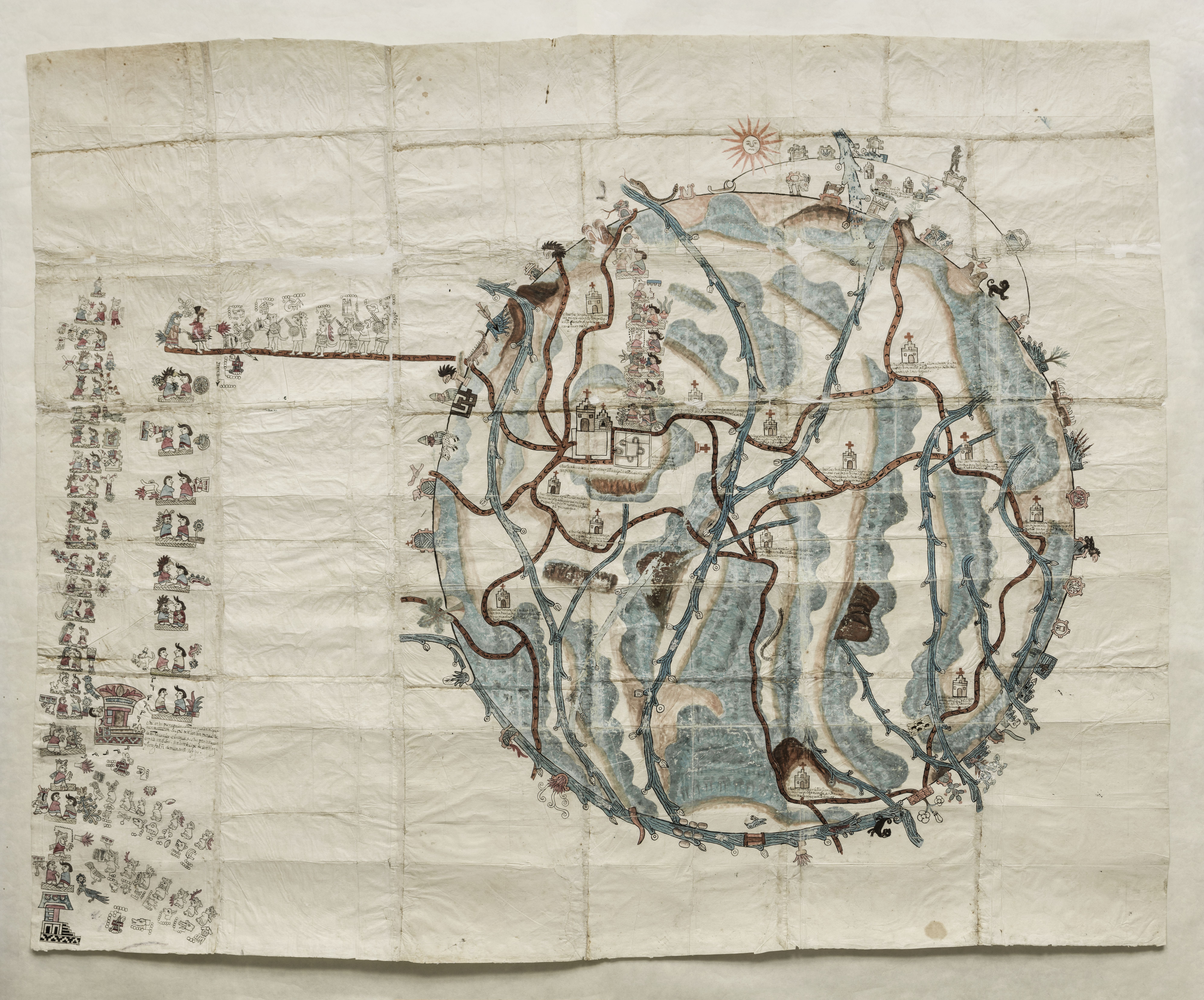
Unkown. "Pintura de Teozacoalco." Map. 1580. https://collections.lib.utexas.edu/catalog/utblac:059d9312-d77c-41d9-81ed-da65bda50a15.BensonLatinAmericanCollection,LLILASBensonLatinAmericanStudiesandCollections,TheUniversityofTexasatAustin
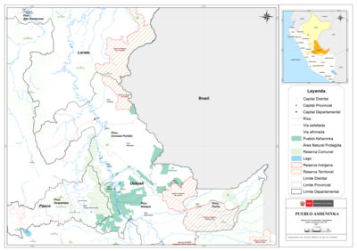
PUEBLO ASHENINKA
Map 2021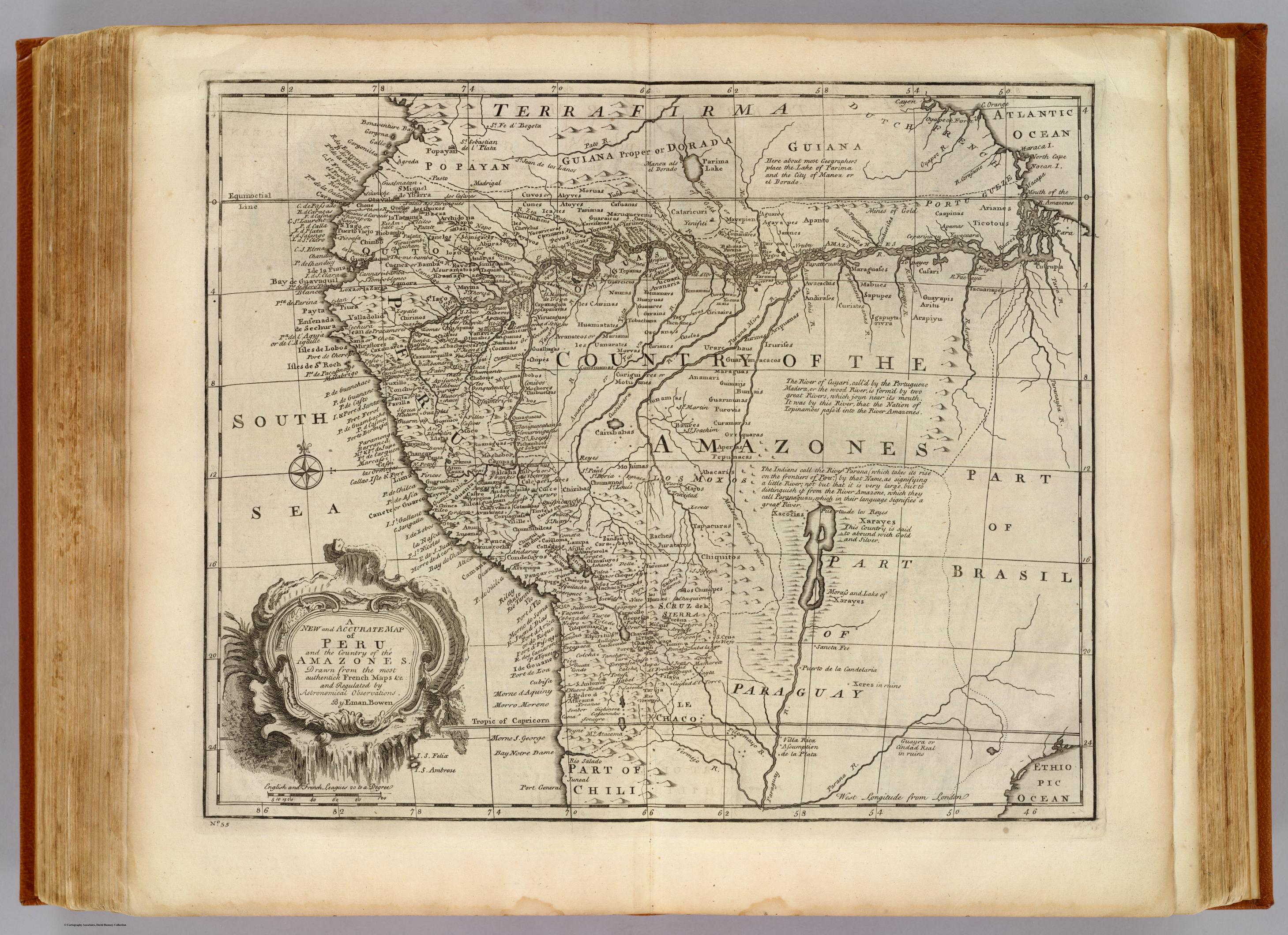
Peru, Amazones
Map 1747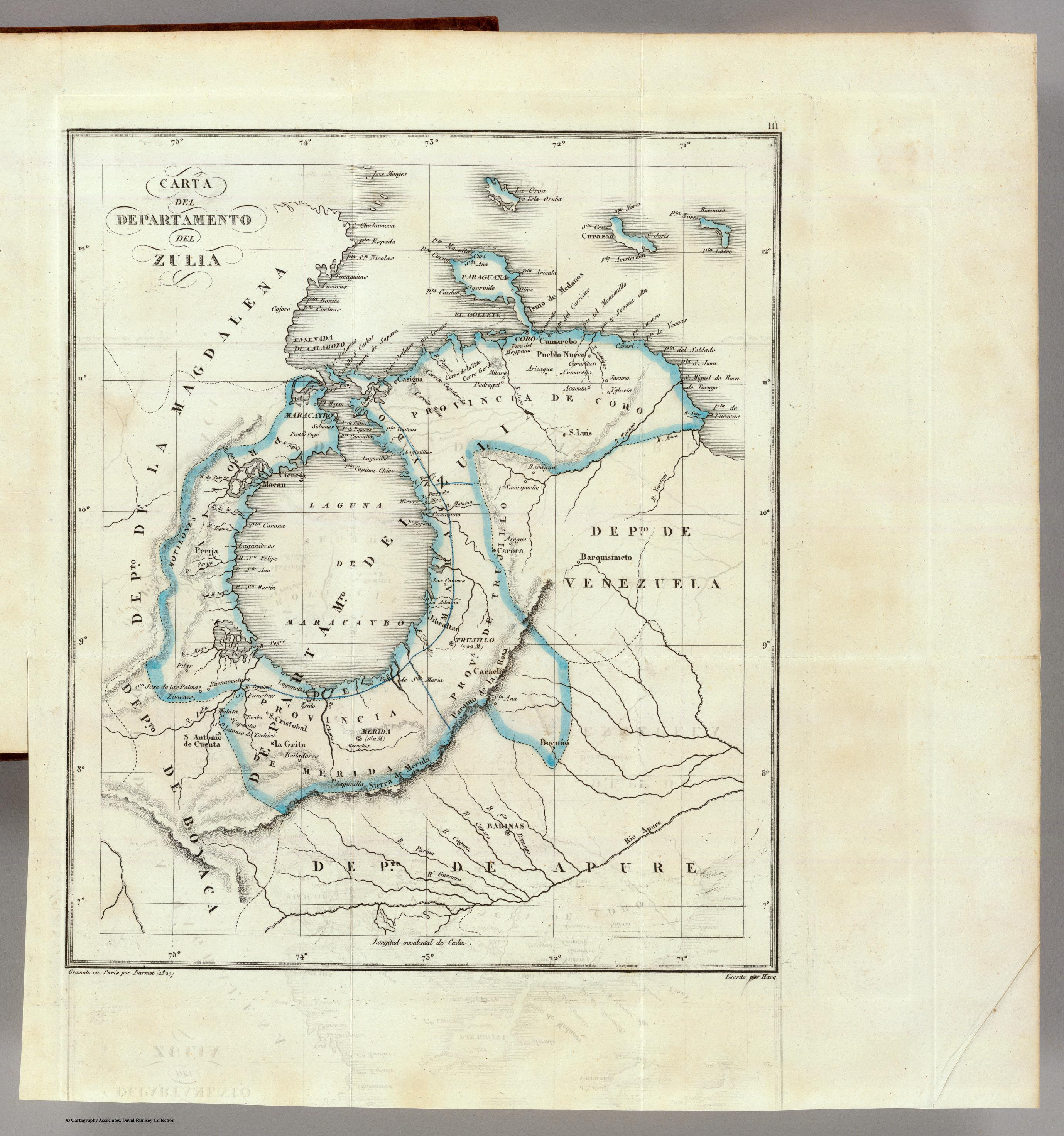
CARTA DEL DEPARTAMENTO DEL ZULIA
Map 1827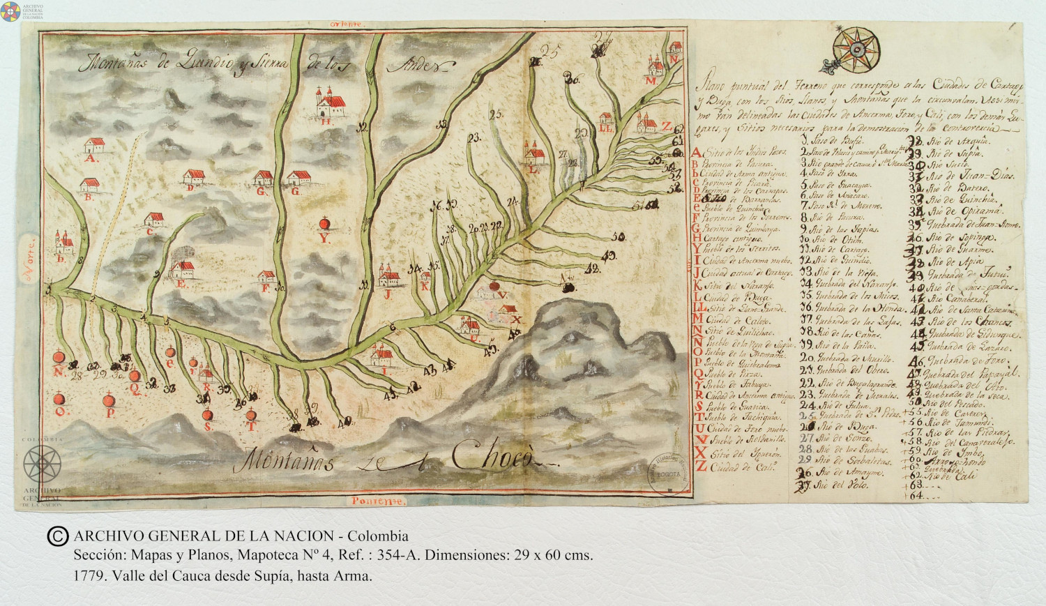
Plano puntual del terreno que corresponde a las ciudades de Cartago y Buga con los rios, llanos, y montañas que las circunvalan.
Map 1779
Provinces depéndant de la triple alliance
Map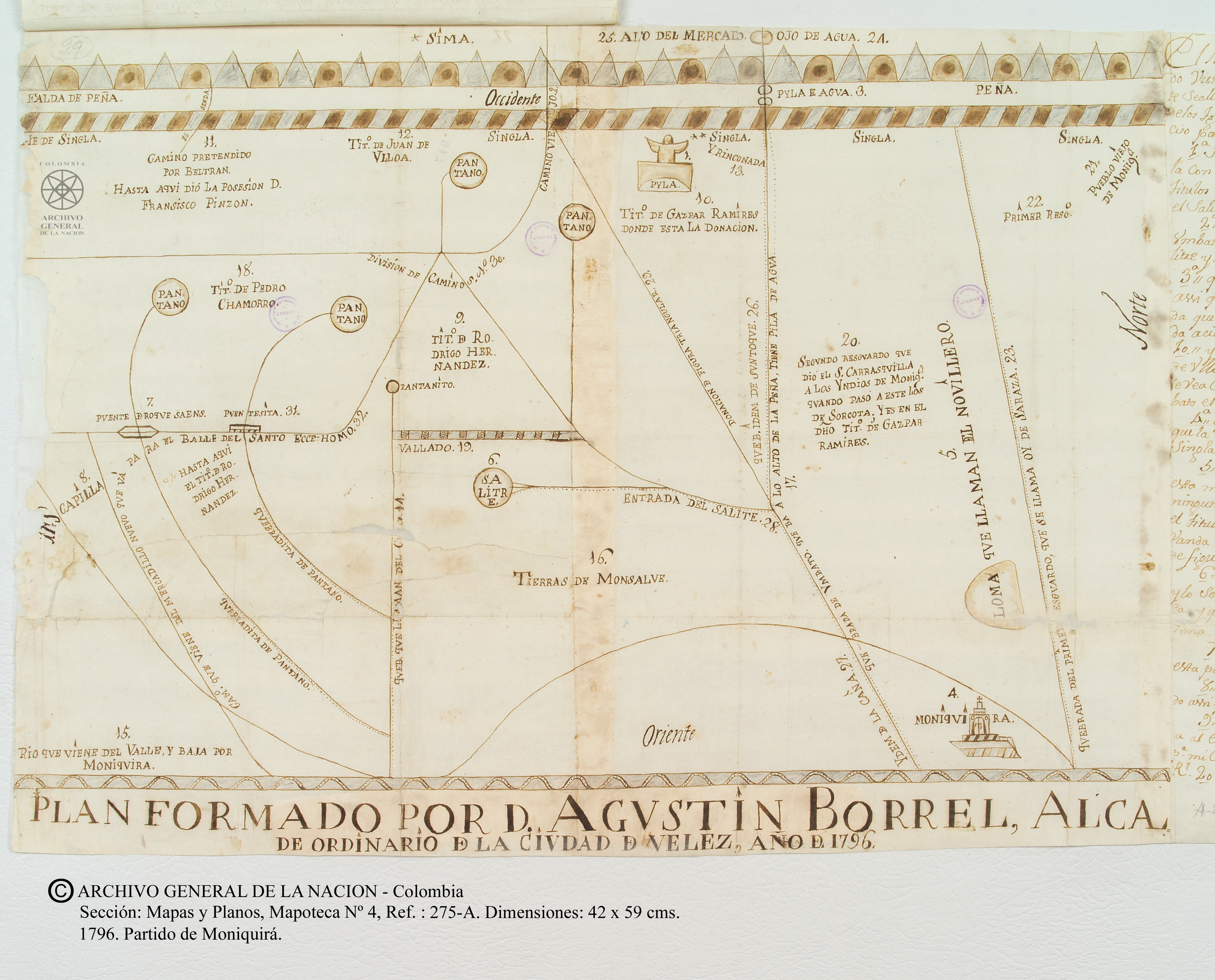
"Mapa del partido de Moniquirá hasta el alto del Mercado."
Map 1796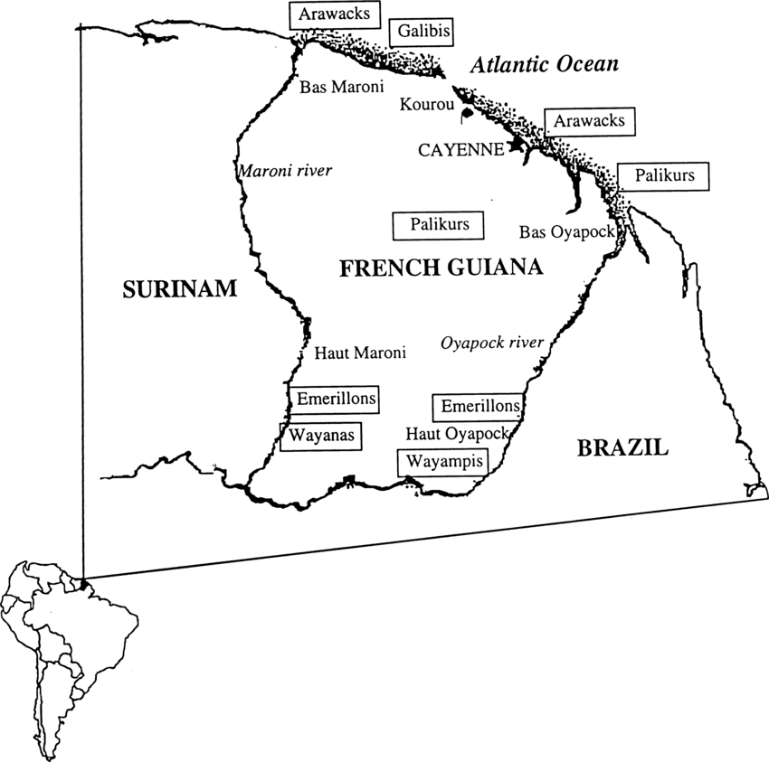
Fig. 1. Map of French Guiana with locations of the various Amerindian groups
Map 1999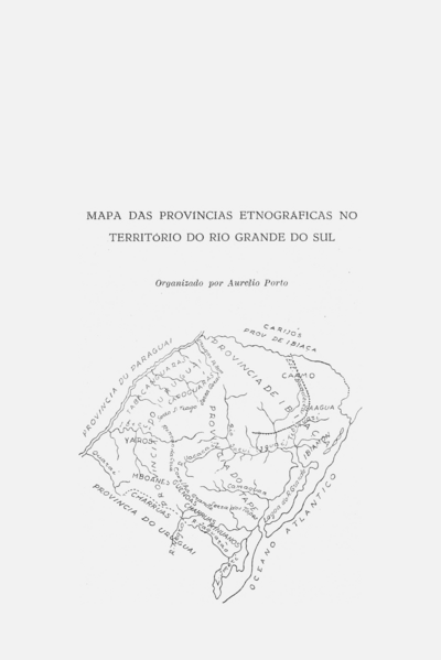
MAPAS DAS PROVINCIAS ETNOGRÁFICAS NO TERRITÓRIO DO RIO GRANDE DO SUL
Map 1500 - 1600