Citation
"Relaciones Geográficas de Oaxaca. Tehuantepec." Map. 1579-1585. http://bdmx.mx/documento/relaciones-geograficas-oaxaca-tehuantepec.
Risaralda
Map 2012
Departamentos y municipios de mayor concentración del pueblo Cofán
Map 2005
Carte huilée des îles de l'Amérique Centrale du sud de la Floride;des côtes du Nicaragua et du Yucatan.
Map 1742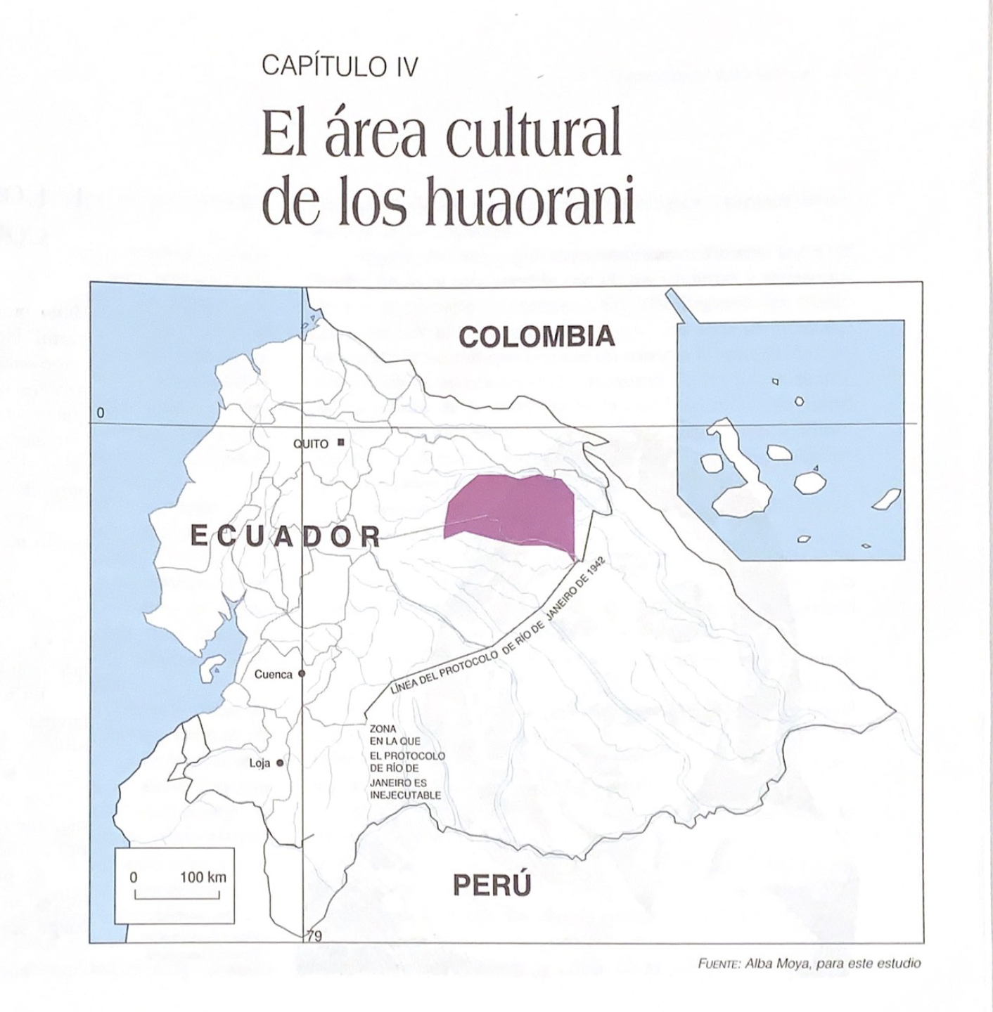
El área cultural de los huaorani
Map 1997![Retrato de Lorenzo Jaramillo [Portrait of Lorenzo Jaramillo]](https://dnet8ble6lm7w.cloudfront.net/art_sm/ACOL006.png)
Retrato de Lorenzo Jaramillo [Portrait of Lorenzo Jaramillo]
Artwork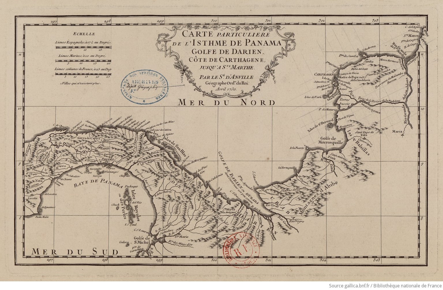
Carte particulière de l'isthme de Panama golfe de Darien, côte de Carthagene, jusqu'à Ste Marthe / par le Sr d'Anville,…
Map 1730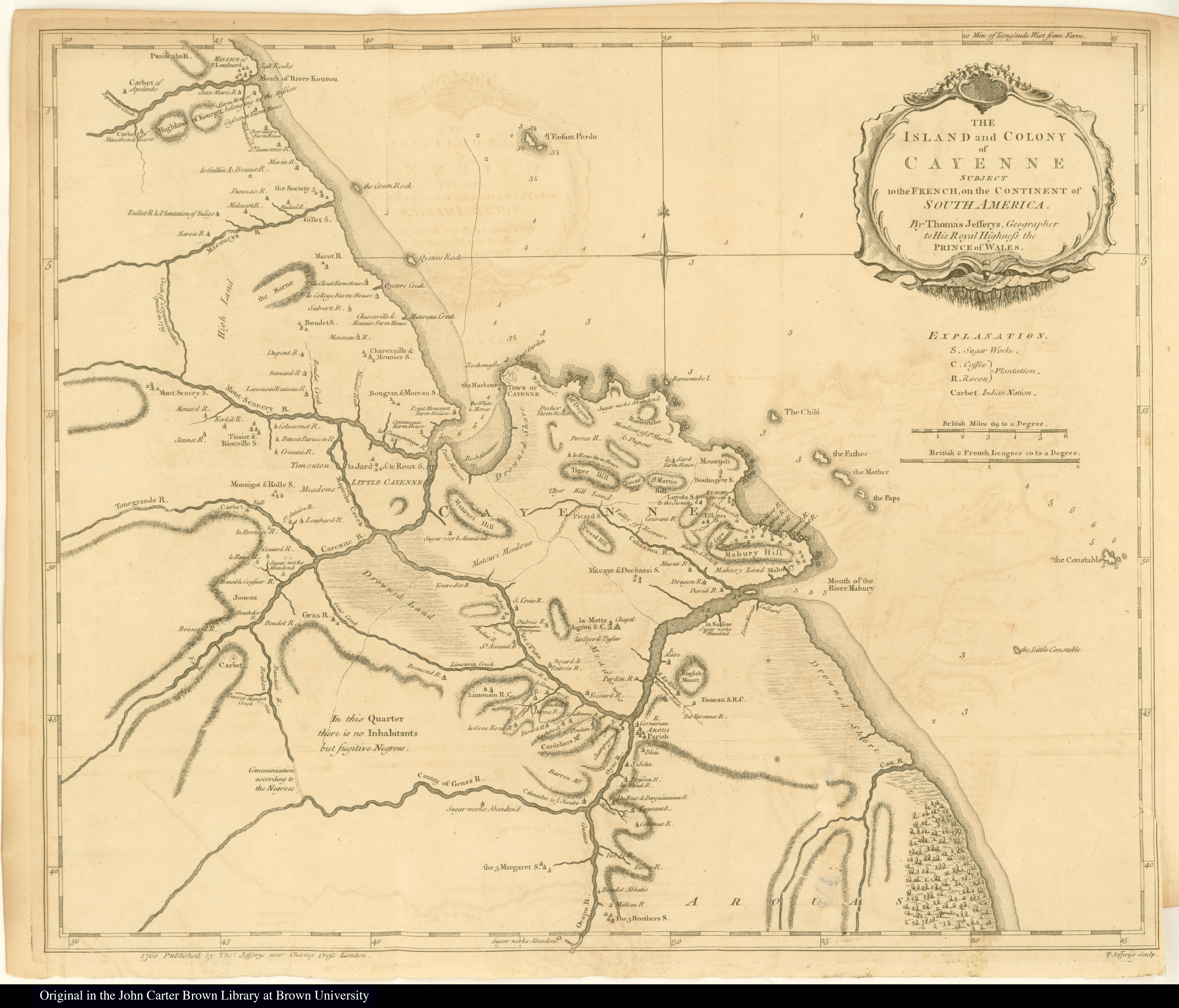
The Island and Colony of Cayenne subject to the French, on the Continent of South America.
Map 1760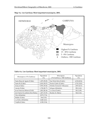
Los Garífuna: Most important municipios, 2001
Map 2001