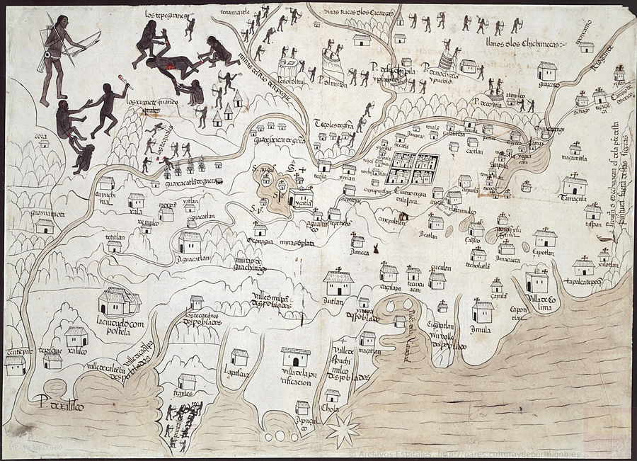
Peoples
- TEPEHUANES
- CHICHIMECAS
- TEQUALES
- XUXUCTEQUANES
- GUAXIXICAR
- TEZOLES
- GUAXACATLAN
Citation
Mapa de la Nueva Galicia. Map. Consejo de Indias, 1550. http://pares.mcu.es/ParesBusquedas20/catalogo/description/21517.
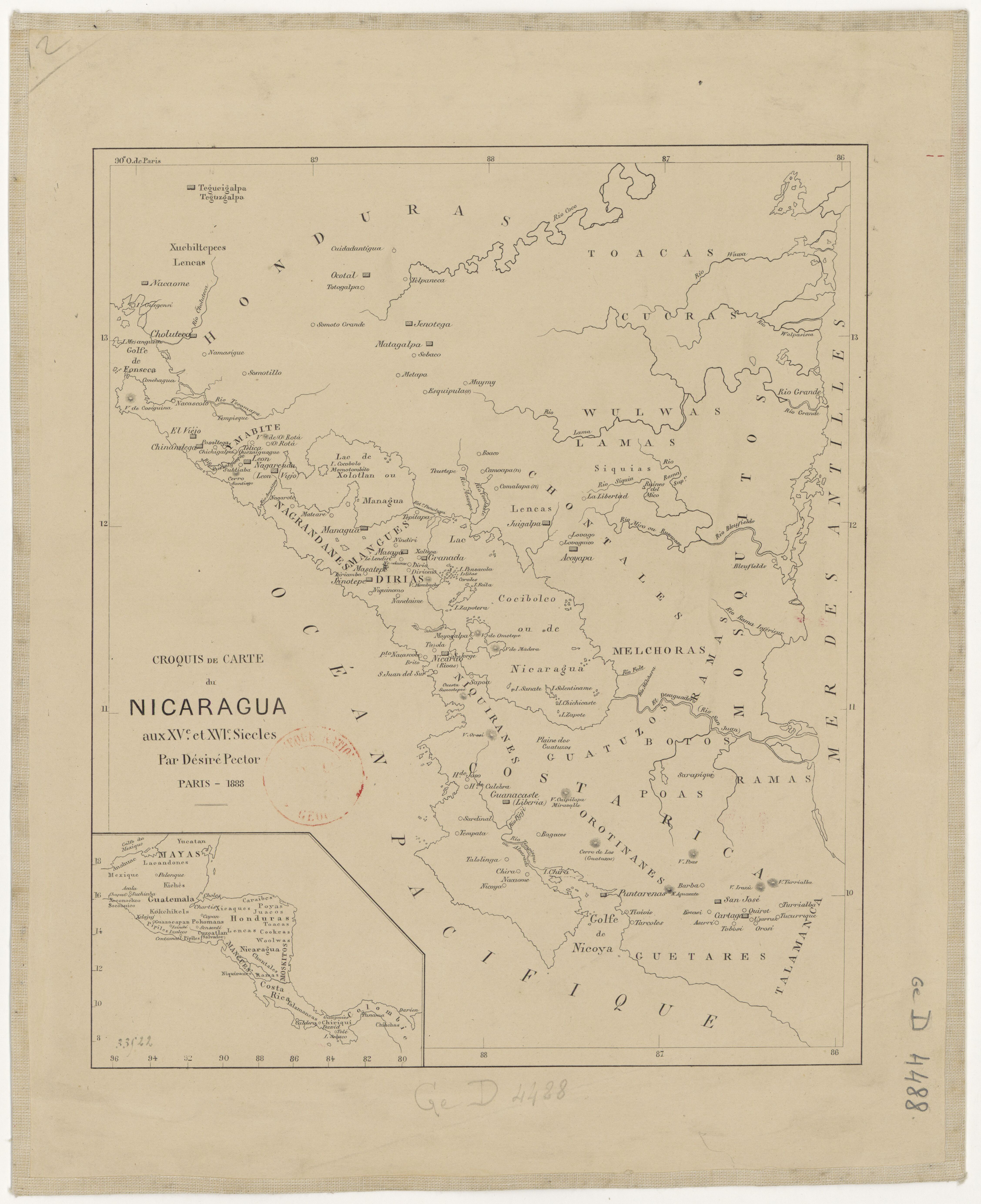
Croquis de carte du Nicaragua aux XVe et XVIe siécles/ par Désiré Pector.
Map 1880 - 1888
Untitled
Artwork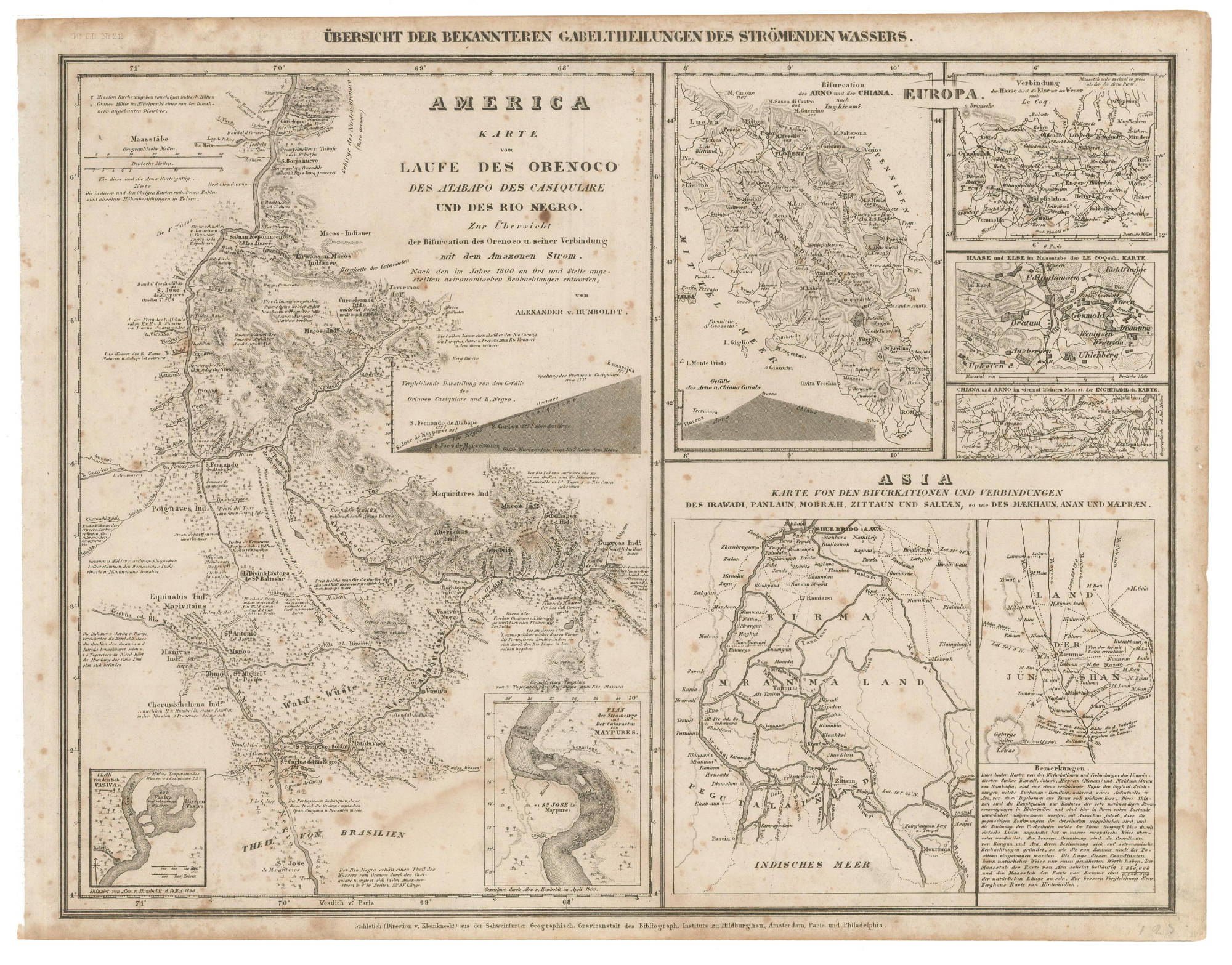
AMERICA KARATE VON LAUFE DES ORENOCO DES ATABAPO DES CASIQUIARE UND DES RIO NEGRO
Map 1850
Guyanes. Amér. Mérid. no. 7. (Dresse par Ph. Vandermaelen, lithographie par H. Ode. Cinquième partie. - Amer. merid. Bruxelles. 1827)
Map 1800 - 1899
PUEBLO URARINA
Map 2021
4. Ubicación de las comunidades indígenas y composición étnica de la región del Vaupés.
Map 2013
MAP SHOWING SACRED PLACES VISITED BY THE HUICHOL INDIANS
Map 1902
The Tribes of Southern South America;at the first European contact period
Map 1512