
Citation
Pueblo de Tetela, perteneciente a la Corona, en el distrito de la Audiencia de México. Map. Consejo de Indias, 1581. http://pares.mcu.es/ParesBusquedas20/catalogo/show/20849.
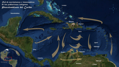
Red de movimientos e intercambios de las poblaciones indígenas Precolombinas del Caribe
Map 1492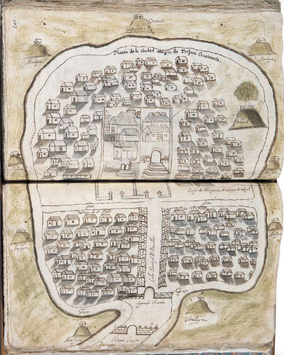
Planta de la ciudad antigua de Tecpan Guatemala
Map 1672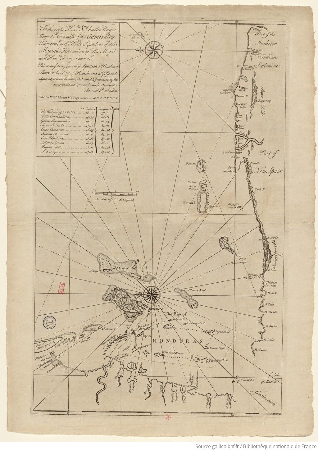
The Spanish and Musketor shore and the bay of Honduras and the islands adjacent
Map 1735
Map representing the linguistic diversity that existed in Central America and the Gulf of Fonseca at the time of contact with the Spanish
Map 1522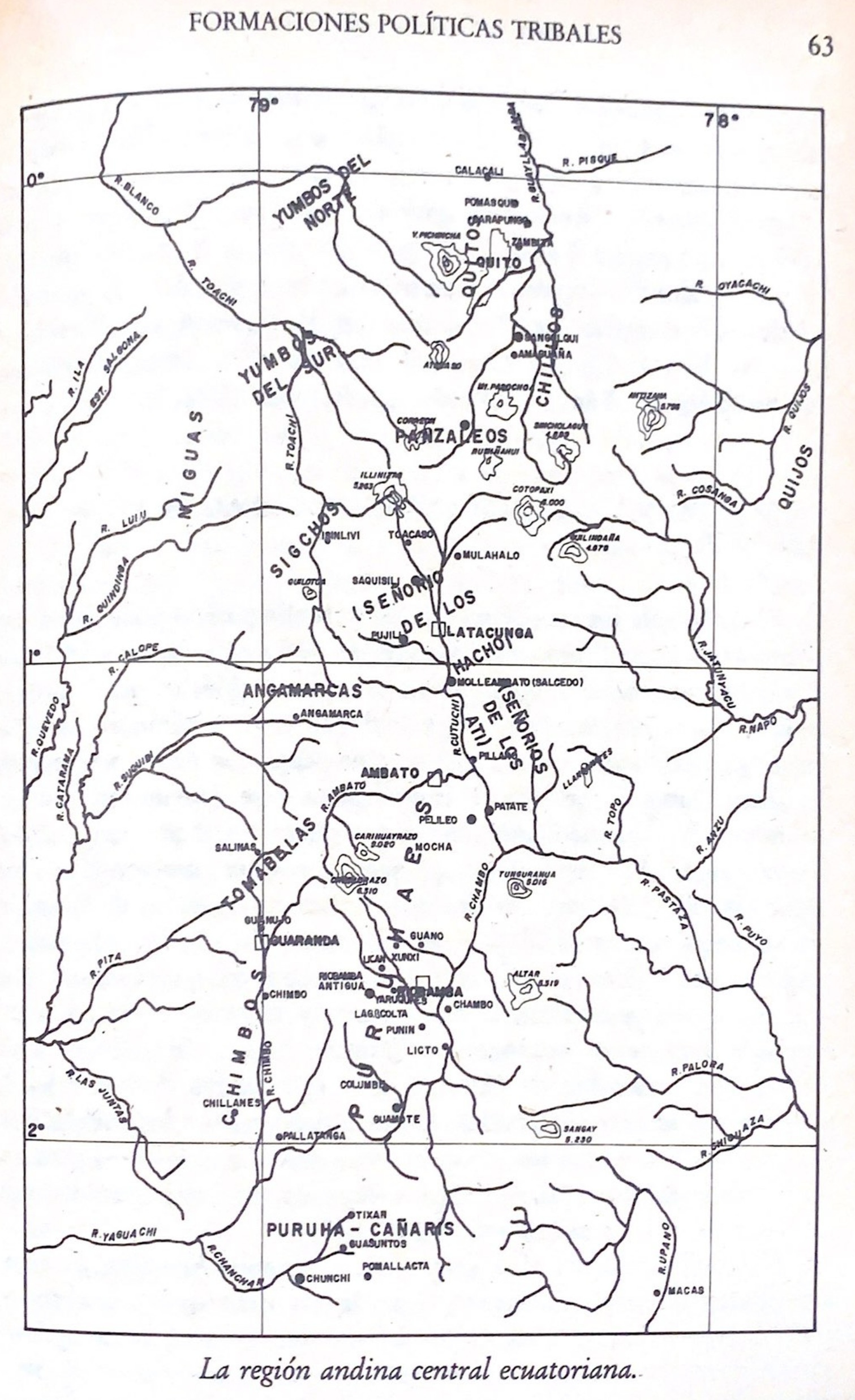
La región andina central ecuatoriana
Map -500 - 1550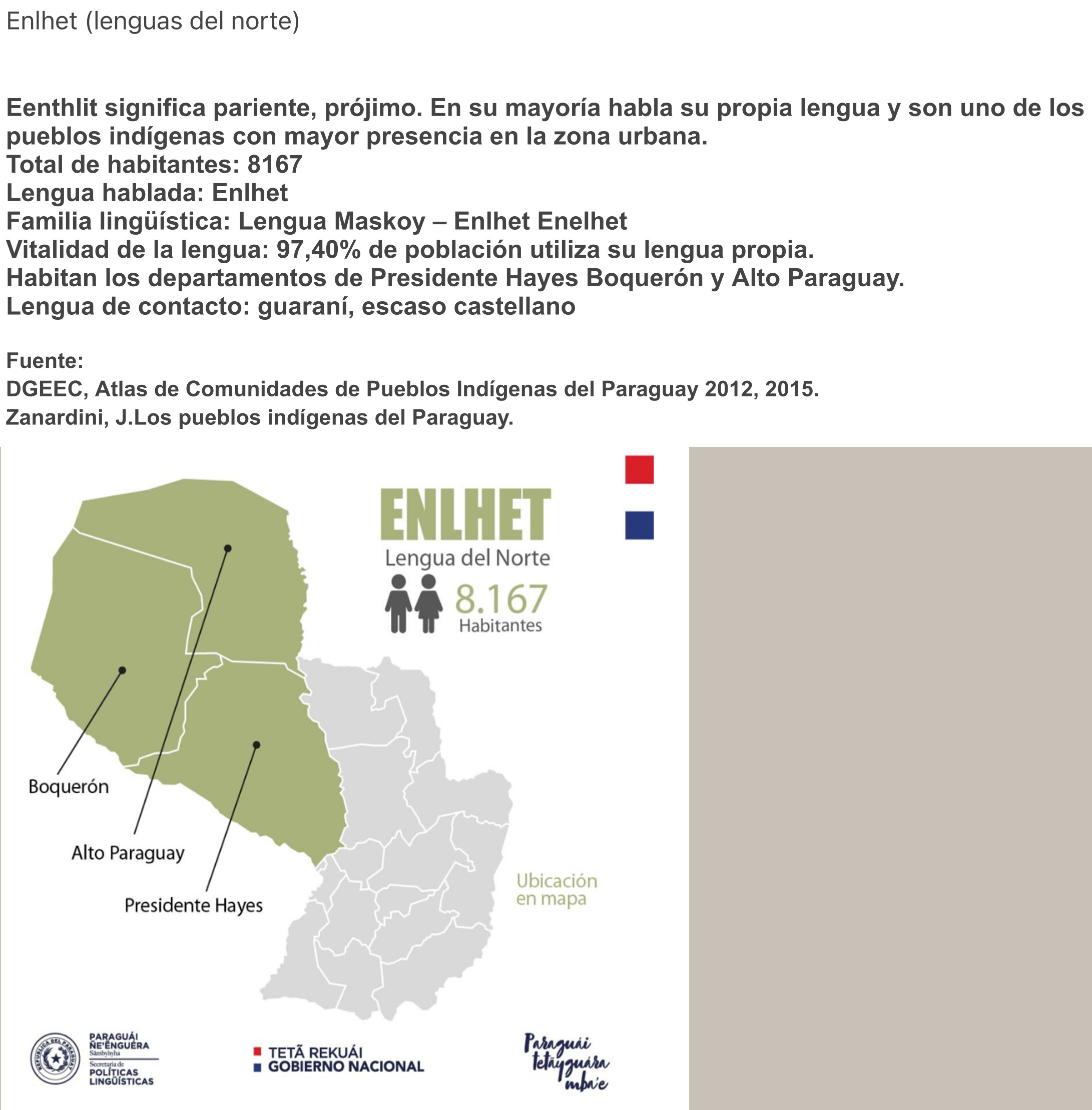
ENLHET Lengua del Norte
Map 2015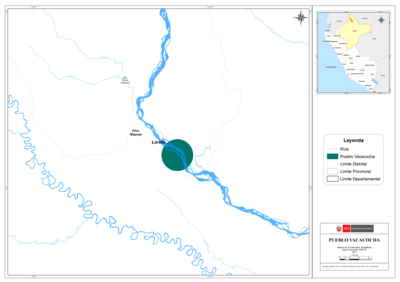
PUEBLO VACACOCHA
Map 2021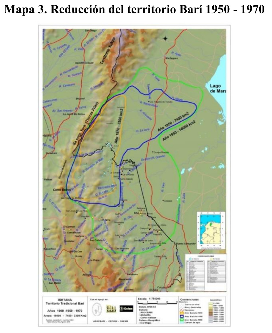
Reducción del territorio Barí 1950 -1970
Map 1950 - 1970