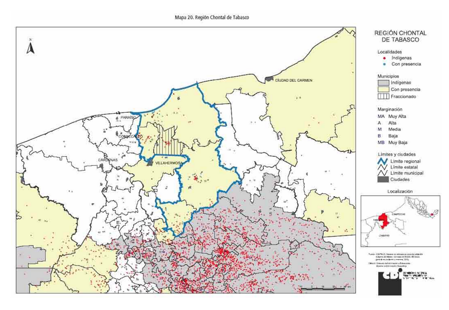
Peoples
- CHONTAL DE TABASCO
Citation
Comisión Nacional para el Desarrollo de los Pueblos Indígenas. Regiones indígenas de México. Publication no. 330.972. 2006. https://www.gob.mx/cms/uploads/attachment/file/35735/cdi-regiones-indigenas-mexico.pdf.
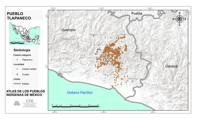
PUEBLO TLAPANECO
Map 2020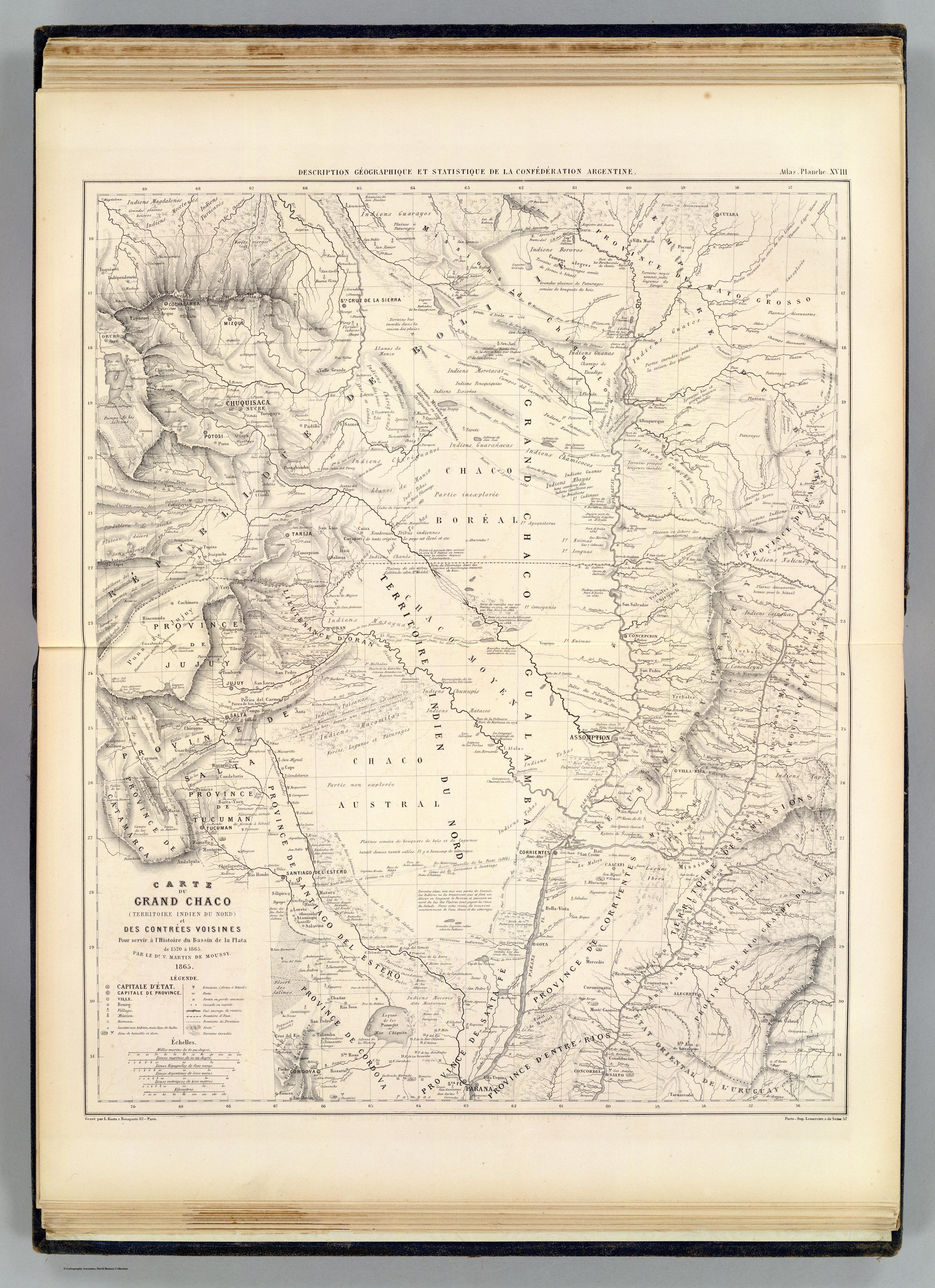
CARTE DU GRAND CHACO (TERRITOIRE INDIEN DU NORD) et DES CONTRÉES VOISINES
Map 1520![No nos culpes por lo que pasó [Do not blame us fow what happened]](https://dnet8ble6lm7w.cloudfront.net/art_sm/AECU010.png)
No nos culpes por lo que pasó [Do not blame us fow what happened]
Artwork![Transversiva Post Andina Revolucionaria: El Regreso [Revolutionary Post-Andean Transversiva: The Return]](https://dnet8ble6lm7w.cloudfront.net/art_sm/AECU022.png)
Transversiva Post Andina Revolucionaria: El Regreso [Revolutionary Post-Andean Transversiva: The Return]
Artwork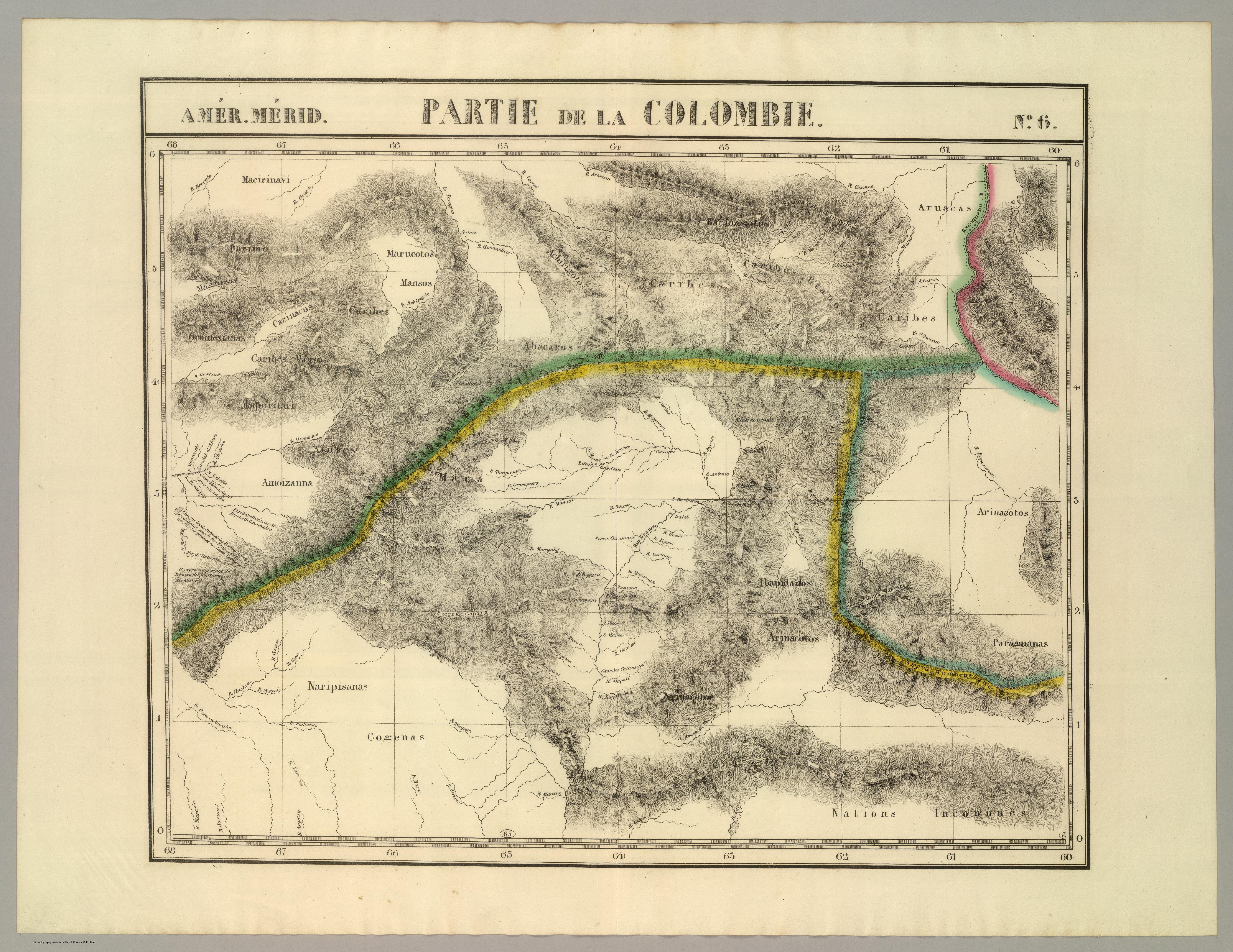
PARTIE DE LA COLOMBIE
Map 1827
The Barima River as depicted on Dixon's compass traverse and the AGS million-scale map published in 1940 (bottom)
Map 1895
CANTON de PIACOA de la PROVINCIA DE GUAYANA
Map 1840
MAPPA CHOROGRAPHICA da Provincia DE STA CATHARINA, PARTE DA PA. DE S. PAULO E DA PA. DE RIO GRANDE DO SUL E PARTE DA REPUBLICA DO PARAGUAY
Map 1774 - 1842