
Peoples
- NAHUA
Citation
Instituto Nacional de los Pueblos Indígenas. "Distribución por Entidad Federativa." Atlas de los pueblos indígenas de México. http://atlas.inpi.gob.mx/distribucion-por-entidad-federativa/.
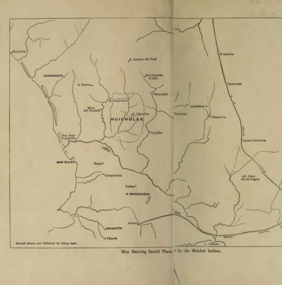
MAP SHOWING SACRED PLACES VISITED BY THE HUICHOL INDIANS
Map 1902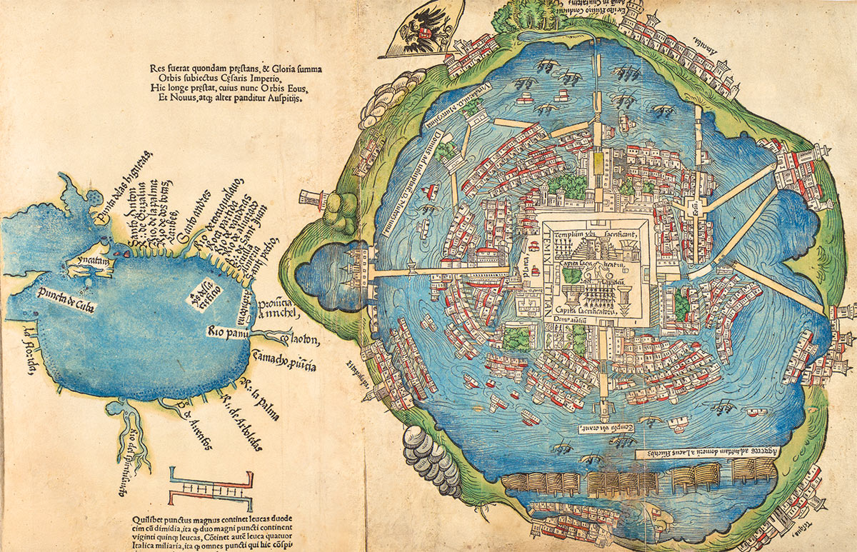
Nuremberg Map of Tenochititlan and the Gulf Coast, 1524
Map 1524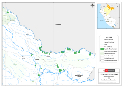
PUEBLO MURUI-MUINANI
Map 2021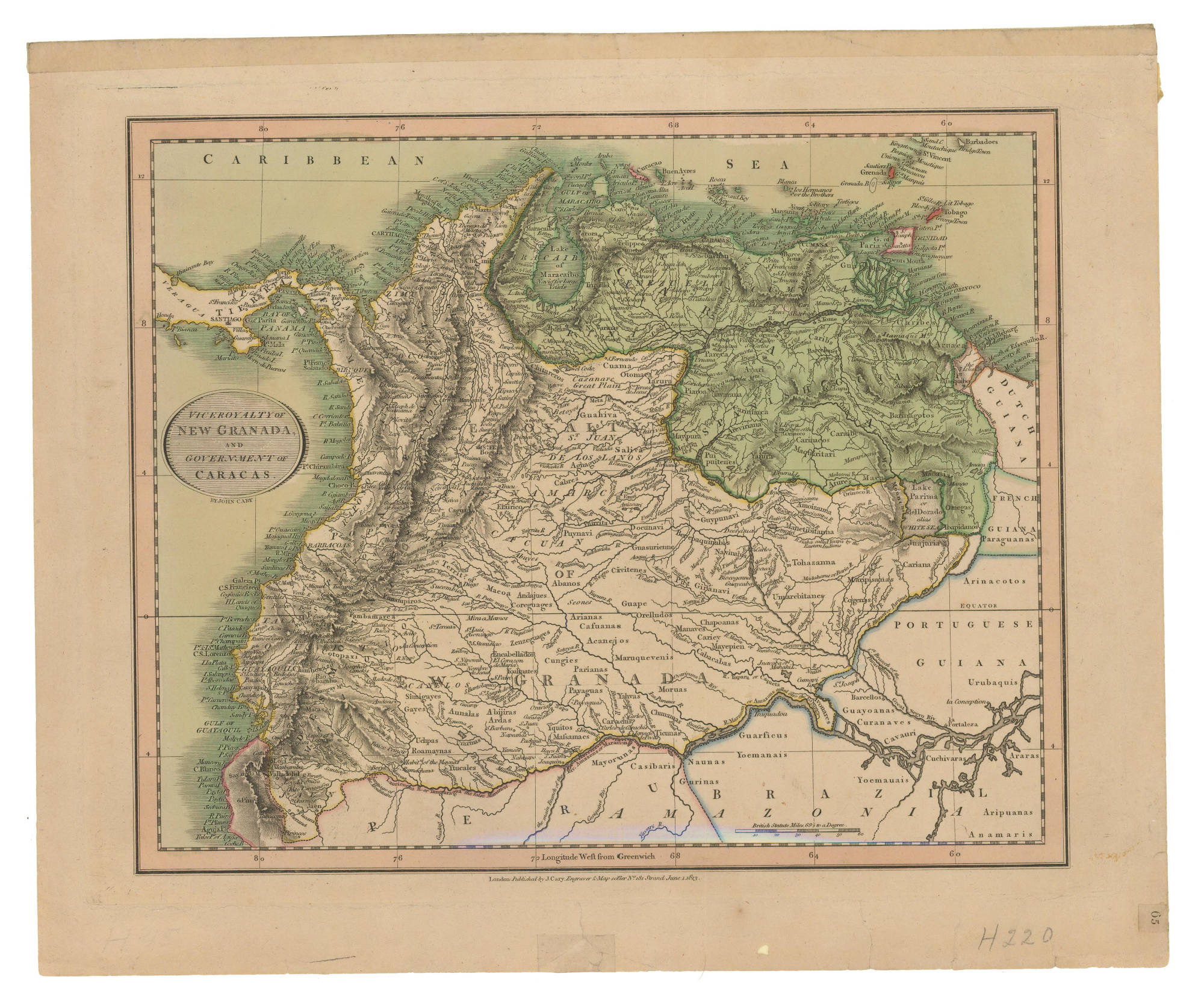
VICEROYALTY OF NEW GRANADA AND GOVERNMENT OF CARACAS
Map 1813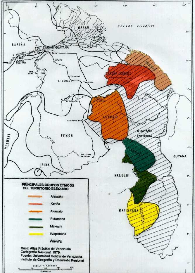
PRINCIPALES GRUPOS ÉTNICOS DEL TERRITORIO ESEQUIBO
Map 1979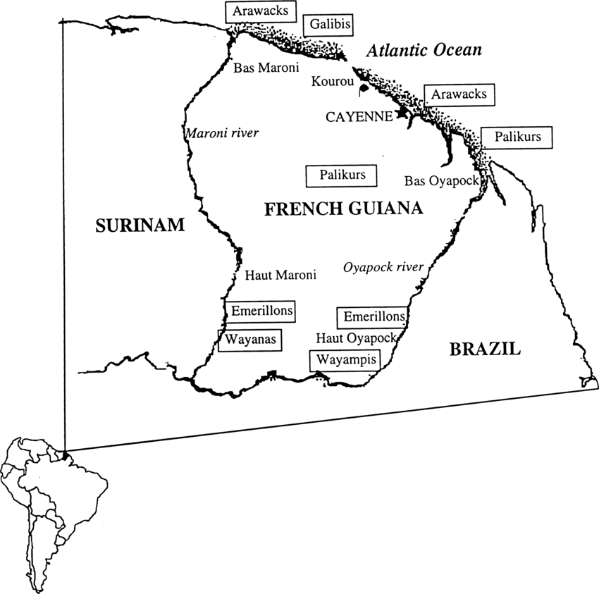
Fig. 1. Map of French Guiana with locations of the various Amerindian groups
Map 1999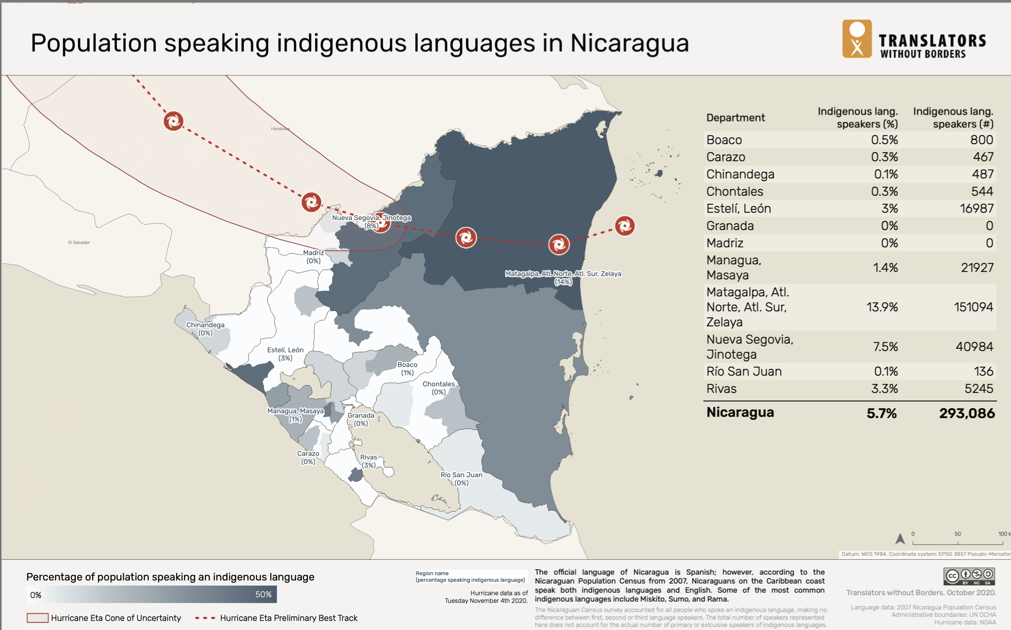
Population Speaking Indigenous Languages in Nicaragua
Map 2000![La partie méridionale de l'Amérique appelée Terre Ferme ou se trouve [sic] les provinces ou grands gouvernements de la Guiane et de la Nouvelle Grenade Cette dernière province subdivisée en Popaya;Cartagene;Ste. Marthe;Rio de la Hacha;Venezuela et Nouvelle Andalousie Le pays et le cours de la rivière des Amazones Au sud de cette carte;comme l'istme de Panama ou nord-ouest;si [sic] trouvent assé bien détaillez](https://dnet8ble6lm7w.cloudfront.net/maps/CNT/CNT0020.jpeg)
La partie méridionale de l'Amérique appelée Terre Ferme ou se trouve [sic] les provinces ou grands gouvernements de la Guiane et de la Nouvelle Grenade Cette dernière province subdivisée en Popaya;Cartagene;Ste. Marthe;Rio de la Hacha;Venezuela et Nouvelle Andalousie Le pays et le cours de la rivière des Amazones Au sud de cette carte;comme l'istme de Panama ou nord-ouest;si [sic] trouvent assé bien détaillez
Map 1719