
Peoples
- AMUZGO
- MIXTECO
- NAHUA
- TLAPANECO
Citation
Instituto Nacional de los Pueblos Indígenas. "Distribución por Entidad Federativa." Atlas de los pueblos indígenas de México. http://atlas.inpi.gob.mx/distribucion-por-entidad-federativa/.
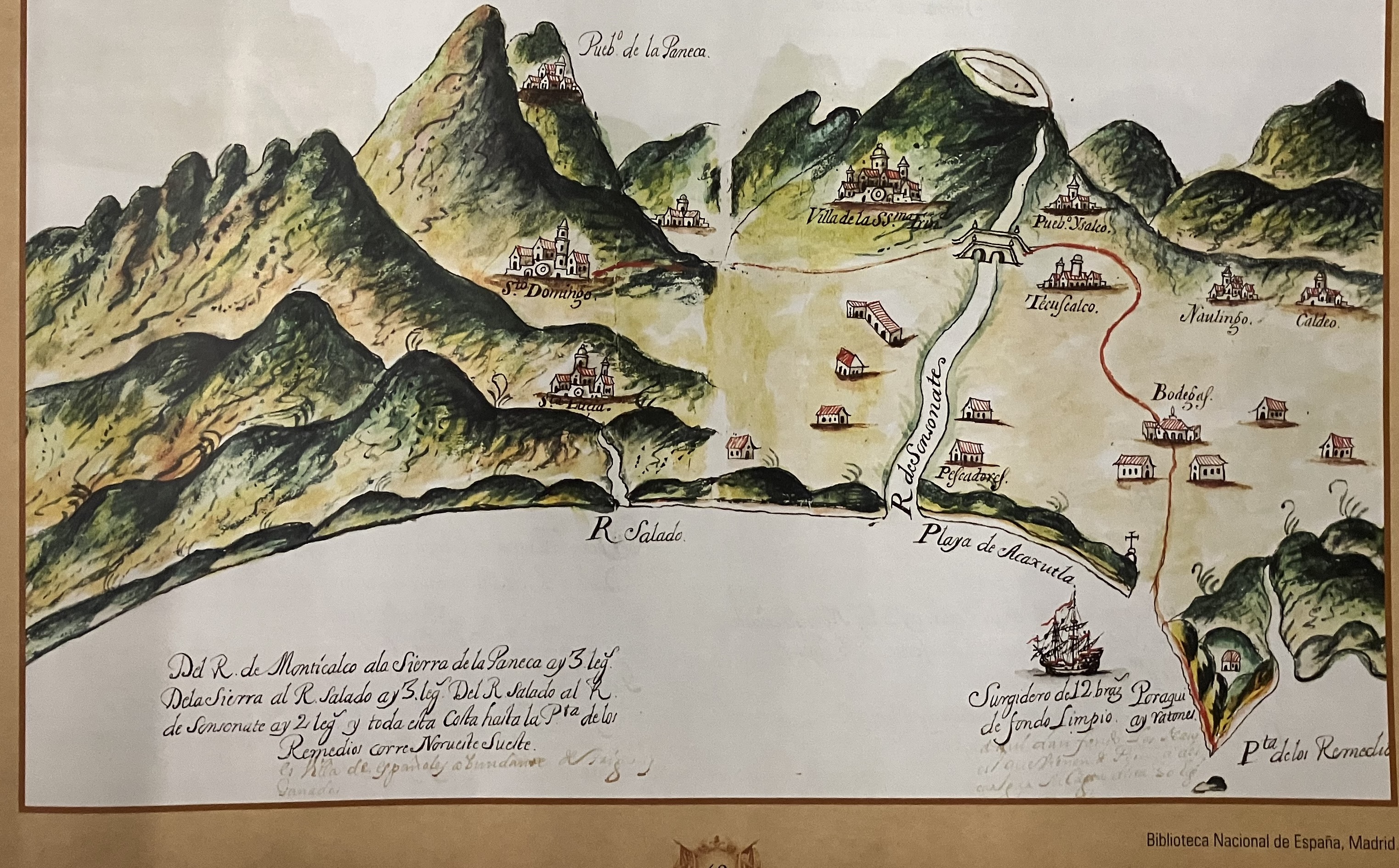
Derrotero de las cartas de América desde la ciudad de Compostela hasta el estrecho Magallanes, con el de las islas de Juan Fernández y las de Salomón
Map 1601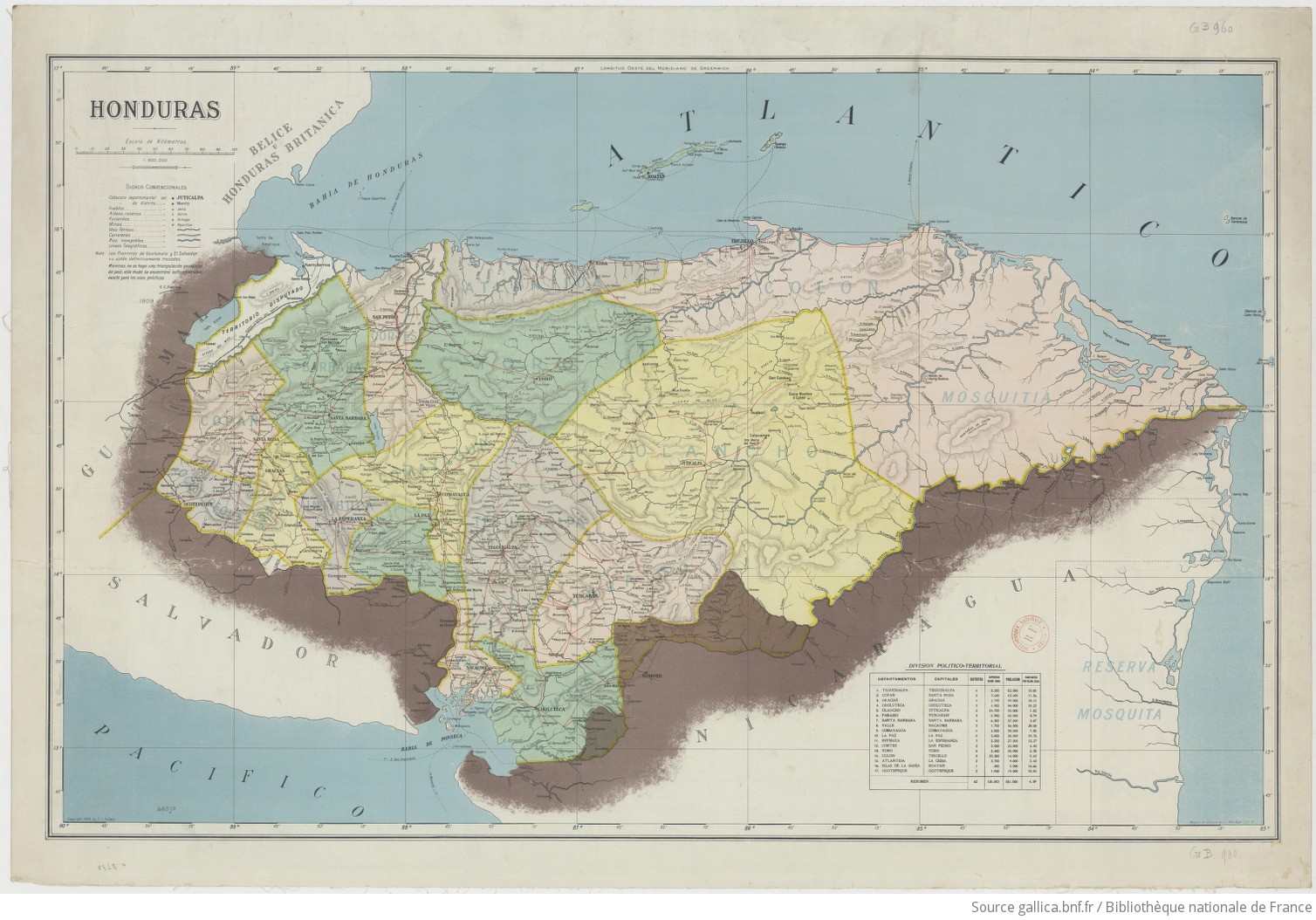
Honduras 1/800.000. Copyright 1909 by E. C. Fiallos
Map 1909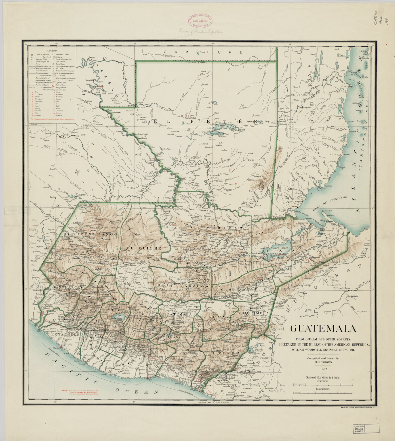
Guatemala: From Official and Other Sources
Map 1900 - 1902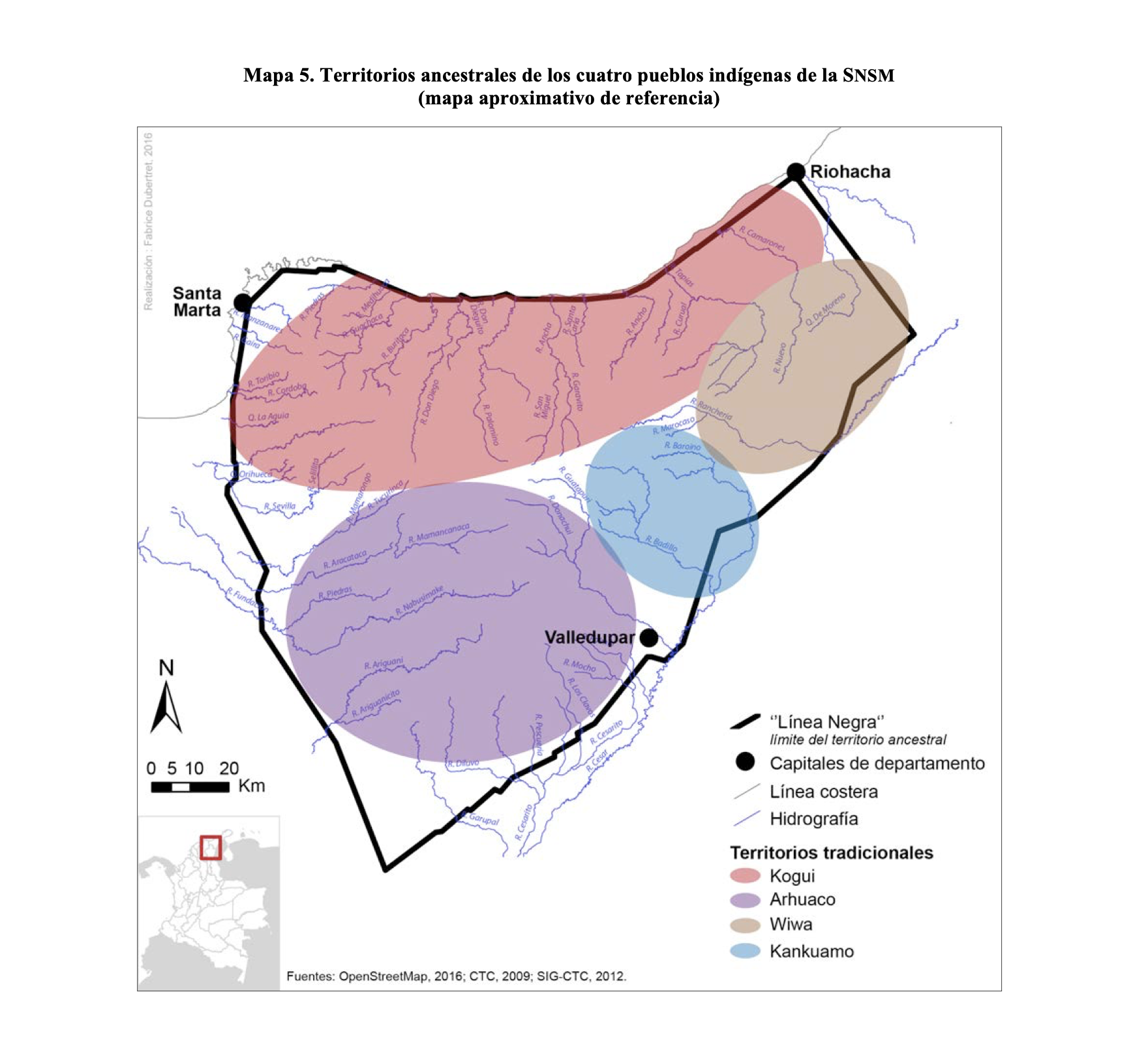
TERRITORIOS ANCESTRALES DE LOS CUATRO PUEBLOS INDIGENAS DE LA SSNM (MAPA APROXIMATIVO DE REFERENCIA)
Map 2009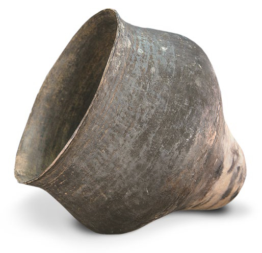
AM, Brazil - Pot
Artwork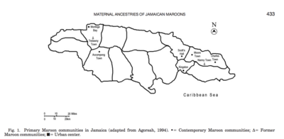
Primary Maroon communities in Jamaica
Map 2015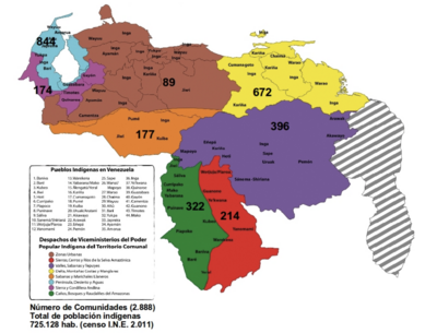
Mapa por despacho de Vice-ministerios
Map 2012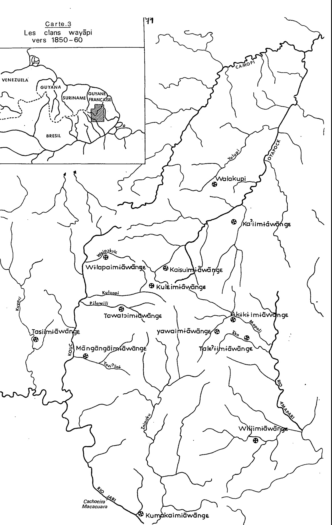
Carte 3. Les clans wayãpi vers 1850-1860
Map 1850 - 1860