
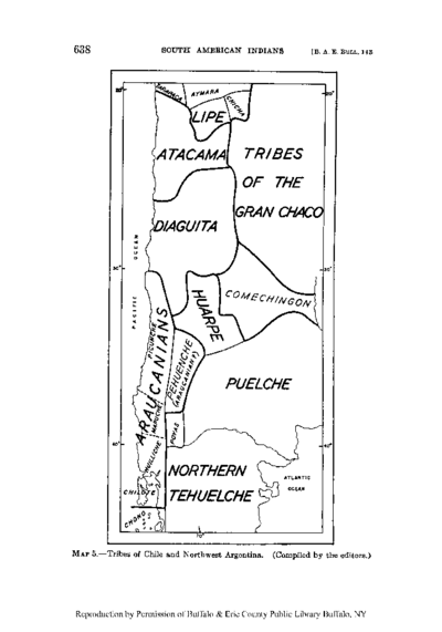
Peoples
- GUARIJIO
- PIMA
- TARAHUMARA
- TEPEHUANO DEL NORTE
Citation
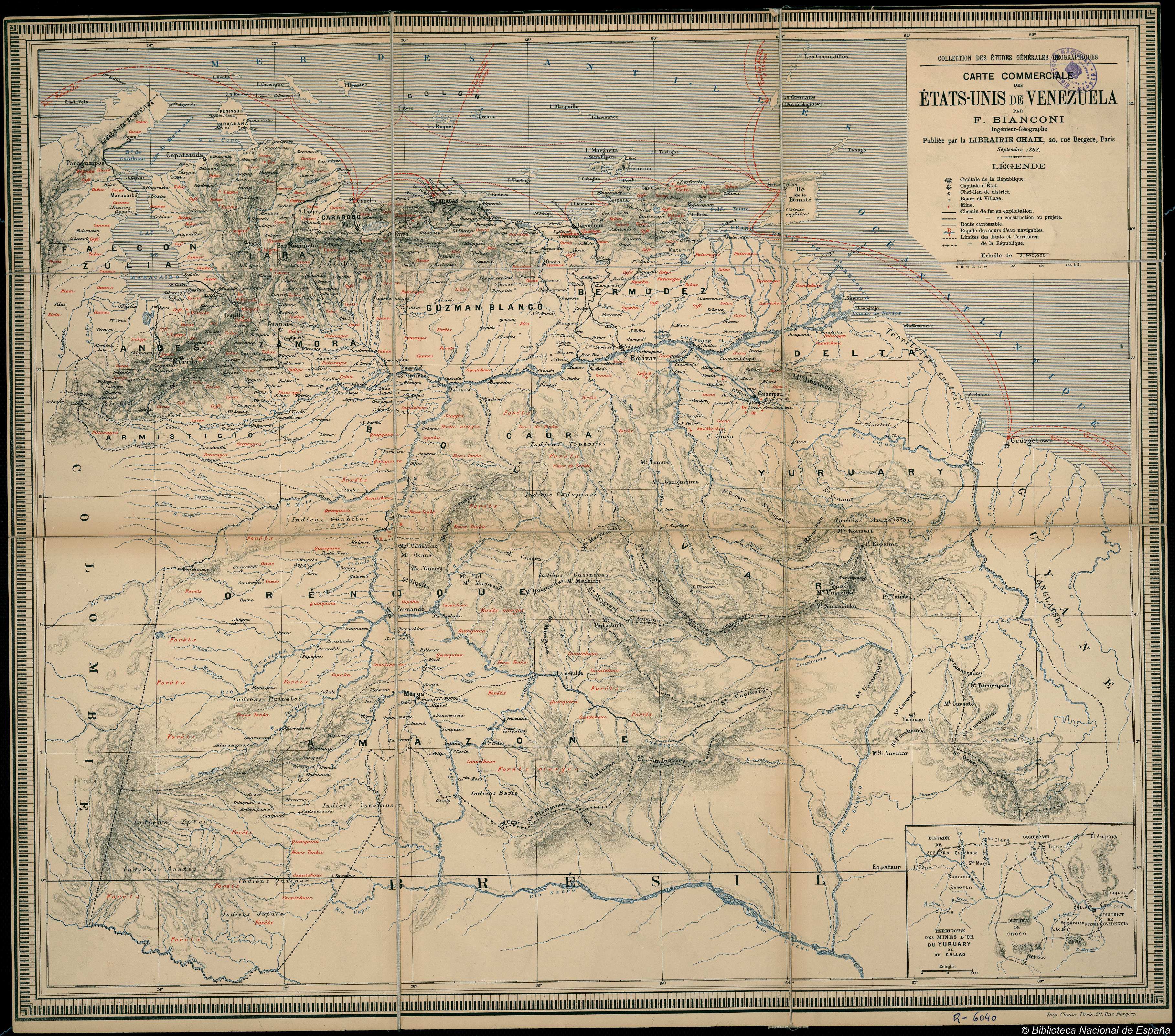
Instituto Nacional de los Pueblos Indígenas. "Distribución por Entidad Federativa." Atlas de los pueblos indígenas de México. http://atlas.inpi.gob.mx/distribucion-por-entidad-federativa/.
![Retrato de Lorenzo Jaramillo [Portrait of Lorenzo Jaramillo]](https://dnet8ble6lm7w.cloudfront.net/art_sm/ACOL006.png)
![Numero 6⁰. Plano que de muestra la porcion de costades de la Punta de Marabiq[u]e [sic] por la parte del oeste, has[t]as la detirbes por el leste, puertos, cauos yslas &c](https://dnet8ble6lm7w.cloudfront.net/maps/HON/HON0020.jpg)