
Citation
Tanck de Estrada, Dorothy. Atlas Ilustrado de los Pueblos de Indios: Nueva España, 1800. México: El Colegio de México, 2005. N/A - NO DIGITAL ACCESS
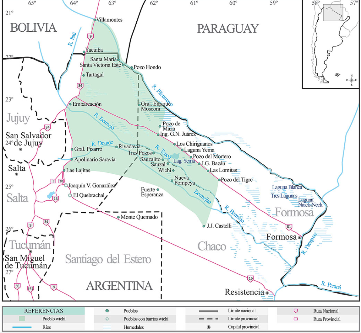
Lengua wichí. Dónde se habla
Map 2009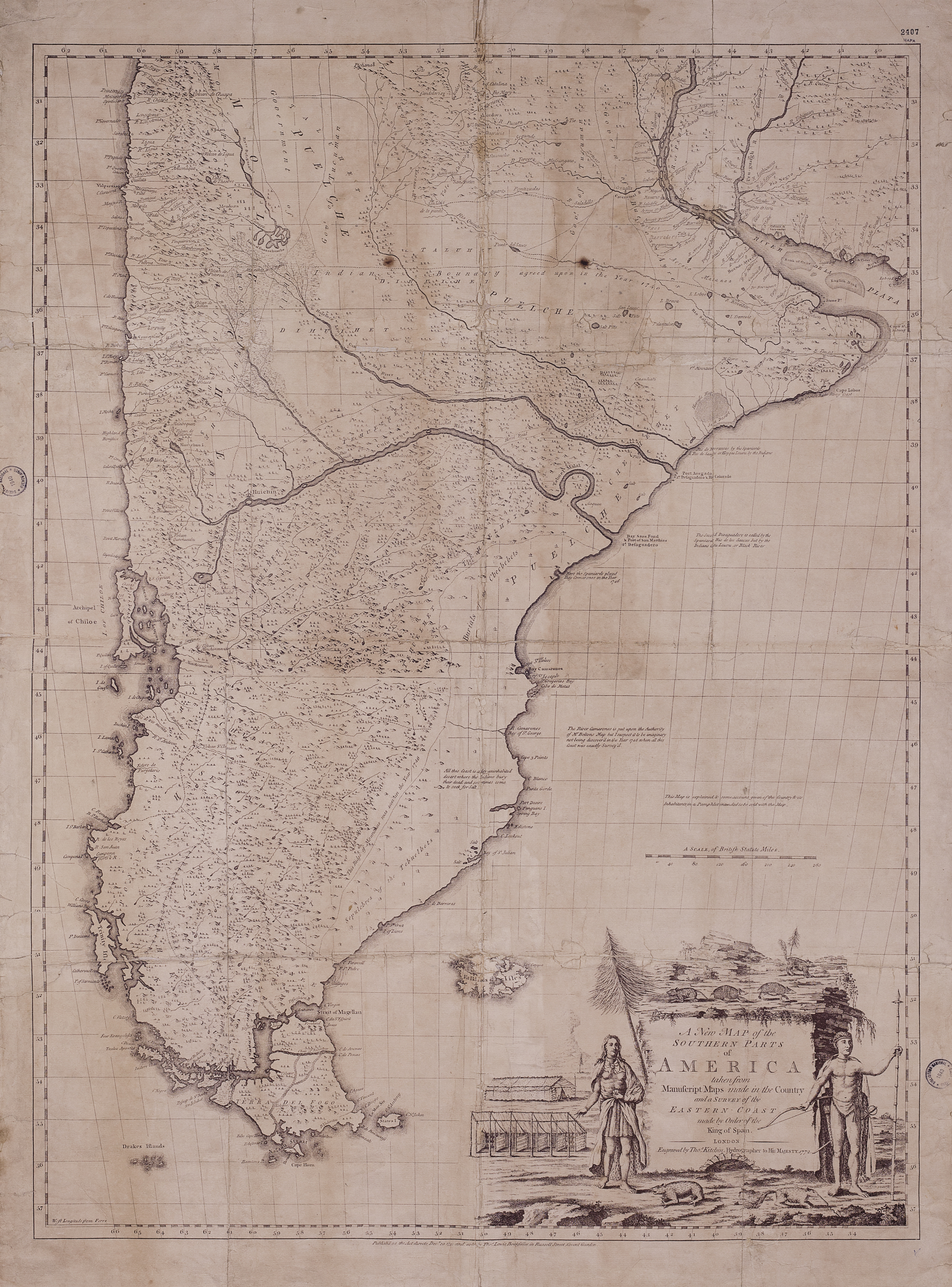
A New Map of the Southern Parts of America
Map 1772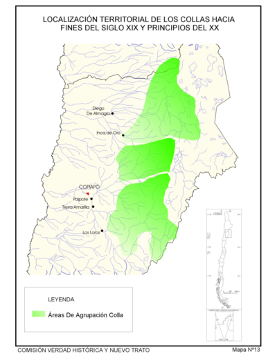
Localización Territorial de los Collas Hacia Fines del Siglo XIX y Principios de Siglo XX."
Map 1800 - 1900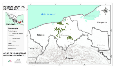
PUEBLO CHONTAL DE TABASCO
Map 2020
MORELOS
Map 2015
DIE EHEMALIGE VERBREITUNG und die MUTHMASSLICHEN WANDERUNGEN der TUPIS. Die jetzigen HAUPT-SPRACHENGRUPPEN.
Map 1875
Carte particulière de la colonie de Cayenne. Levée et présentée à Monseigneur le Comte de Pontchartrain, Ministre et secrétaire d'Etat ;Par son très humble serviteur et très obéissant serviteur De Créanton officier de la marine
Map 1701
TERRITORIOS ANCESTRALES DE LOS CUATRO PUEBLOS INDIGENAS DE LA SSNM (MAPA APROXIMATIVO DE REFERENCIA)
Map 2009