Citation
Mapas españoles de América, siglos XV-XVII. Madrid: Editorial Maestre, 1951. http://consulta.archivogeneral.gov.co/ConsultaWeb/imagenes.jsp?id=3251550&idNodoImagen=3251551&ini=1&total=410
![Victoria regia [Giant Water Lily]](https://dnet8ble6lm7w.cloudfront.net/art/APER015.jpg)
Victoria regia [Giant Water Lily]
Artwork
PUEBLO MAYA
Map 2020
PUEBLO POPOLOCA
Map 2020
America sive India nova ad magnae Gerardi Mercatoris avi universalis imitationem in compendium. Redacta per Michaelem Mercatorem Duysburgensem
Map 1600 - 1699
Government map of Nicaragua : from the latest surveys ordered by President Patricio Rivas and Genl. William Walker ;executed under the supervision of the Señor Fermín Ferrer;Governor of the Western Department;1856
Map 1800 - 1856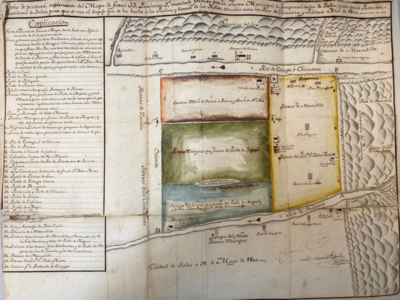
Plano de pintura, suplemento del mapa de foxas 53, quaderno 3, mandado a formar por la junta de temporalidades de salta, y este por el protector/partidario del indio, para que el despojo que se ha hecho de los pueblos y tierras de los indios
Map 1790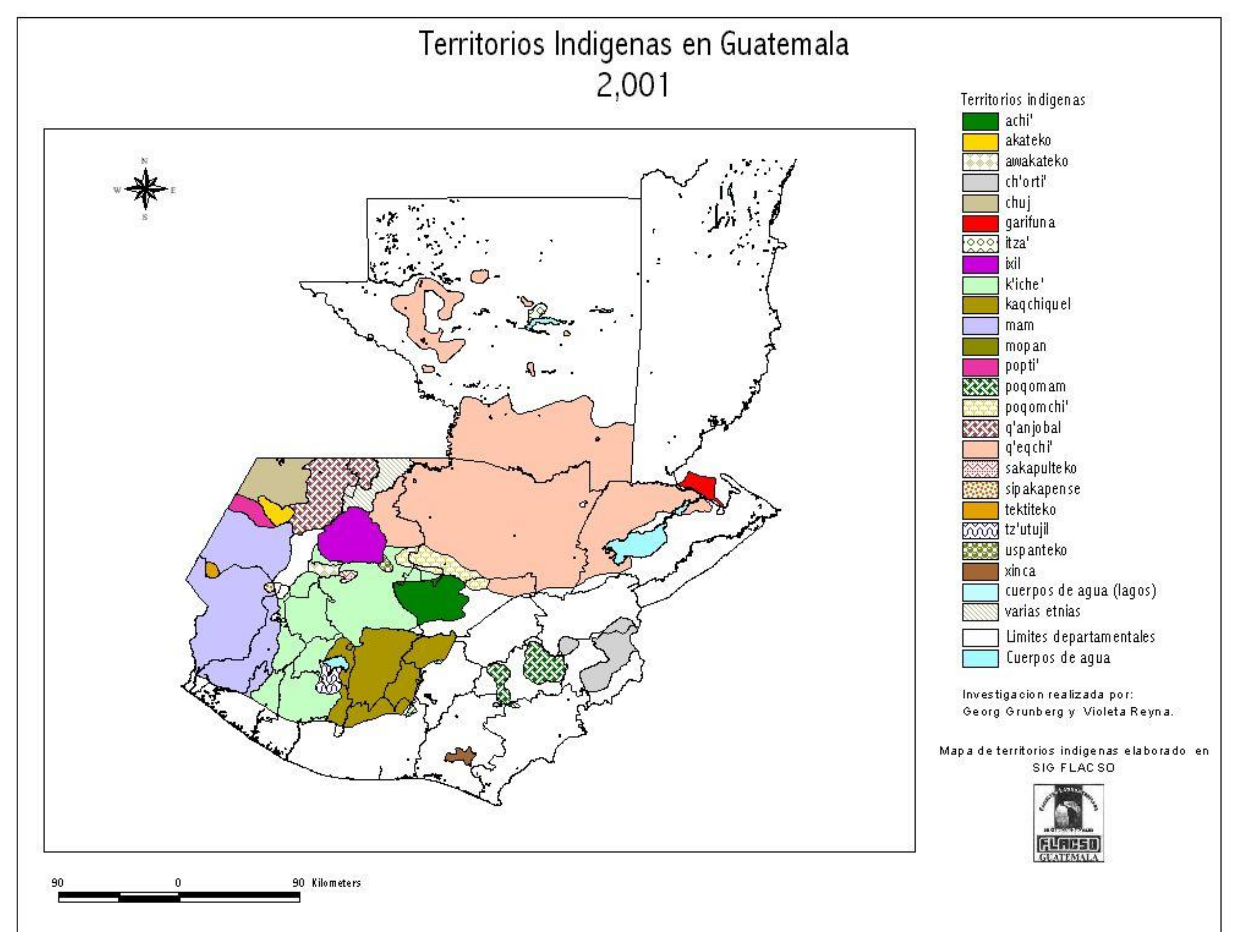
Territorios Indigenas en Guatemala 2,001
Map 2001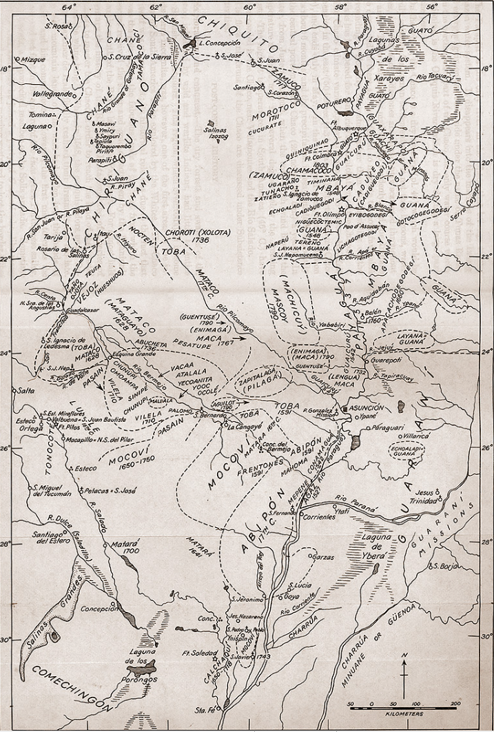
Tribus del Gran Chaco
Map 1527 - 1790