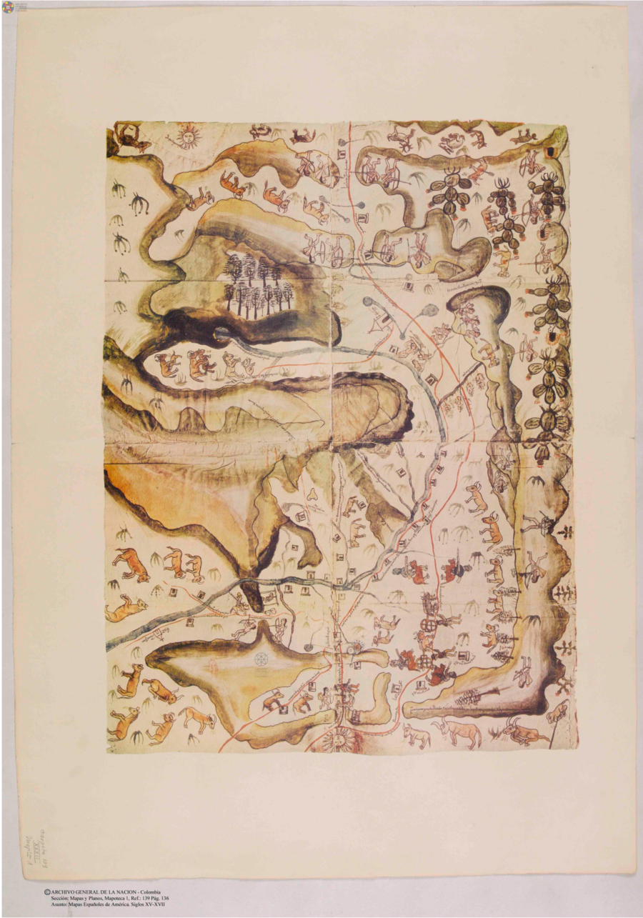
Citation
Mapas españoles de América, siglos XV-XVII. Madrid: Editorial Maestre, 1951. http://consulta.archivogeneral.gov.co/ConsultaWeb/imagenes.jsp?id=3251550&idNodoImagen=3251551&ini=1&total=410
![Walimanai People [Baniwa]
São Joaquim Village, Ayari River, Alto Rio Negro Indigenous Territory, AM (Amazonas), Brazil Plaque](https://dnet8ble6lm7w.cloudfront.net/art_sm/ABRA020.png)
Walimanai People [Baniwa] São Joaquim Village, Ayari River, Alto Rio Negro Indigenous Territory, AM (Amazonas), Brazil Plaque
Artwork![Nos roban las palabras o A Calzón quitado, o Insurrecciones que son heréticas resurrecciones [They steal our words or Barefaced, or Insurrections that are Heretical Resurrections]](https://dnet8ble6lm7w.cloudfront.net/art_sm/AMEX006.png)
Nos roban las palabras o A Calzón quitado, o Insurrecciones que son heréticas resurrecciones [They steal our words or Barefaced, or Insurrections that are Heretical Resurrections]
Artwork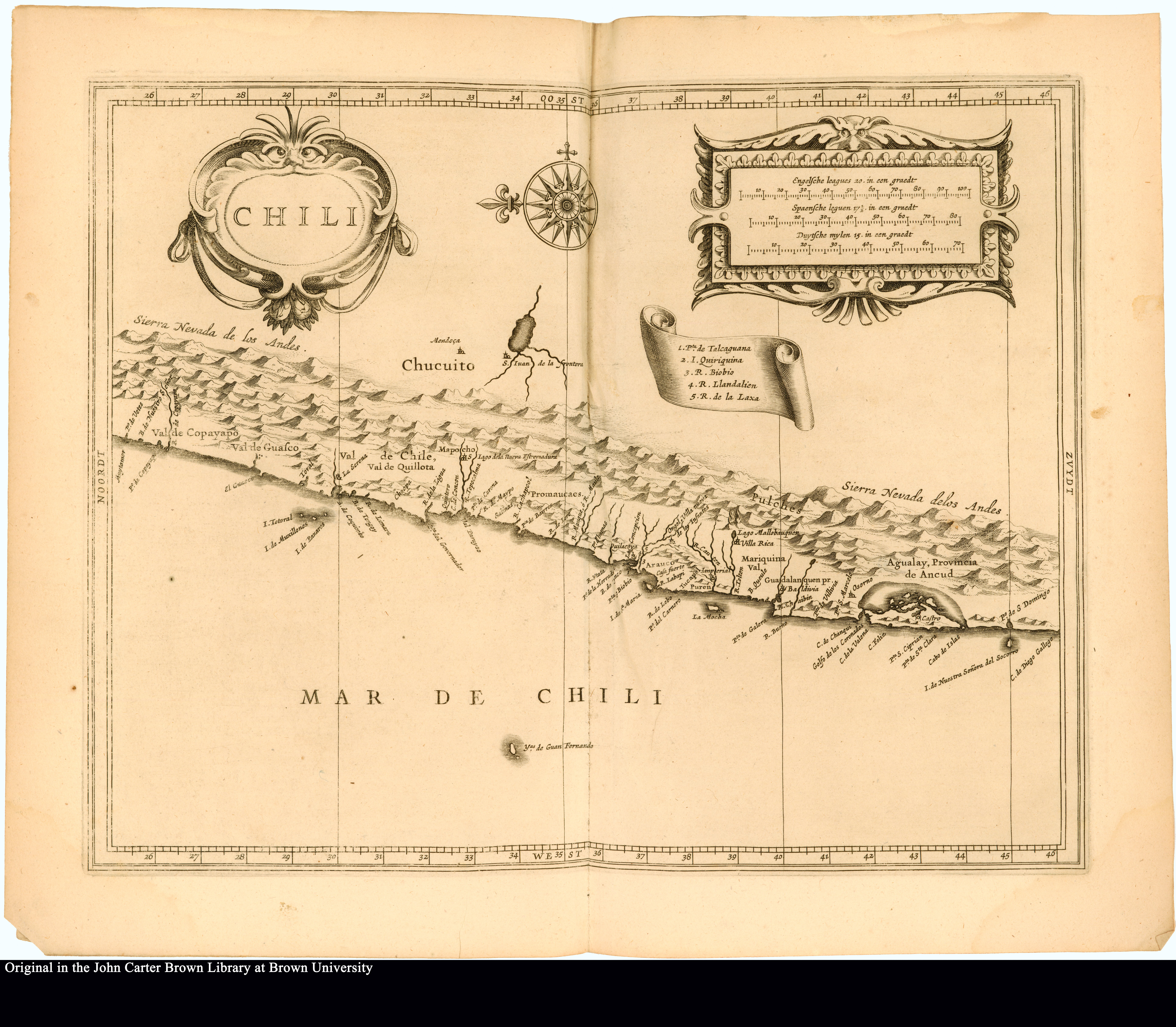
Chili
Map 1625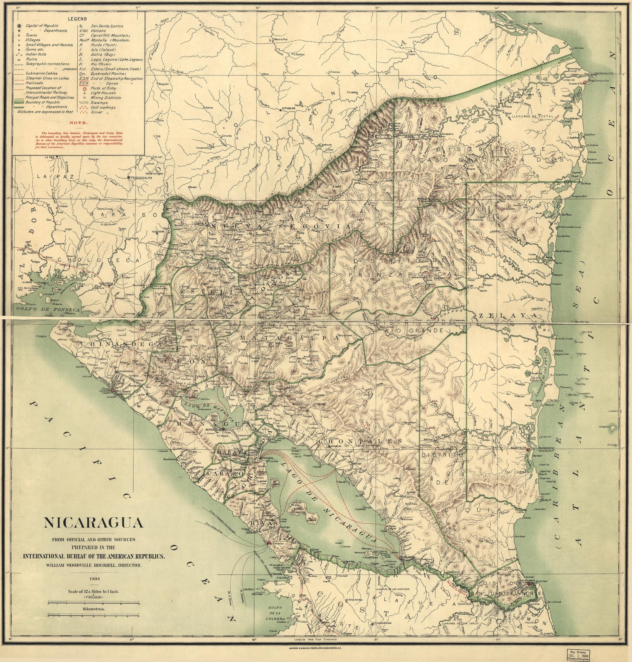
Nicaragua
Map 1900 - 1903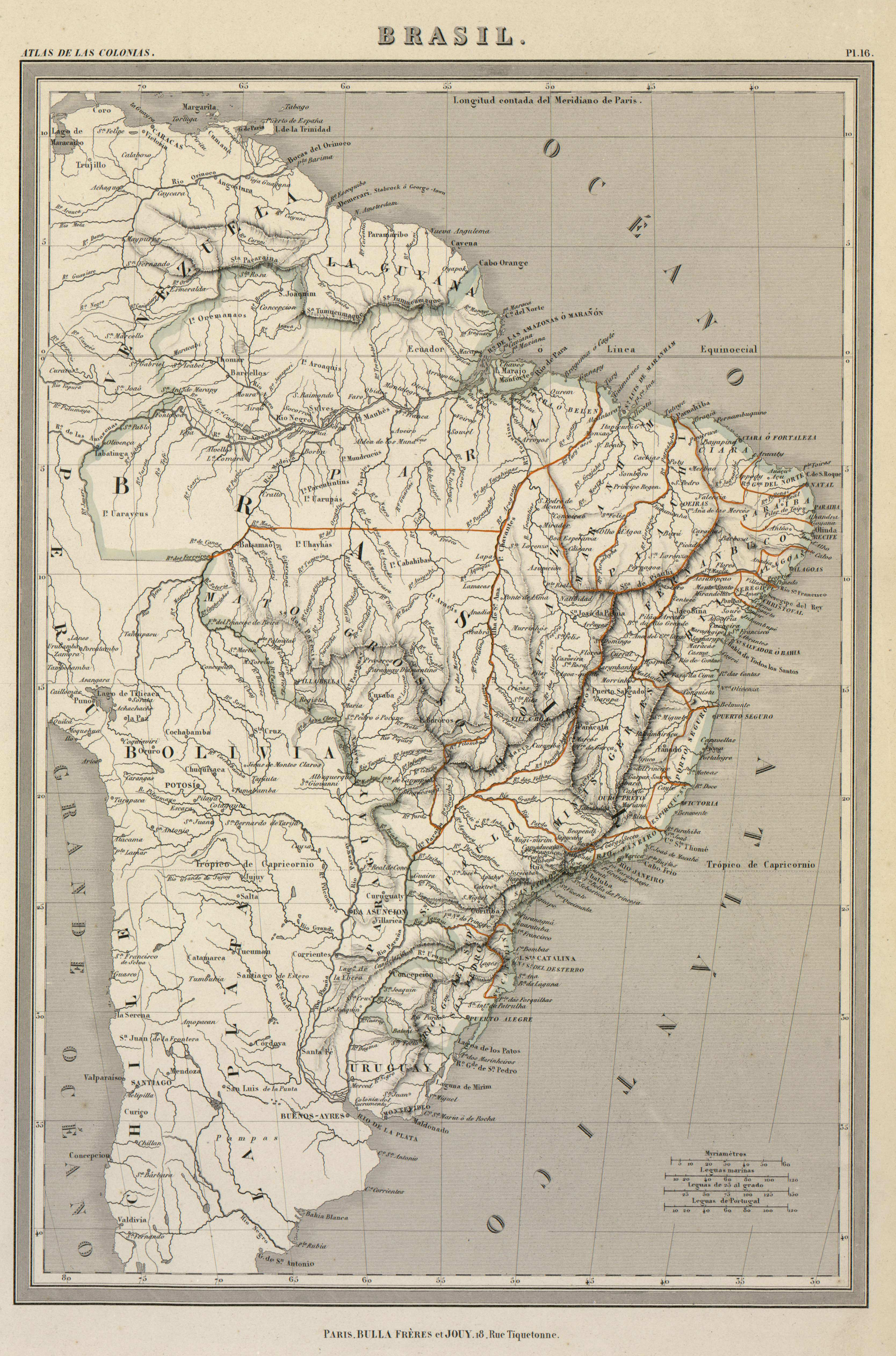
BRASIL
Map 1800 - 1899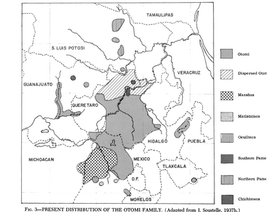
Present Distribution of the Otomi Family
Map 1969
MAPA DE LOS TERRITORIOS INDÍGENAS TITULADOS (TIOC) DE BOLIVIA, AL 2011
Map 2011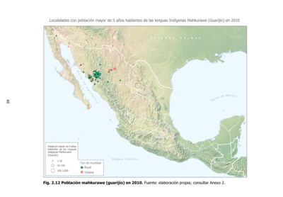
Población mahkurawe (guarijío) en 2010
Map 2010