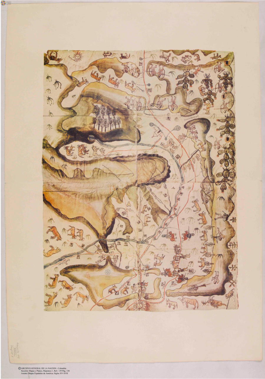
Dispossesions in the Americas

Dispossesions in the Americas

  • Home
  • Explore
  • About
  • Authors
  • Art
  • Bodies
  • Curricula
  • Cultural Heritage
  • Maps
  • Territories
Back to Explore
Map 1580

Plano del valle del río de San Miguel, desde sus fuentes hasta San Francisco de Chamacuero

  • ANONIMO

Published: 1580

  • Download Image

Citation

Mapas españoles de América, siglos XV-XVII. Madrid: Editorial Maestre, 1951. http://consulta.archivogeneral.gov.co/ConsultaWeb/imagenes.jsp?id=3251550&idNodoImagen=3251551&ini=1&total=410

  • Download Image

Reading in Spanish

Map 1580

Plano del valle del río de San Miguel, desde sus fuentes hasta San Francisco de Chamacuero

  • ANONIMO

Published: 1580

  • Download Image
  • Download Image

Related Content

Vision etnografica del Choco Medidional

Vision etnografica del Choco Medidional

Map 1596
ECUADOR;NEW GRANADA;VENEZUELA;AND GUIANA.

ECUADOR;NEW GRANADA;VENEZUELA;AND GUIANA.

Map 1800 - 1899
Ishir (Chamacoco)

Ishir (Chamacoco)

Map 2001
Map of the basin of La Plata : based upon the results of the expedition under the command of Thos. J. Page;U.S. Navy;in the years 1853;-'54;-'55;& 56 and of the adjacent countries

Map of the basin of La Plata : based upon the results of the expedition under the command of Thos. J. Page;U.S. Navy;in the years 1853;-'54;-'55;& 56 and of the adjacent countries

Map 1853 - 1856
The modern departments of Ahuachapán, La Libertad, Santa Ana, and Sonsonate (highlighted in red) now contain the highest concentration of Indigenous communities in El Salvador.

The modern departments of Ahuachapán, La Libertad, Santa Ana, and Sonsonate (highlighted in red) now contain the highest concentration of Indigenous communities in El Salvador.

Map 2010
Carta della Guiana

Carta della Guiana

Map 1700 - 1799
Mapa de la America meridional, desde la equinoccial hasta
     la Tierra del Fuego

Mapa de la America meridional, desde la equinoccial hasta la Tierra del Fuego

Map 1596
WESTINDIEN CENTRAL-AMERICA UND DAS NOERDLICHE UND NOERDWESTLICHE SUED AMERICA;NUEVA GRANADA UND VENEZUELA

WESTINDIEN CENTRAL-AMERICA UND DAS NOERDLICHE UND NOERDWESTLICHE SUED AMERICA;NUEVA GRANADA UND VENEZUELA

Map 1866

Dispossessions in the Americas

A project by

University of Pennsylvania

Copyright 2024

With support from

Mellon Foundation

Site design & development

Element 84

Art Credits

Mapas españoles de América, siglos XV-XVII. Madrid: Editorial Maestre, 1951. http://consulta.archivogeneral.gov.co/ConsultaWeb/imagenes.jsp?id=3251550&idNodoImagen=3251551&ini=1&total=410

Site Pages

  • Home
  • Explore
  • About
  • Authors
  • Art
  • Bodies
  • Curricula
  • Cultural Heritage
  • Maps
  • Territories