Peoples
- TARASCO
- TLAXCALA
- MEXICA
- CUITLATECA
- MIXTECAPAN
- ZAPOTECAPAN
- MIXE-ZOQUE
Citation
Drucker, Susana, Roberto Escalante, and Roberto J. Weitlaner. "The Cuitlatec." In Ethnology, edited by Robert Wauchope and Evon Z. Vogt, 565. Vols. 7-8 of Handbook of Middle American Indians. Austin: University of Texas Press, 1969. https://ebookcentral-proquest-com.proxy.library.upenn.edu/lib/upenn-ebooks/reader.action?docID=4826335&ppg=586.
![Chamán asháninka [Ashánika Shaman]](https://dnet8ble6lm7w.cloudfront.net/art_sm/APER051.png)
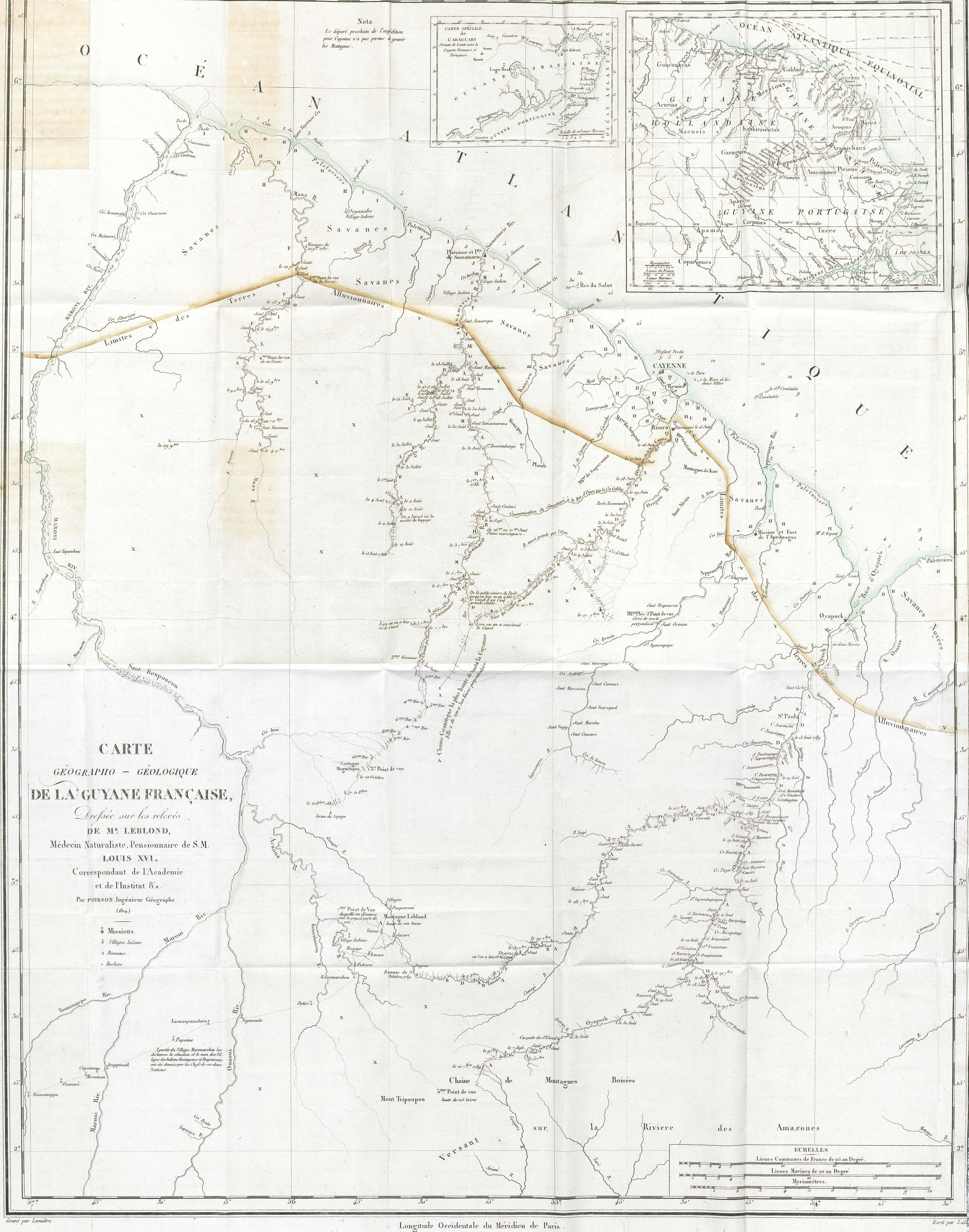
![Carte de la Guyane française (2ème édition). Service géographique des colonies. [Feuille 1]](https://dnet8ble6lm7w.cloudfront.net/maps_sm/FGU/FGU0011-0.png)