Peoples
- MEXICANERO DE DURANGO
Citation
Instituto Nacional de los Pueblos Indígenas. "Mexicaneros de Durango – Ubicación." Atlas de los Pueblos Indígenas de México. http://atlas.inpi.gob.mx/mexicaneros-de-durango-ubicacion/.
Carte de la Terre Ferme du Perous, du Bresil et du Pays des Amazones Dressée sur les Descriptions de Herrera, de Laet, et des PP. d'Acuña et M. Rodrigués et sur plusieur Relations et Observations posterieurs
Map 1782
LA POBLACIÓN INDIGENA DEL GRAN CHACO A mediados del Siglo XVII
Map 1612![[Partie de l'Oyapock]](https://dnet8ble6lm7w.cloudfront.net/maps/FGU/FGU0054.jpeg)
[Partie de l'Oyapock]
Map 1700 - 1799
Algunos grupos chichimecas
Map 2014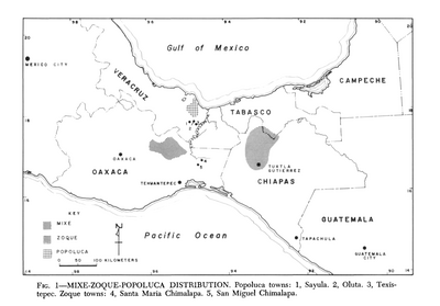
Mixe-Zoque-Popoluca Distribution
Map 1969
Railroad Map of British Honduras Transportation Department of the United States Department of Commerce. Library of Congress Geography and Map Division. https://hdl.loc.gov/loc.wdl/wdl.11329
Map 1900
Mosquitia or The Mosquito Shore with The Eastern Part of Yucatán as far as the 20th Degree of North Latitude
Map 1787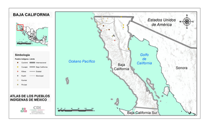
BAJA CALIFORNIA
Map 2015