
Peoples
- TRIQUI
Citation
Instituto Nacional de los Pueblos Indígenas. "Triquis – Ubicación." Atlas de los Pueblos Indígenas de México. Accessed July 7, 2021. http://atlas.inpi.gob.mx/localizacion-pueblo-triqui/.
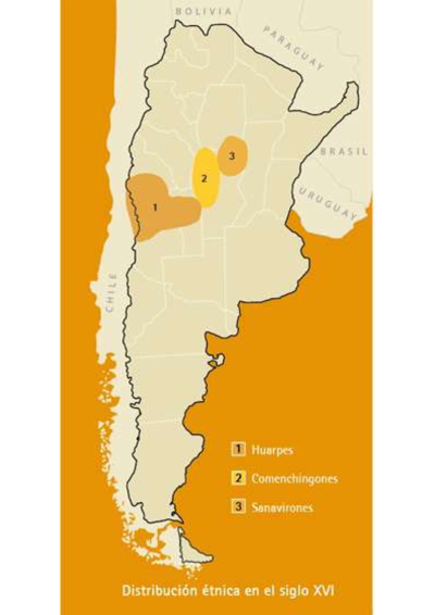
Distribución étnica en el siglo XVI
Map 1500 - 1599
CARTA GEOGRÁFICA DEL ECUADOR POR DR. TEODORO WOLF;PUBLICADA POR ORDEN DEL SUPREMO GOBIERNO DE LA REPÚBLICA Y TRABAJADA BAJO LAS PRESIDENCIAS DE LOS EE. SEÑORES DR. D.J.M. PLÁCIDO CAAMAÑO Y DR. D. ANTONIO FLORES. 1892 ... INSTITUTO GEOGRAFICO DE H. WAGNER & E. DEBES EN LEIPZIG. (WITH) LA REGION ORIENTAL DEL ECUADOR. (WITH) ARCHIPIÉLAGO DE GALÁPAGOS.
Map 1892![Ombre des Amazonies [Shadows of the Amazon]](https://dnet8ble6lm7w.cloudfront.net/art/APER055.JPG)
Ombre des Amazonies [Shadows of the Amazon]
Artwork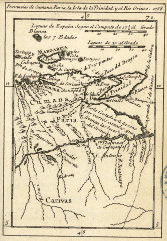
Provincias de Cumana;Paria;la Isla de la Trinidad;y el Rio Orinoco. 1758.
Map 1758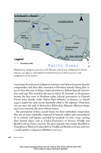
Indigenous provinces in El Salvador around 1500. (Adapted from Fowler 1989140-141, figure 5, with additional information from Lehman 1920:719, with modifications by the author.)
Map 1500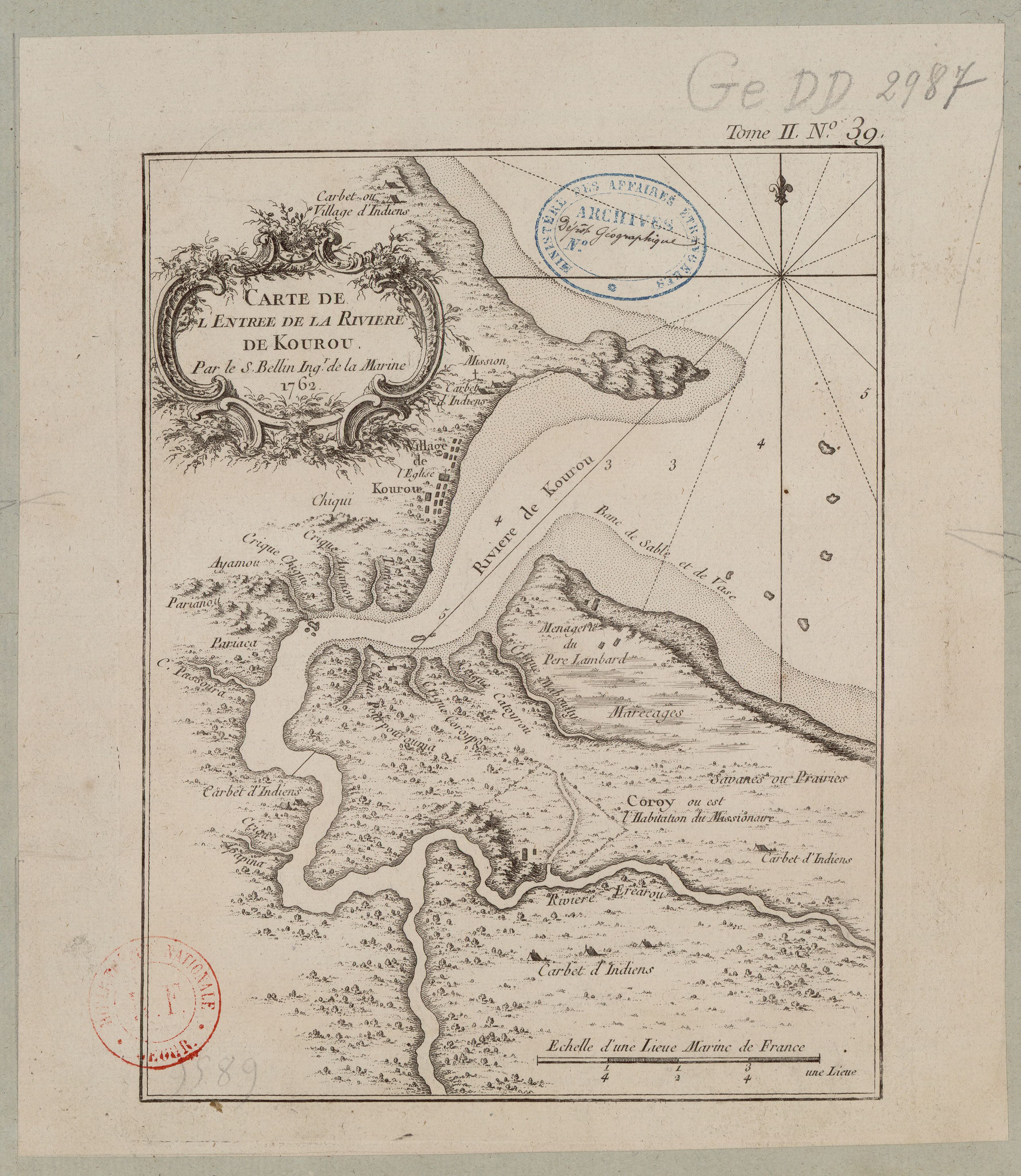
Carte de l'entrée de la Rivière de Kourou.
Map 1764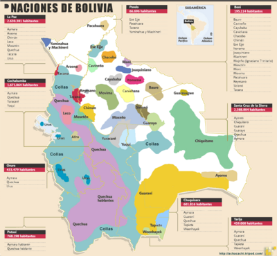
Naciones de Bolivia
Map 2009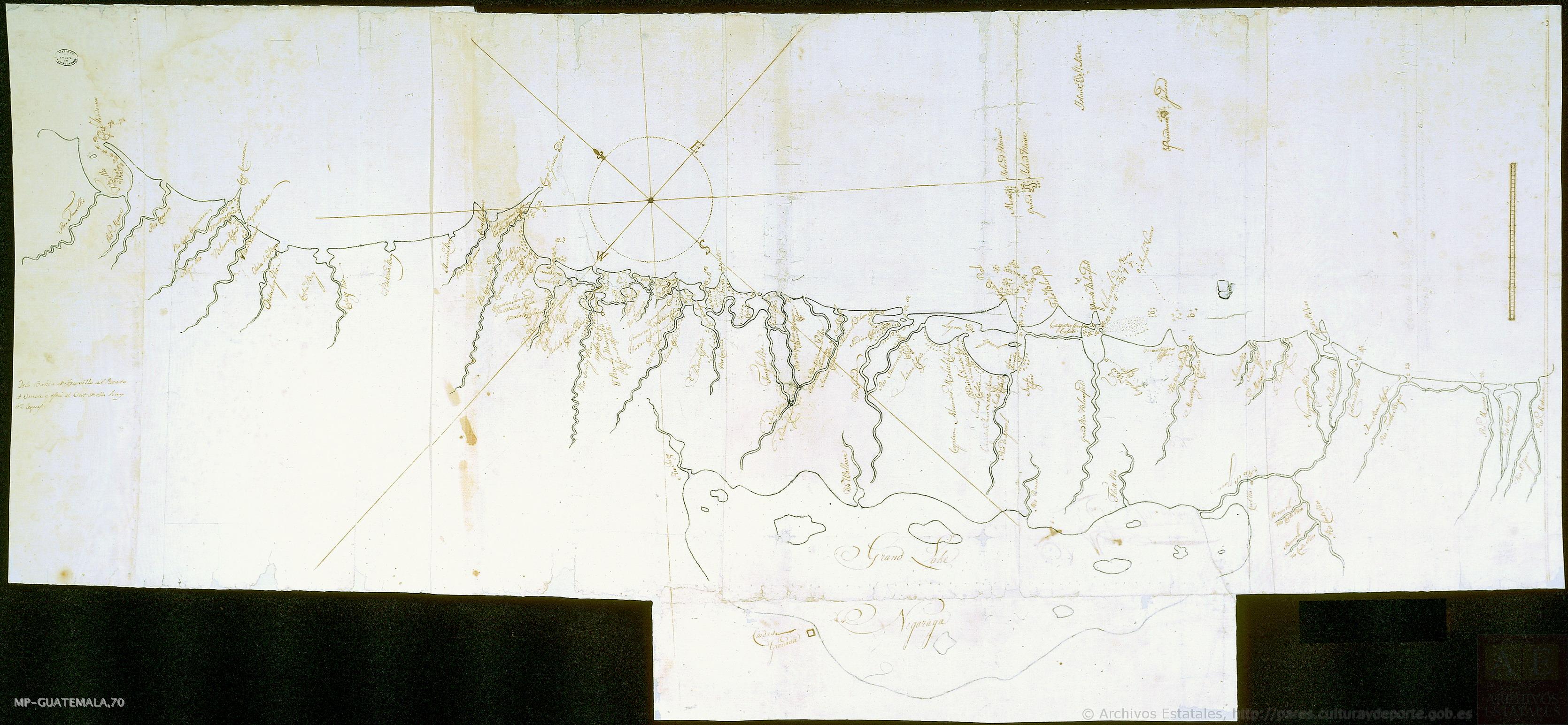
Mapa de costa comprendida entre Trujillo (Honduras) y la desembocadura del río de Matina.
Map 1768