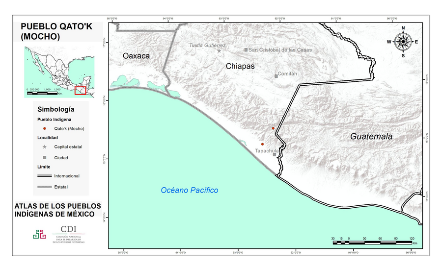
Peoples
- MOCHO
Citation
Instituto Nacional de los Pueblos Indígenas. "Mochós – Ubicación." Atlas de los Pueblos Indígenas de México. Accessed July 7, 2021. http://atlas.inpi.gob.mx/mochos-ubicacion/.
![Jornadas de limpieza (tercera jornada) [Cleaning Sessions (Third Day)]](https://dnet8ble6lm7w.cloudfront.net/art_sm/ACOL013.png)
Jornadas de limpieza (tercera jornada) [Cleaning Sessions (Third Day)]
Artwork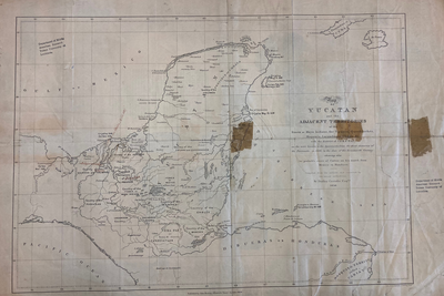
MAP OF YUCATAN AND THE ADJACENT TERRITORIES OF THE ITZAEX OR MAYA INDIANS, THE TIPUANS, QUECHEACHES, MOPANES, LACANDONES, CHOLES, & WITH THE DISTRICT OF VERA PAZ
Map 1854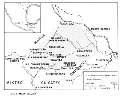
Mazatec Area
Map 1969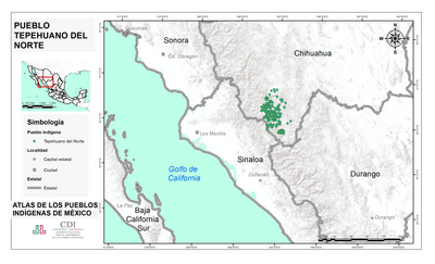
PUEBLO TEPEHUANO DEL NORTE
Map 2020
PROVINCIA DE SANTA CRUZ
Map 1873
CARTA GEOGRÁFICA DEL ECUADOR POR DR. TEODORO WOLF;PUBLICADA POR ORDEN DEL SUPREMO GOBIERNO DE LA REPÚBLICA Y TRABAJADA BAJO LAS PRESIDENCIAS DE LOS EE. SEÑORES DR. D.J.M. PLÁCIDO CAAMAÑO Y DR. D. ANTONIO FLORES. 1892 ... INSTITUTO GEOGRAFICO DE H. WAGNER & E. DEBES EN LEIPZIG. (WITH) LA REGION ORIENTAL DEL ECUADOR. (WITH) ARCHIPIÉLAGO DE GALÁPAGOS.
Map 1892
Mapa particular del Golfo e Ystmo del Darien ocupados por la mayor parte de los indios gentiles enemigos crueles y alevosos de la Nacion española quanto amigos dela inglesa : para la inteligencia de los ataques que conviene hacerlos para su reducion o aniquilacion
Map 1700 - 1799
A NEW MAP OF BRAZIL, COMPILED FROM THE LATEST Government & other Authentic Surveys.
Map 1866