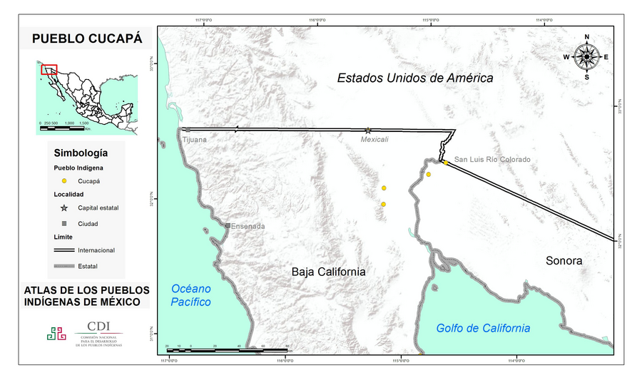
Peoples
- CUCAPA
Citation
Instituto Nacional de los Pueblos Indígenas. "Cucapás – Ubicación." Atlas de los Pueblos Indígenas de México. http://atlas.inpi.gob.mx/cucapa-ubicacion/.
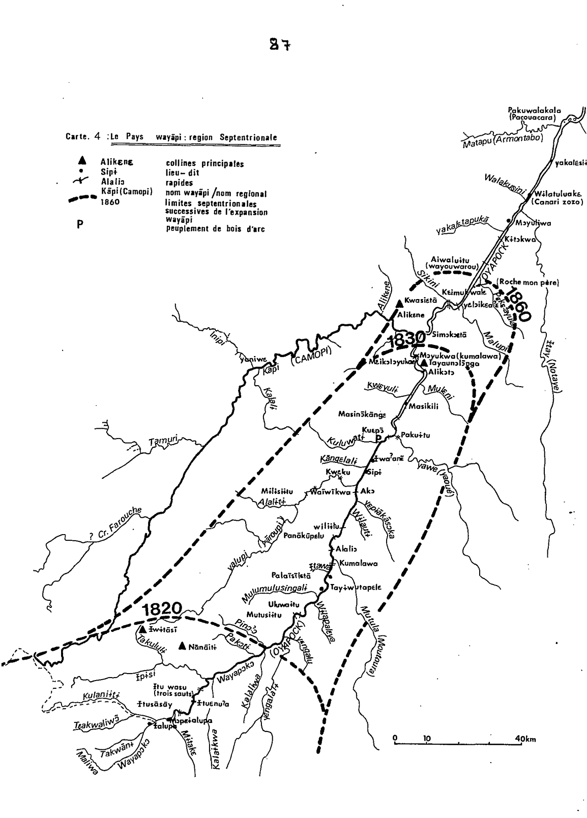
Carte 4: Le Pays Wayãpi : region Septentrionale
Map 1820 - 1860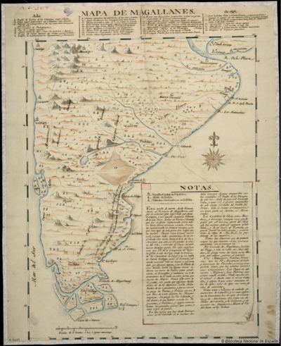
Mapa de Magallanes
Map 1746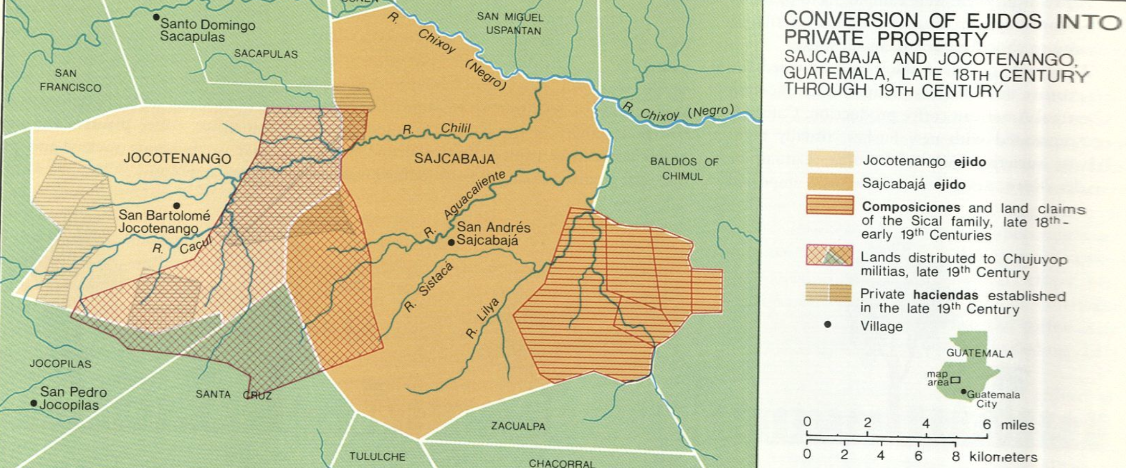
Conversion of Ejidos into Private Property, Sajcabaja and Jocotenango, Guatemala, Late 18th Century through 19th Century
Map 1700 - 1800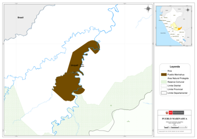
PUEBLO MARINAHUA
Map 2021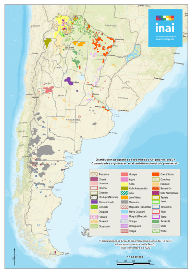
Distribución geográfica de los Pueblos Originarios según Comunidades registradas en el ámbito nacional y/o provincial
Map 2020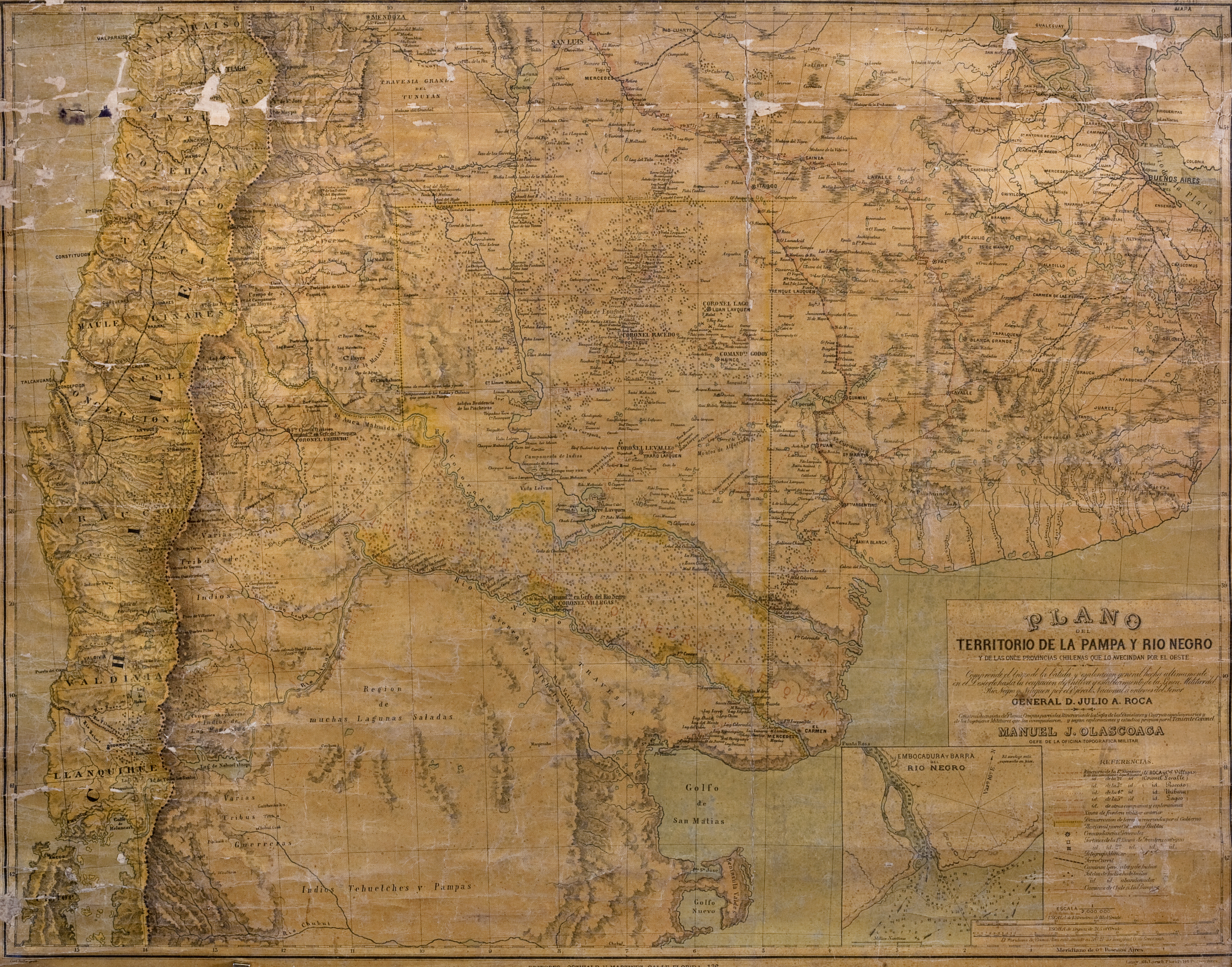
Plano del territorio de la Pampa y Río Negro, y de las once provincias chilenas que lo avecindan por el oeste
Map 1880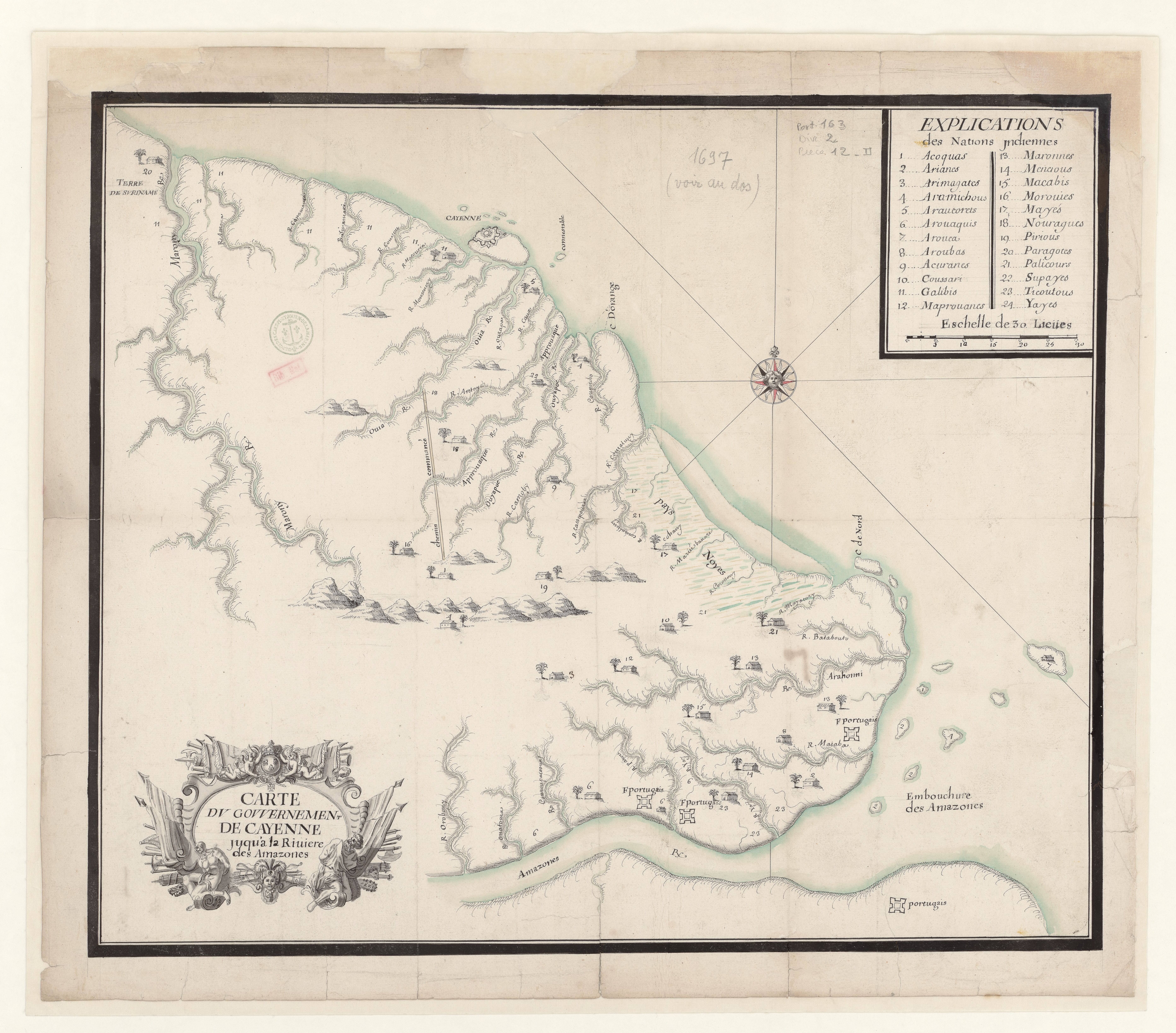
Carte du gouvernement de Cayenne jusqu'à la rivière des Amazones.
Map 1697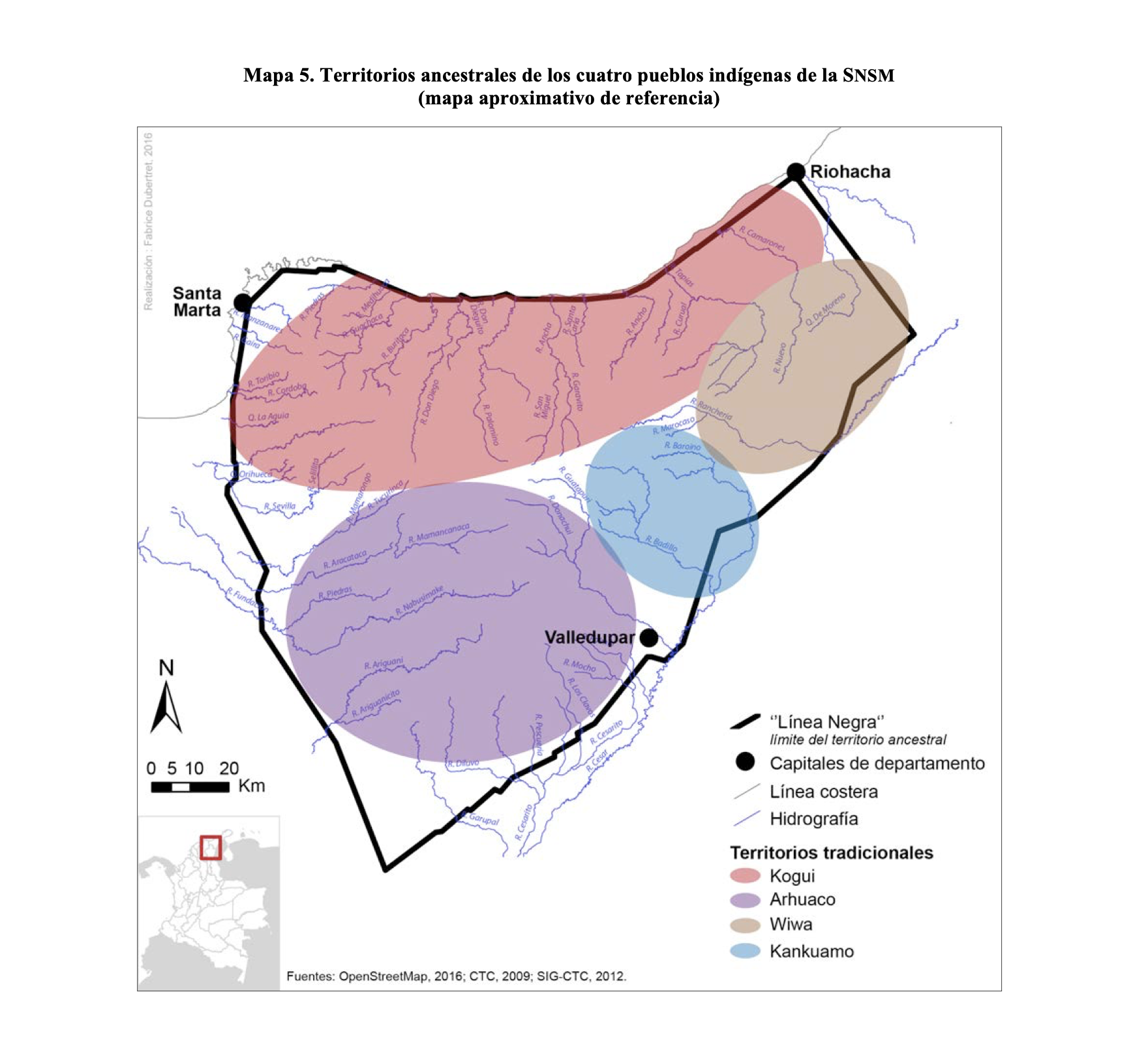
TERRITORIOS ANCESTRALES DE LOS CUATRO PUEBLOS INDIGENAS DE LA SSNM (MAPA APROXIMATIVO DE REFERENCIA)
Map 2009