
Peoples
- OPATA
Citation
Rascón Valencia, Rodolfo. Vestigios de la cultura ópata. Hermosillo: Instituto Sonorense de Cultura, 2015. https://native-land.ca/wp/wp-content/uploads/2018/06/Opata-territory-map.pdf.
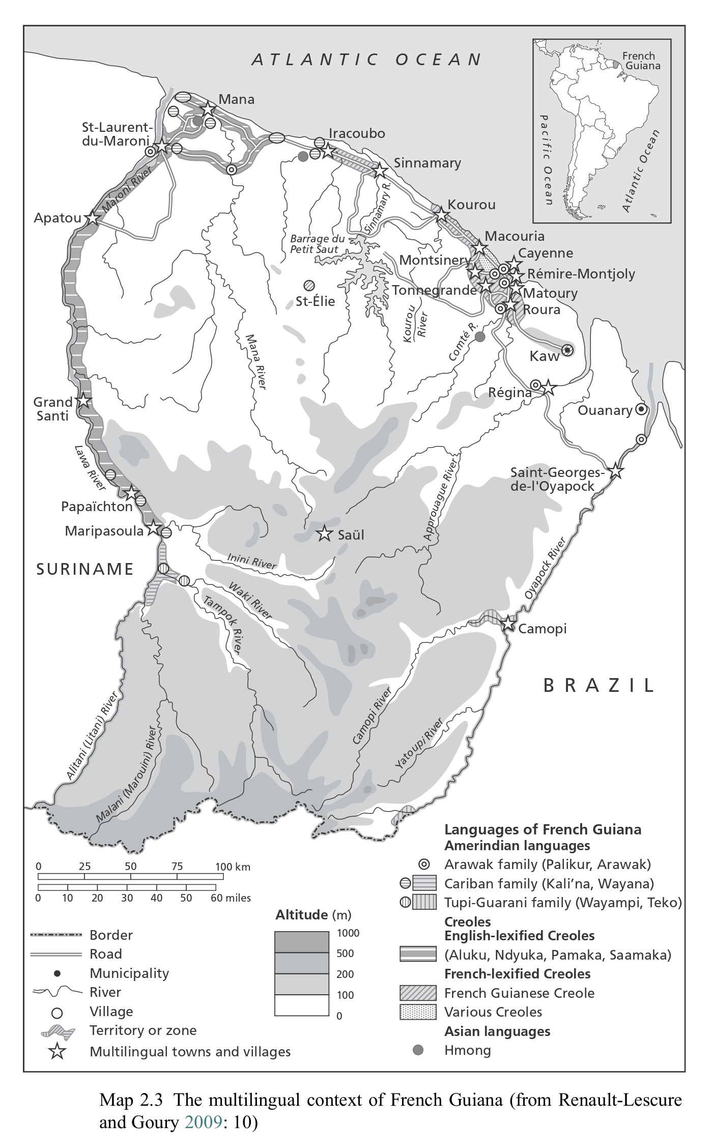
Map 2.3 The multilingual context of French Guiana (from Renault-Lescure and Goury 2009: 10)
Map 2012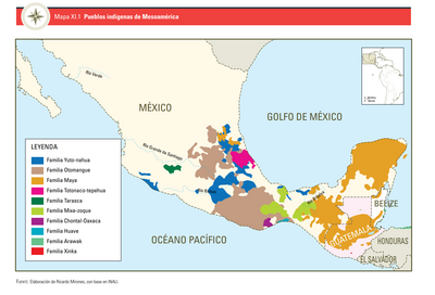
PUEBLOS INDÍGENAS DE MESOAMÉRICA
Map 2009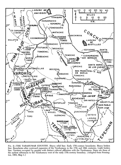
The Tarahumar Country
Map 1600 - 1699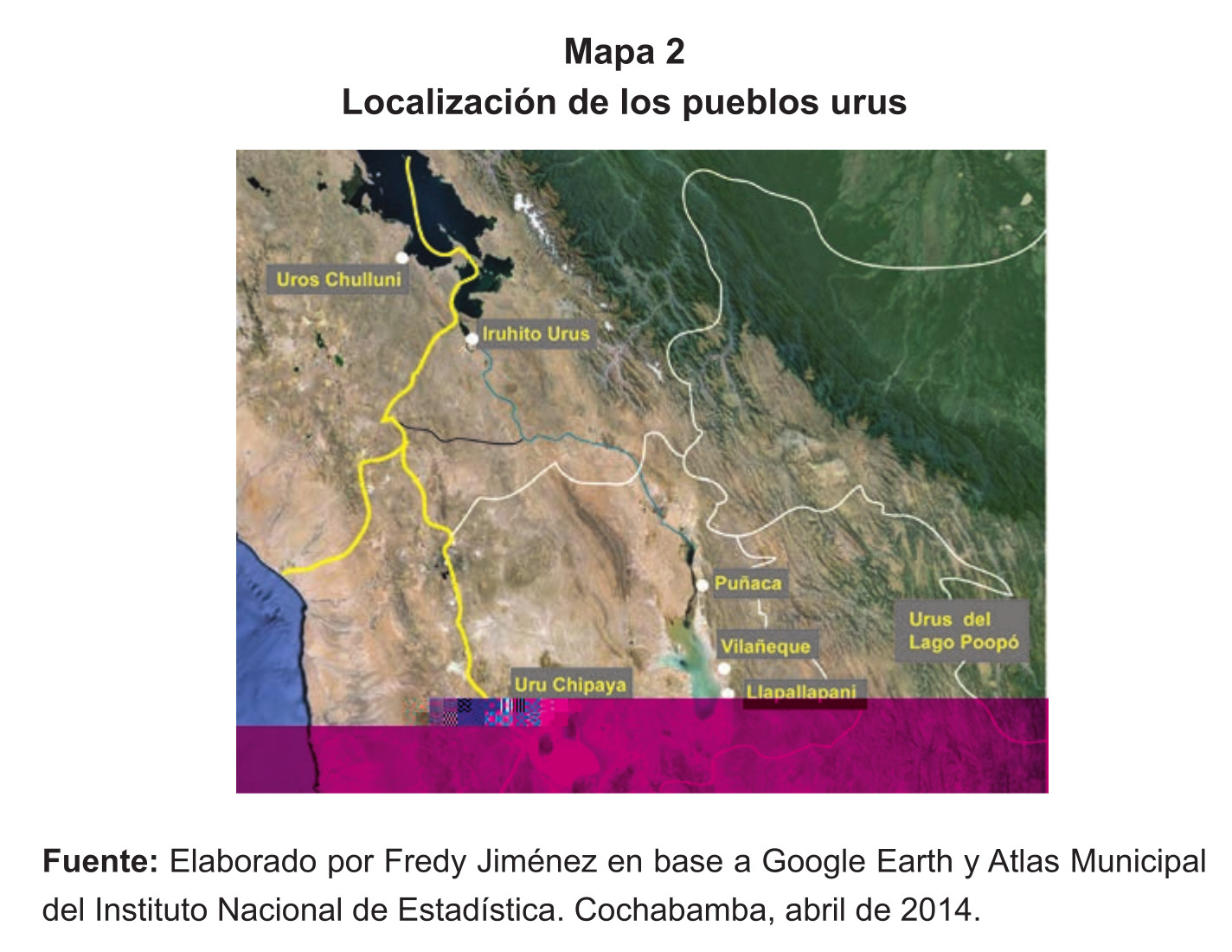
Localización de los pueblos urus
Map 2014![[Embouchures de l'Oyapock et de diverses rivières].](https://dnet8ble6lm7w.cloudfront.net/maps/FGU/FGU0056.jpeg)
[Embouchures de l'Oyapock et de diverses rivières].
Map 1700 - 1799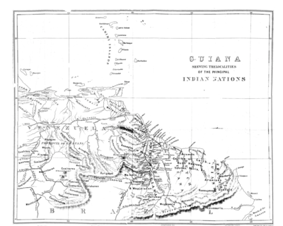
Guiana Shewing the Localities of the Principal Indian Nations
Map 1800 - 1899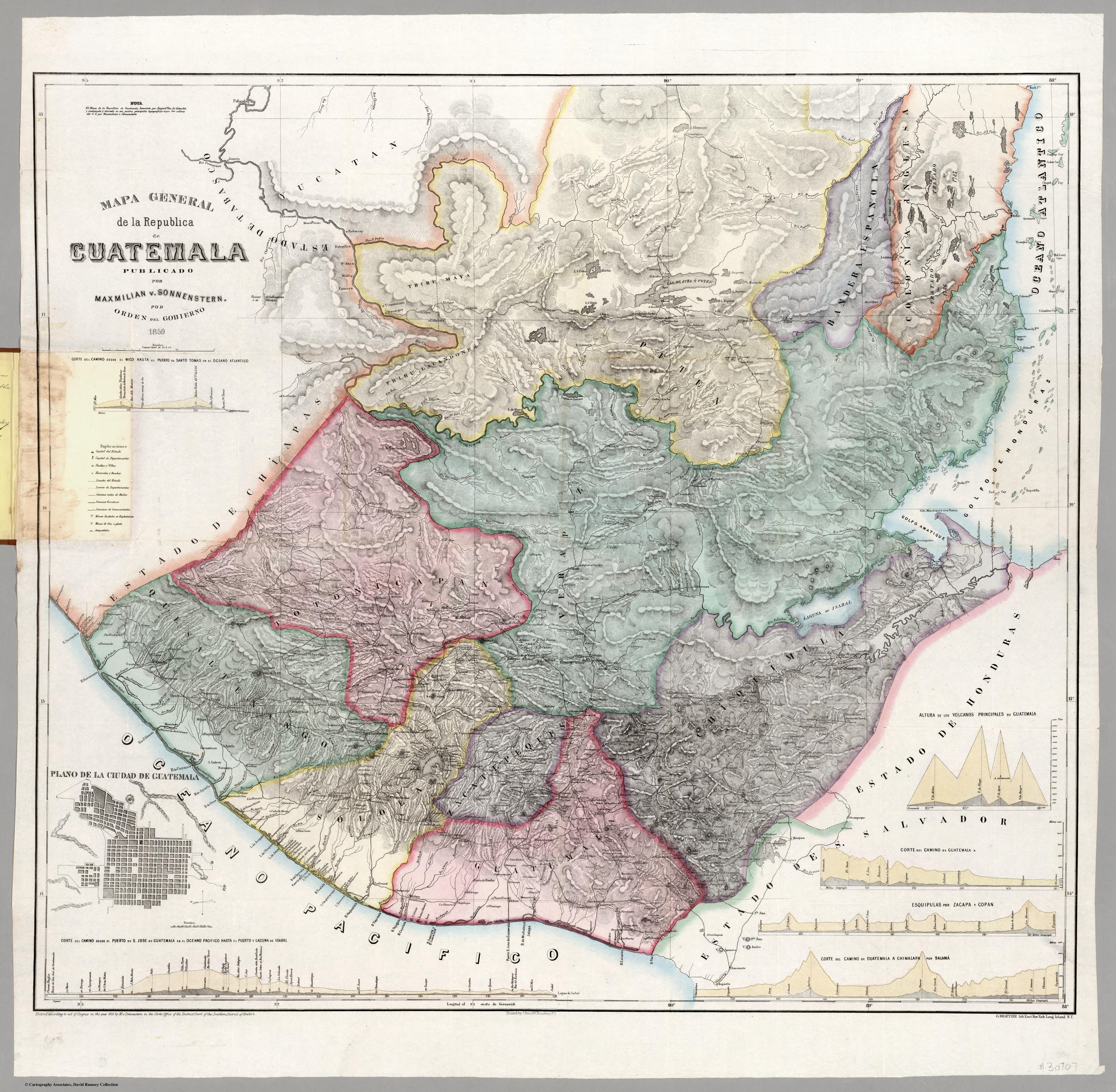
Mapa general de la Republica de Guatemala. Publicado por Maximilian v. Sonnenstern por orden del gobierno, 1859. Printed by J. Rau, 33 Broadway, NY. G Kraetzer lith, East New York Long Island, N.Y. "Entered according to act of Congress in the year 1859 by M.v Sonnenster...New York. (insets) Plando de la Ciudad de Guatemala;and 6 releif profiles.
Map 1800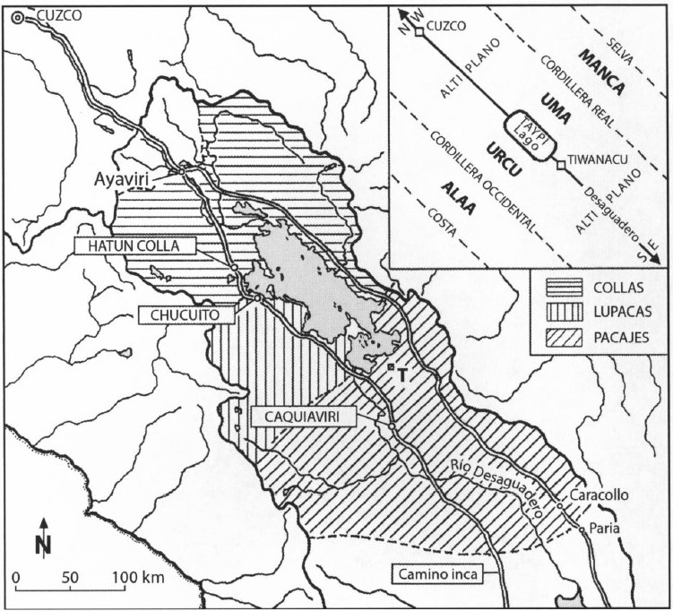
AYMARA POLITIES AROUND THE TITICACA LAKE IN THE 15TH AND 16TH CENTURIES
Map 1548 - 1610