Citation
Kofi Agorsah, E. "Archaeology and the Maroon Heritage in Jamaica." Jamaica Journal 24, no. 2. 1995.: 2-9. https://pdxscholar.library.pdx.edu/cgi/viewcontent.cgi?article=1030&context=black_studies_fac.
TABULA geographica del rio Maranon o Amazonas
Map 1690
MAPA ÉTNICO DEL RÍO DE LA PLATA
Map 1500 - 1900
Mapa de la America meridional, desde la equinoccial hasta la Tierra del Fuego
Map 1596![La sirena del Ucayali [The Ucayali Mermaid]](https://dnet8ble6lm7w.cloudfront.net/art_sm/APER044.png)
La sirena del Ucayali [The Ucayali Mermaid]
Artwork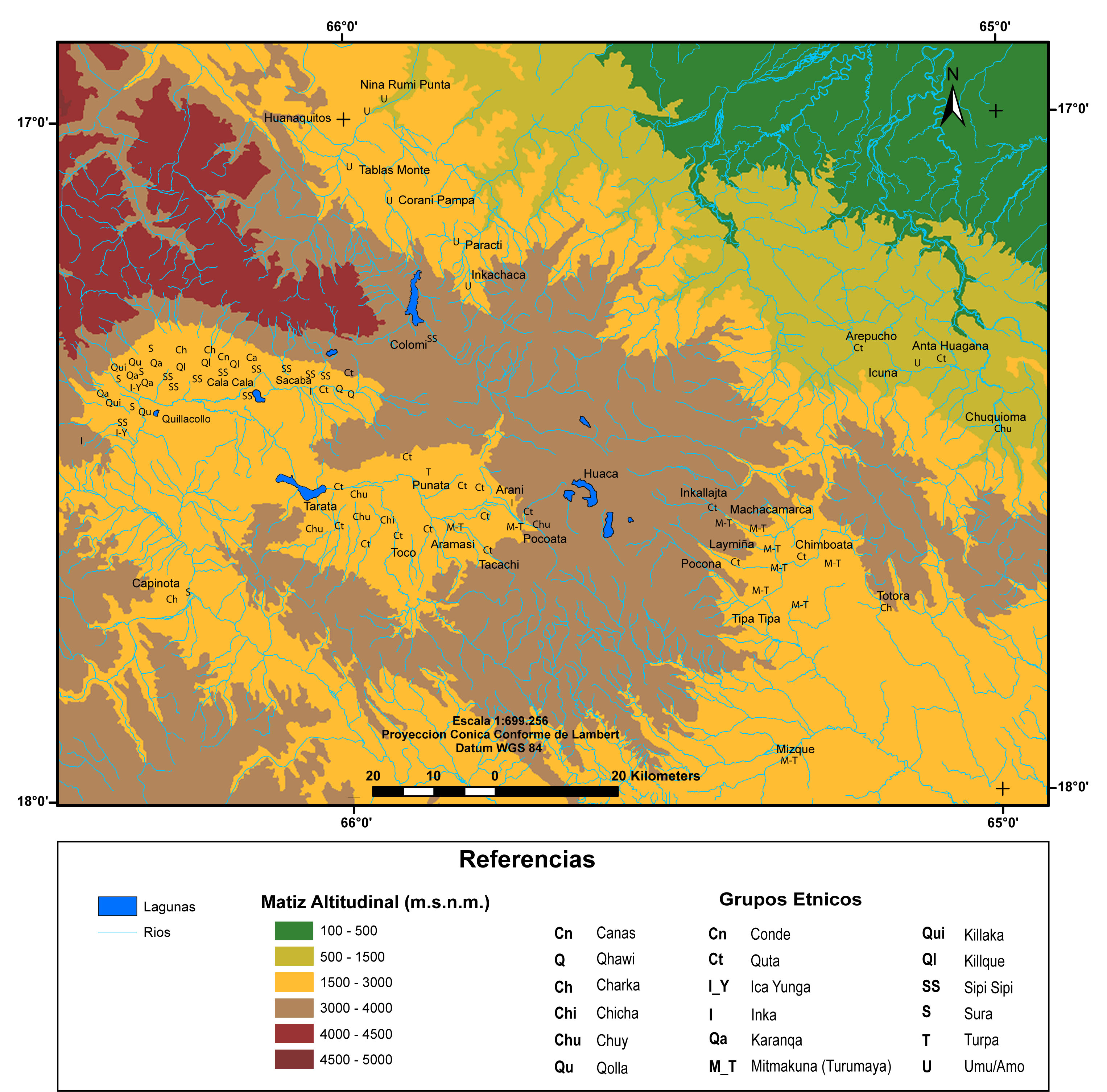
MULTI-ETHNIC TERRITORY under INCA DIRECT RULE: THE CENTRAL AND UPPER VALLEYS OF COCHABAMBA in the 1530s
Map 1520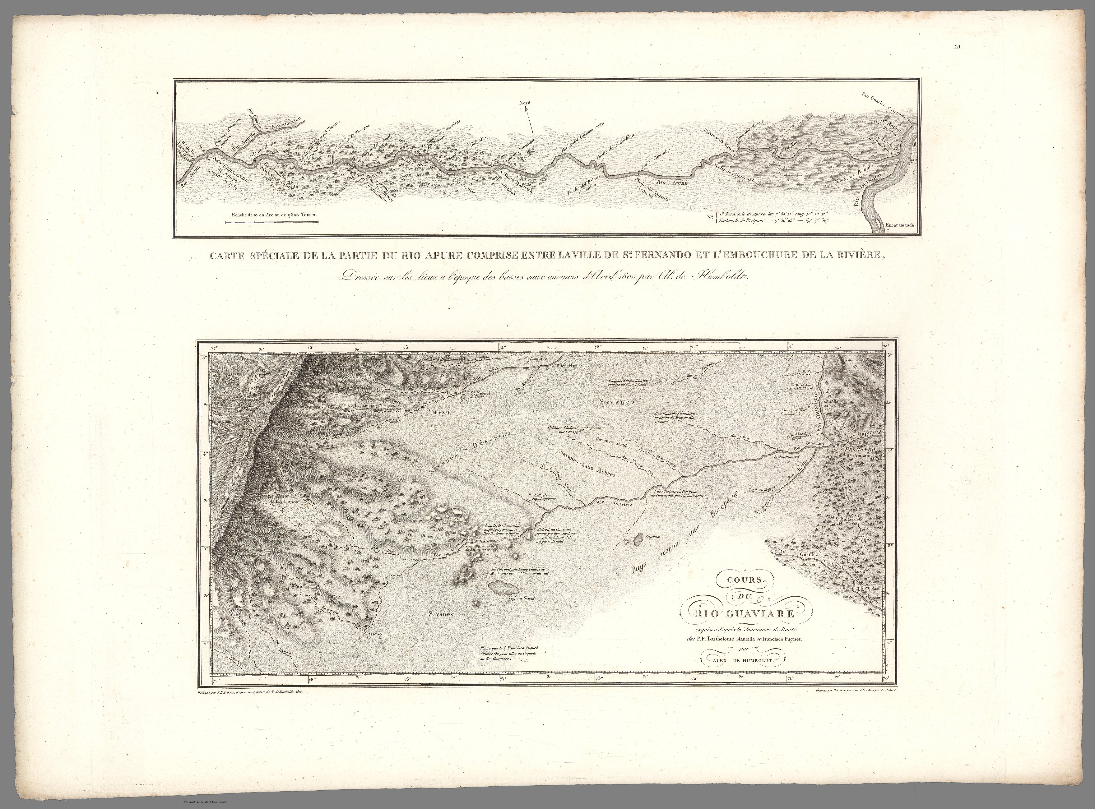
XXI. Cours du Rio Guaviare et de la partie de l'Apure comprise entre la ville de San-Fernando et le confluent de l'Apure avec l'Orenoque.
Map 1799 - 1804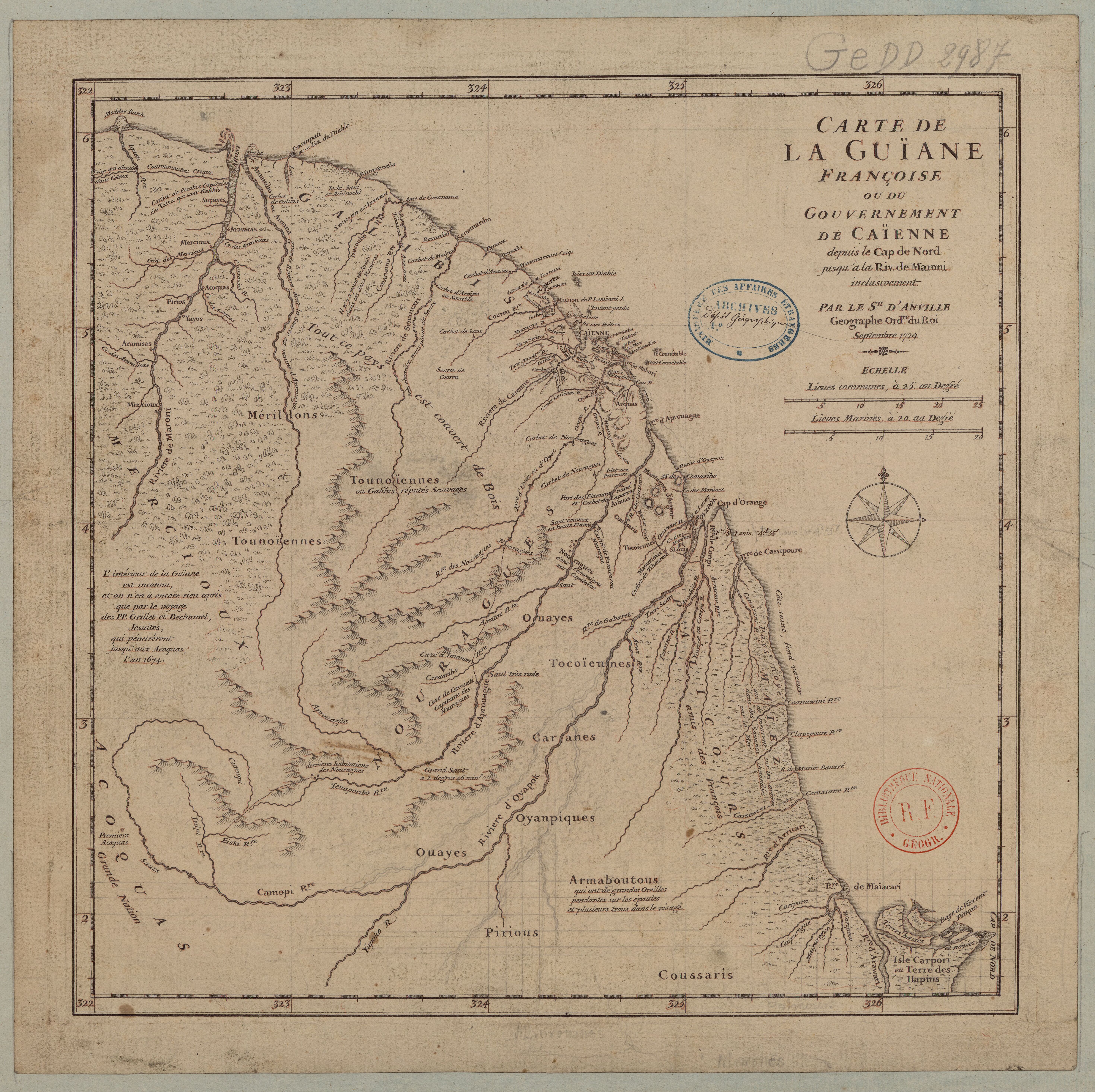
Carte de la Guïane françoise ou du gouvernement de Caïenne depuis le Cap de Nord jusqu'àla rivière de Maroni inclusivement.
Map 1729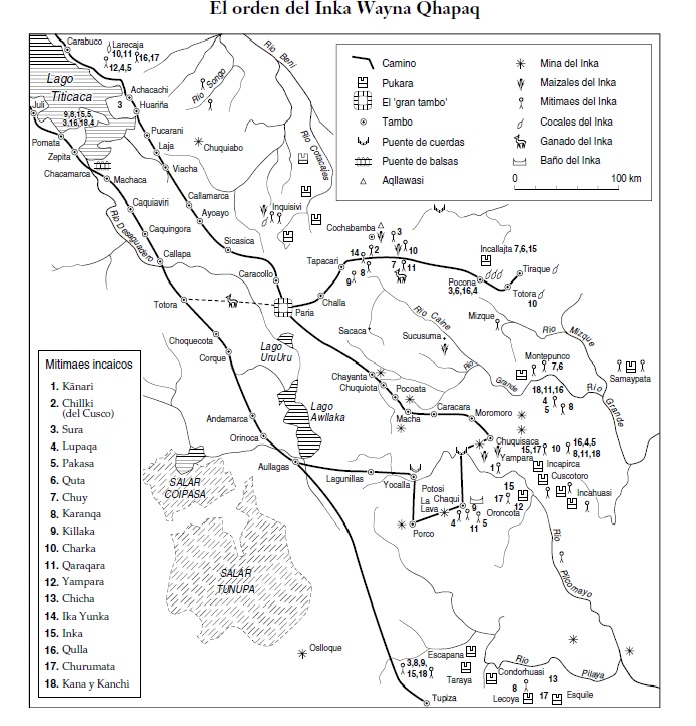
SPATIAL ORGANIZATION OF THE QULLASUYU UNDER INCA RULE
Map 1500 - 1530