Peoples
- INDIAN
Citation
Moll, Hermann. The Gulf of Amapalla or Fonesca. Map. London, England: Thomas Bowles, 1711. Accessed August 10, 2023. https://gallica.bnf.fr/ark:/12148/btv1b8596159m.r=Honduras?rk=665239;2#.
![Serie Historia de la peruvian corporaishion [History of the Peruvian Corporaishion Series]](https://dnet8ble6lm7w.cloudfront.net/art_sm/APER037.png)
Serie Historia de la peruvian corporaishion [History of the Peruvian Corporaishion Series]
Artwork
Carte de l'Amérique Méridionale dressée par Alcide d'Orbigny. d'aprés ses itinéraires sur les parties qu'il à parcourues servant à l'intelligence de son voyage et de ses observations sur l'homme américain
Map 1829
Fig. 1 Map of the Guianas with schematic locations of the indigenous groups relevant to our study, based on the linguistic map of South America (http://www.muturzikin.com/cartesamerique/ 7.htm). Carib-speaking groups are indicated in yellow, Arawak-speaking groups in blue, Tupi-speaking Wayãpi in pink and the Warao-speaking group in green
Map 2000 - 2024
Carte particulière de l'Isle de Cayenne avec les sondes
Map 1600 - 1699
Specialkarte von A. v. HUMBOLDT’S REISEN in VENEZUELA und am ORINOKO-STROM
Map 1799 - 1800
MAPA DE LOS TERRITORIOS INDÍGENAS TITULADOS (TIOC) DE BOLIVIA, AL 2011
Map 2011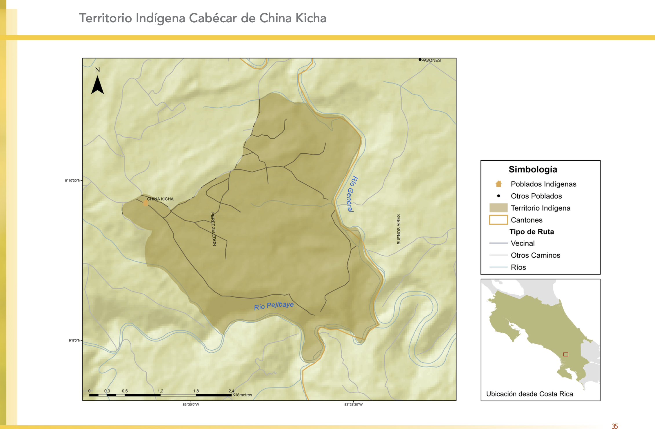
"Territorio Indígena Cabécar de China Kicha"
Map 2010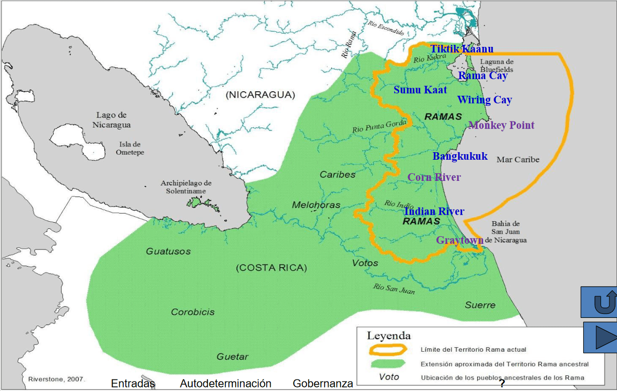
Pueblos Originarios y Afrodescendientes de Nicaragua, Etnografía, ecosistemas naturales y áreas protegidas
Map 1400 2022